26.10.2013Salar de Uyuni – The World’s Largest Salt Flat
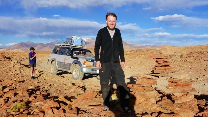
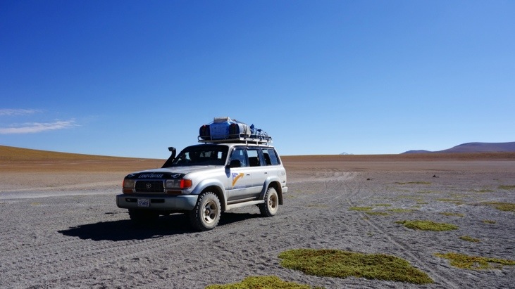
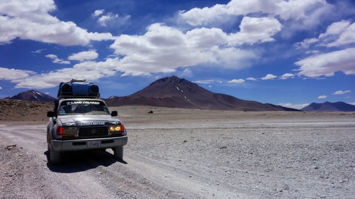
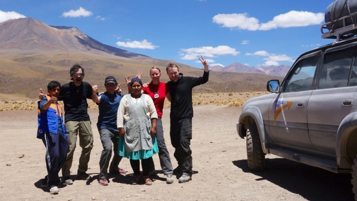
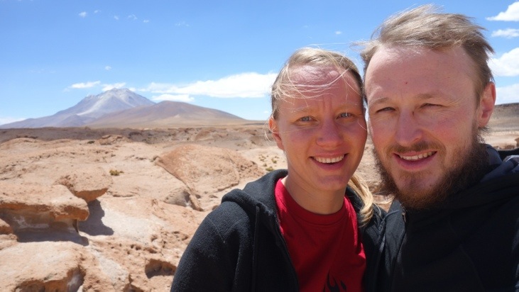
After spending several days in Tupiza we started our 4 day Salar de Uyuni trip. This time we traveled with a 4 WD Toyota Landcruiser and 2 fellow companions from Buenos Aires, Argentina. This turned out as a very lucky incident as they were not only very friendly and helpful in translating the Spanish of our driver but also did we make new friends by the end of the trip.
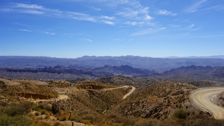
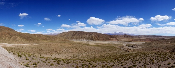
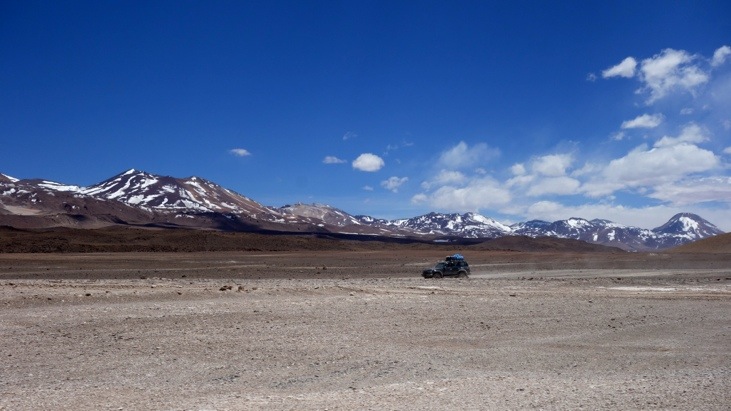
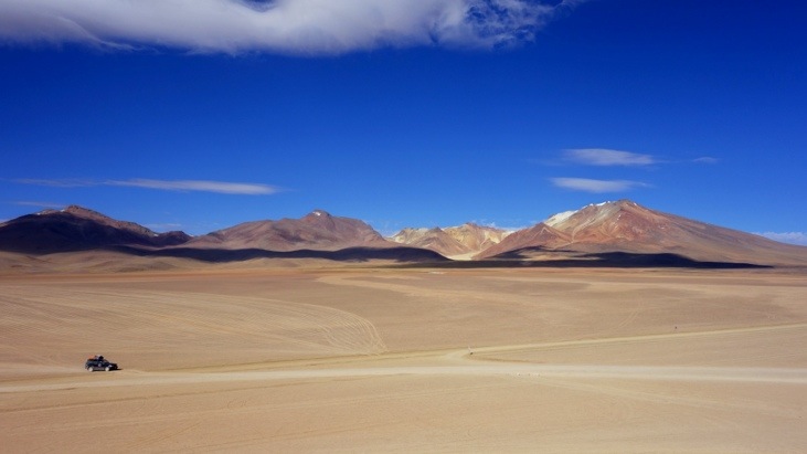
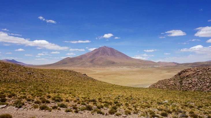
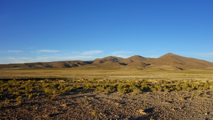
To give you a brief idea of the trip: We passed stunning landscapes in the Bolivian altiplano leading us above 4900 m altitude and a national reserve with breathtaking landscapes on the first three days. On the fourth day we crossed the famous and gigantic salt lake called Salar de Uyuni, before the trip ended in Uyuni.
On this interactive Google map of our Salar Uyuni trip you can get a pretty good overview of the route of our trip. (If you wait for it to load you can zoom in on all parts of the trip; be careful when using the mouse wheel for scrolling while the mouse cursor is located on the map!)
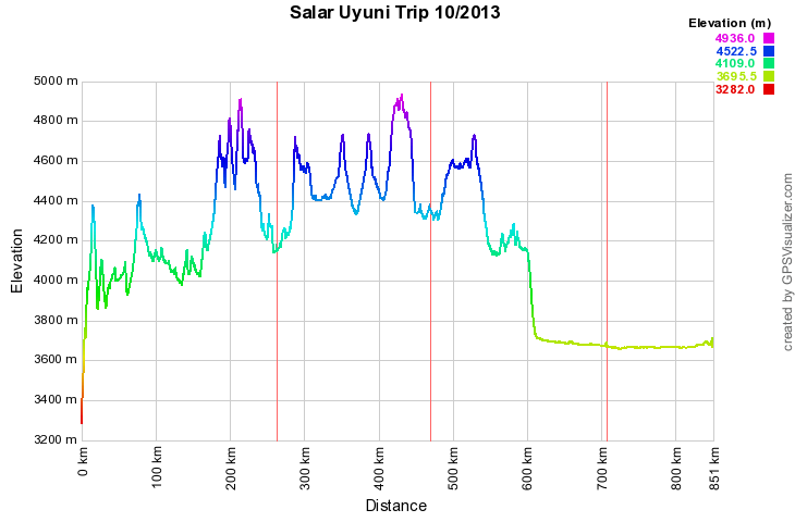
The elevation profile of our 4 day trip:
But before we started we already had to deal with some annoying local Bolivian events! Starting from Tupiza we suffered from a total city blockage by the local taxi drivers, fighting for god knows what. In any case they blocked all streets leading into the city and forced us to leave the city on foot, carrying all our belongings. That sure caused us a good sweat and we managed the one hour hike with lots of bickering about those inconsiderate taxi drivers 😉
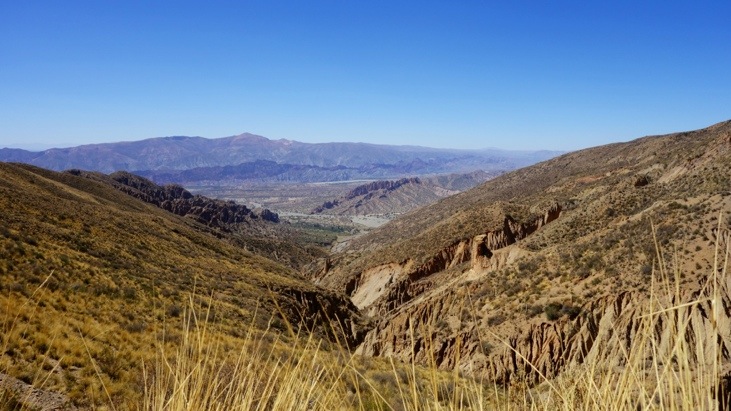
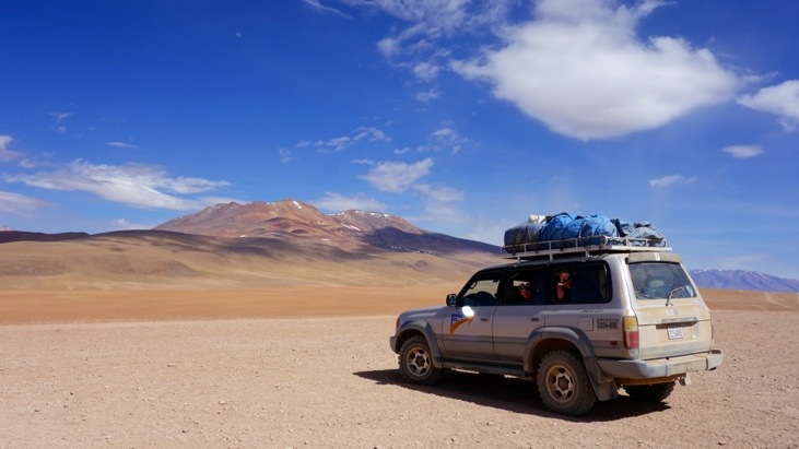
Finally at the cars we were welcomed by our driver David and our cook Bernadina and quickly stowed our luggage on the roof of the jeep. Then we started our ride up into the Bolivian Altiplano which quickly brought us above 4000 m altitude.
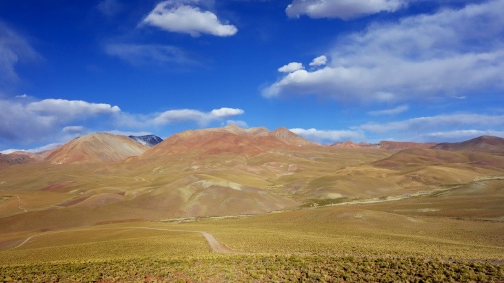
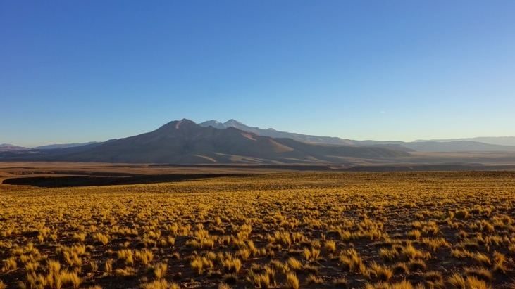
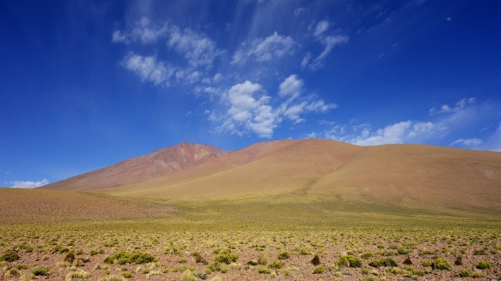
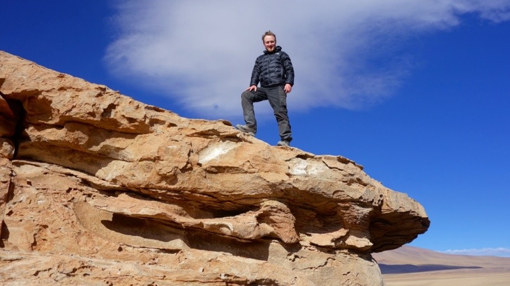
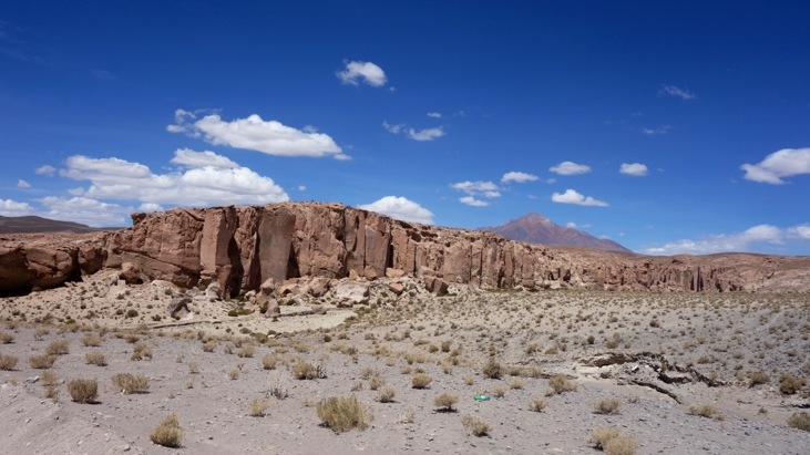
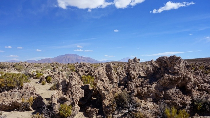
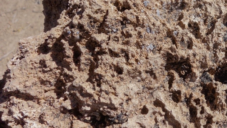
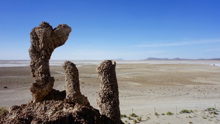
As you will see we kept passing incredible landscapes all the time. We would stop whenever anybody requested a stop for pictures or other purposes and at all “official” sights along the way. The very first official site was El Sillar, an amazing stone forest of almost vertical pillars which reminded us of the Bryce Canyon Amphitheater (in Utah, USA):
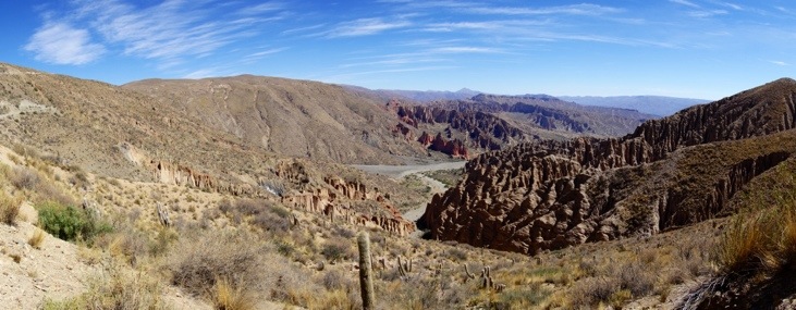

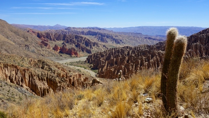
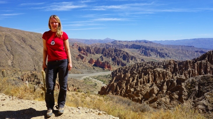
However we only had the chance to gaze at it from the distance before we headed on.
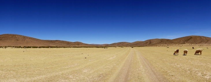
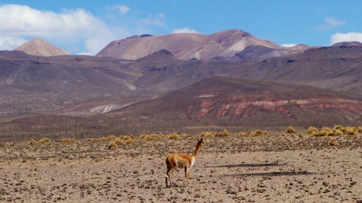
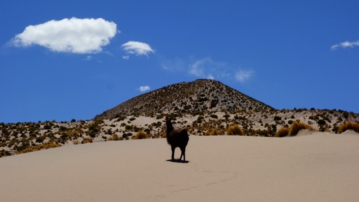
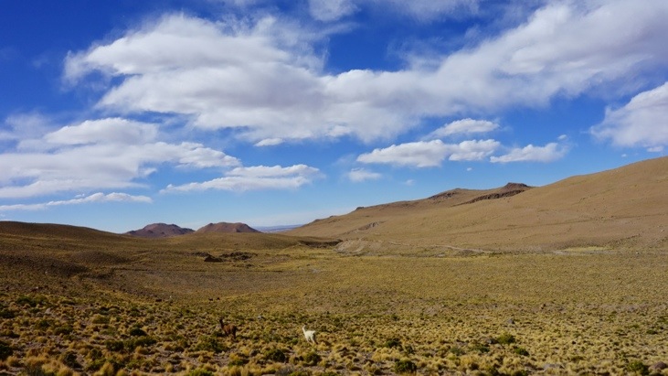
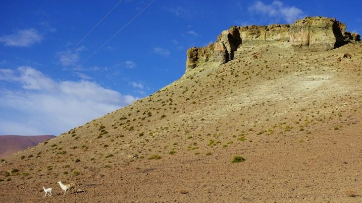
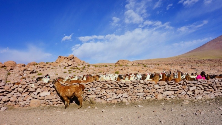
Altitudes of above 4000 m are the habitat of llamas and alpacas which we often encountered along this trip:
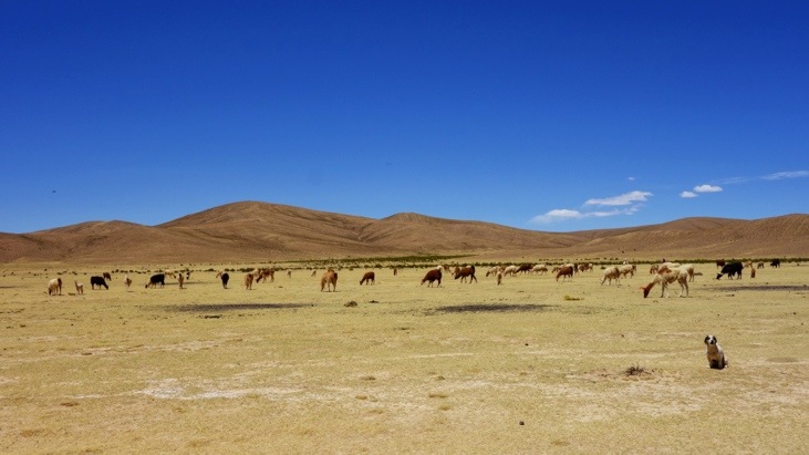
Even though it looks warm and sunny it was always a lot cooler and quite windy 🙂
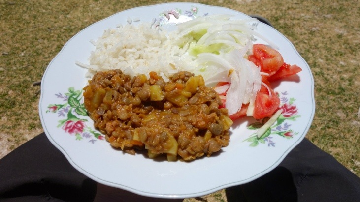
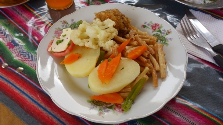
Around noon we stopped for lunch which Bernadina prepared for us. Even just lunching in these surroundings above 4000 m altitude is amazing. The main dish was a kind of lentil stew and despite what it may look like, quite tasty!
After lunch we continued on …

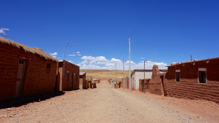
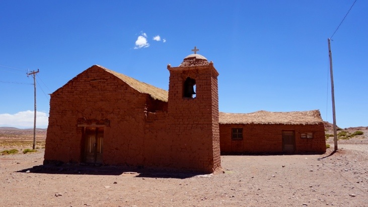
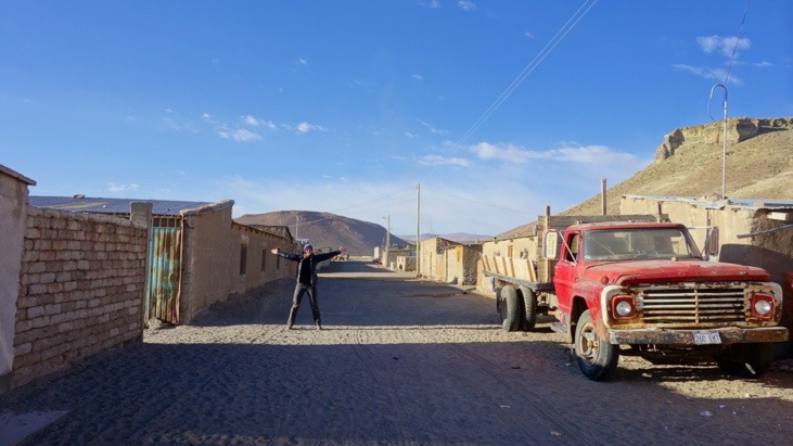
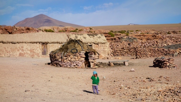
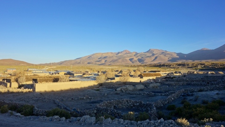
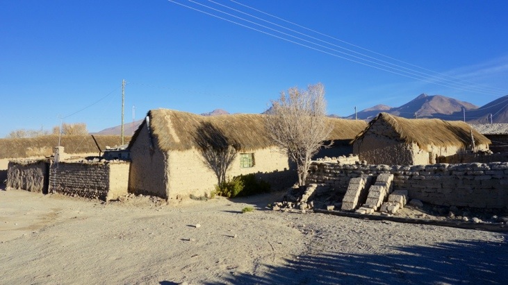
and arrived at the small village of San Pablo de Lipez. It is built entirely from locally fabricated bricks as you can tell by the red color.
We got to see some of the locals pursuing their every day business …
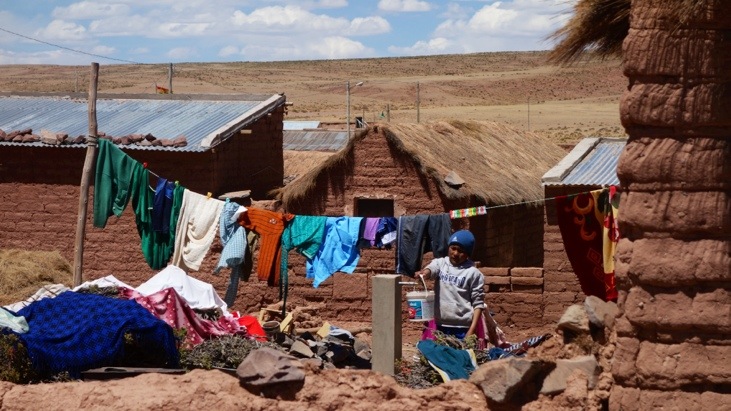
and strolled around the very small village which even had a small church:
We also passed dozens of very shy vicuñas:
and here a black goat on white sand:
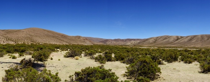
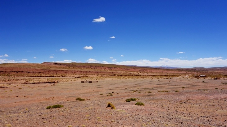
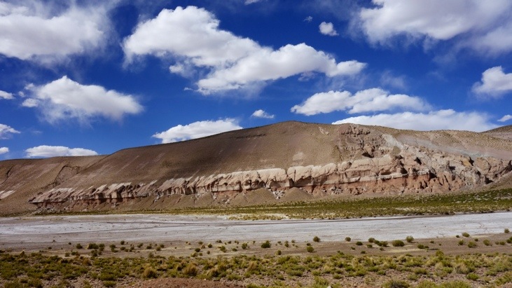
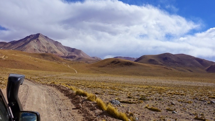
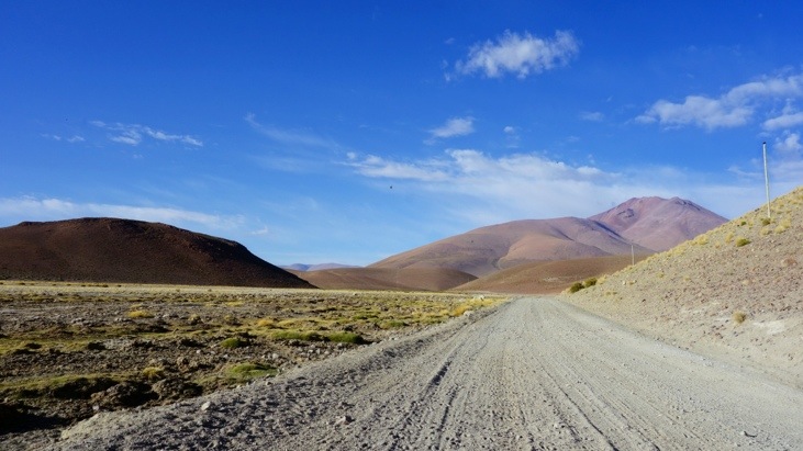
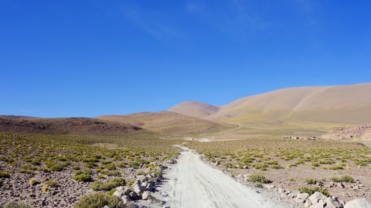
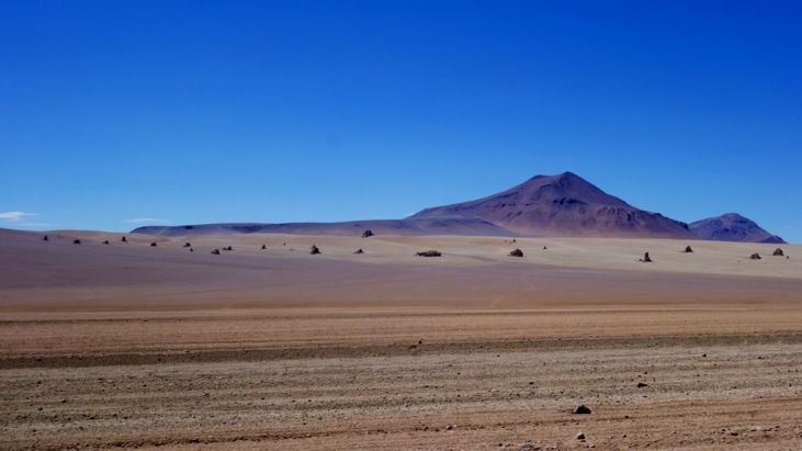
We continued on with few stops and tried to soak up the passing landscapes:
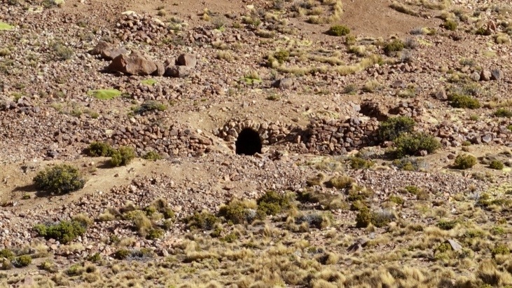
This hole in the mountain is the entrance to an old gold mine:
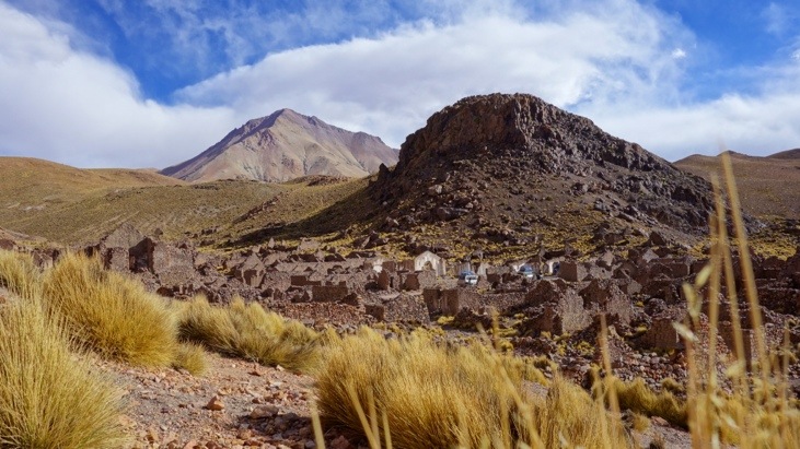
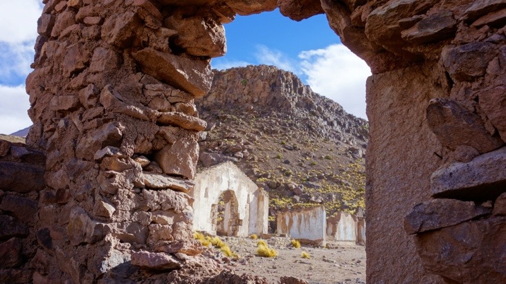
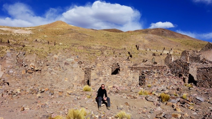
In the afternoon we arrived at the ruins of the deserted city of San Antonio de Lipez. San Antonio is an abandoned 16th century mining town where prospectors used slave labor to mine gold and silver. The town was abandoned after there was a slave rebellion. An attempt in the 70s to repopulate the town failed and people decided to live in a town of the same name that is close by Volcano Uturuncu (6020 m) and also at lower altitude.
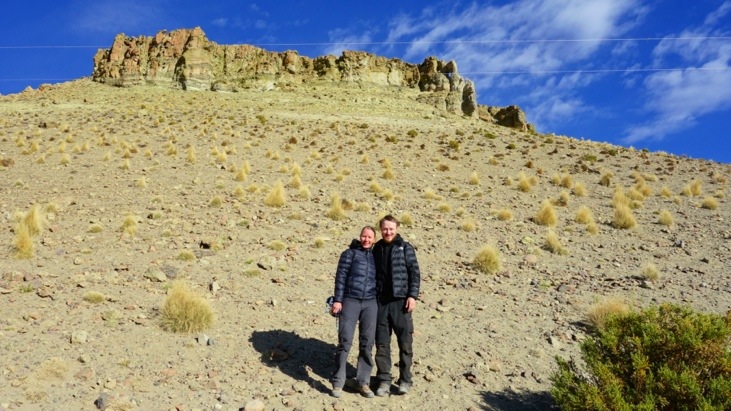
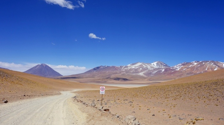
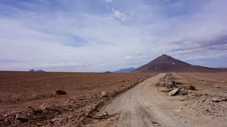
After enough time to explore the ruins we quickly headed on to one of the highest points of the trip (4850m):
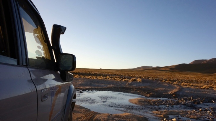
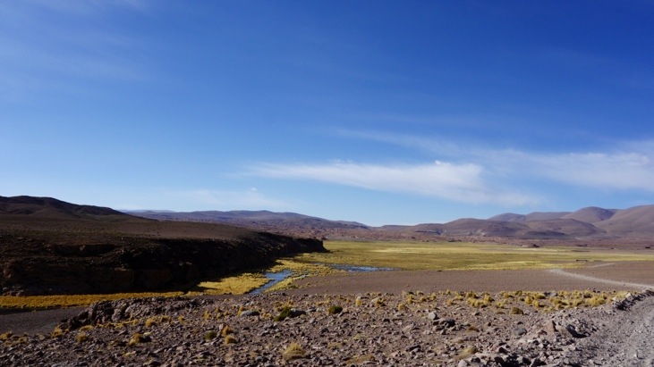
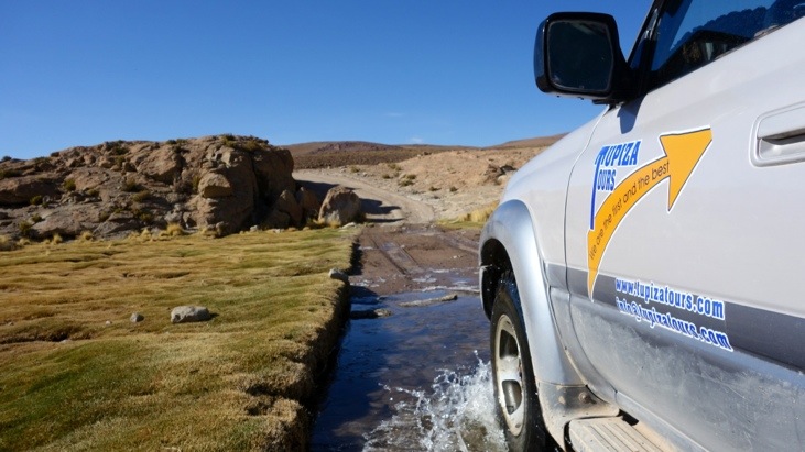
On the way we often passed through brooks and little rivers:
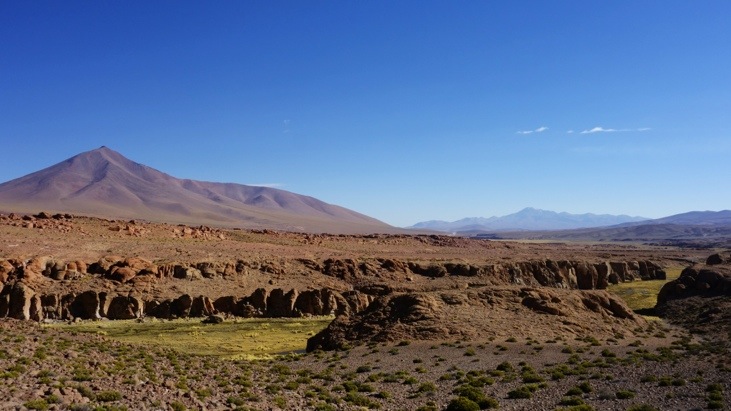
And could hardly get enough of the stunning contrast between the blue sky and the red, yellow and green shades of the passing landscapes:
The view from the second highest altitude of our trip reaching 4900 m. We stopped to enjoy the scenery, but while it looks warm and sunny the weather was rather chilly due to the wind:
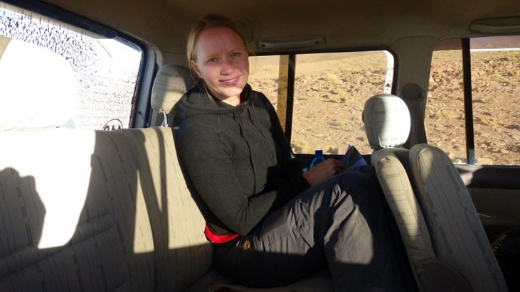
Tini seeking shelter in the car:
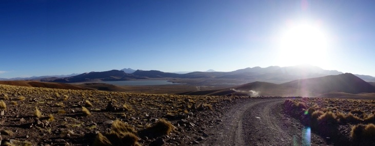
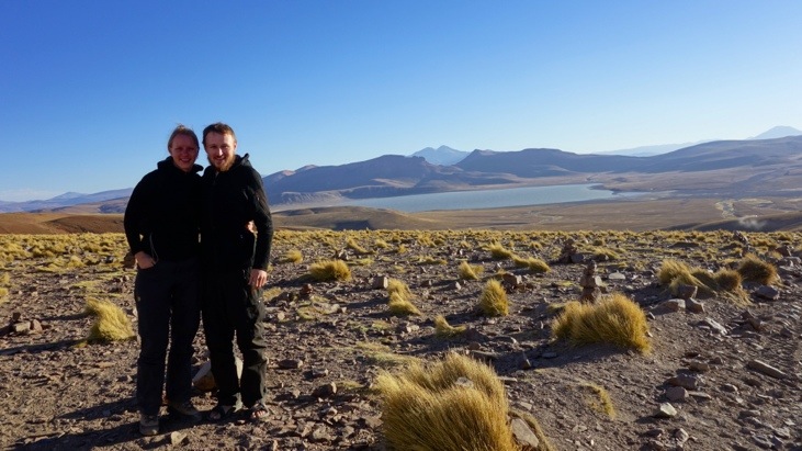
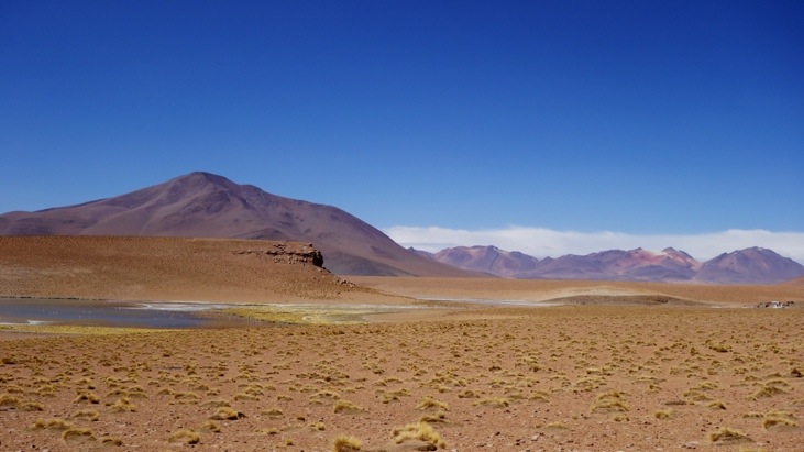
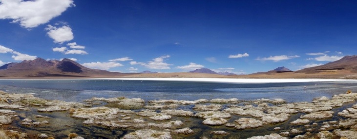
And in the background the very first lagoon on our trip called Laguna Morejo:
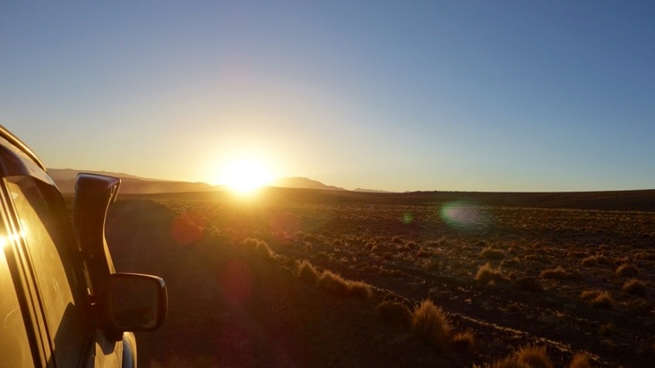
As the sun disappeared behind the horizon, …
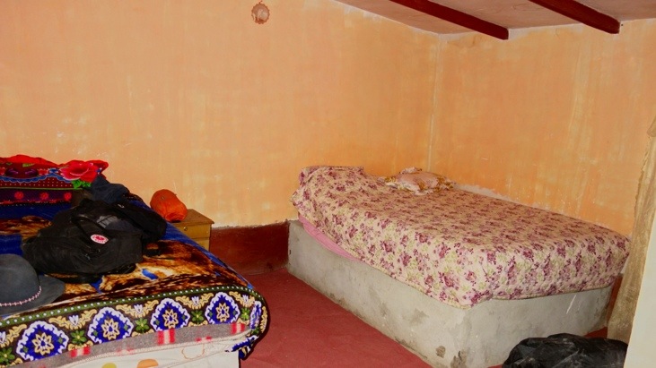
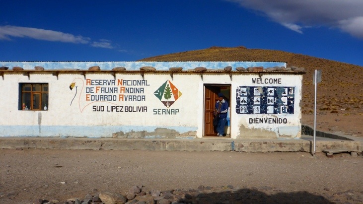
we entered the “Reserva Nacional de Fauna Andina” called “Eduardo Avaroa”.
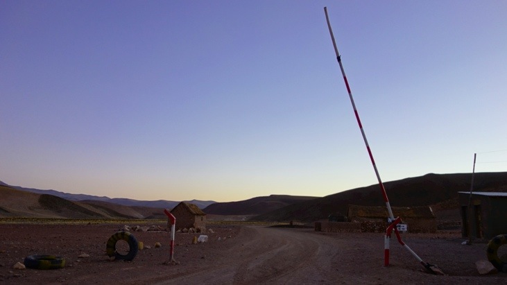
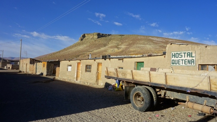
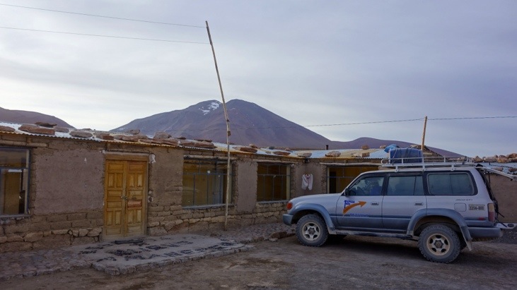
Shortly after we arrived in our very simple but clean hostel Quetena. The mattresses were placed on a stone pedestal and due to the altitude of the village it got quite cold in the night.
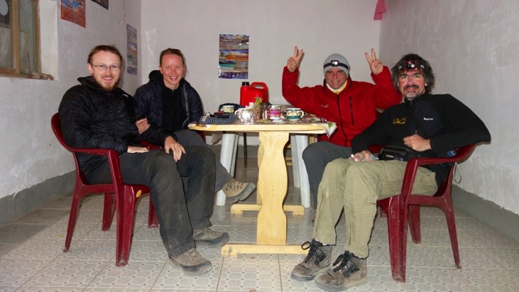
After arranging ourselves we gathered in the dining room for tea and crackers while Bernadina prepared dinner. Our new friends from Buenos Aires: Mario in the black jacket and Sergio in the red jacket:
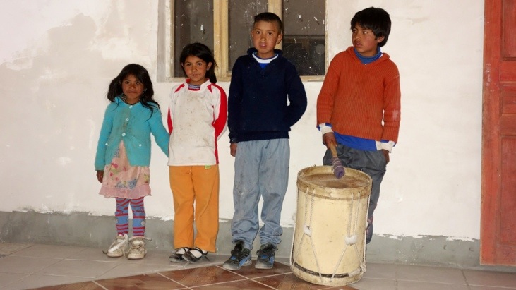
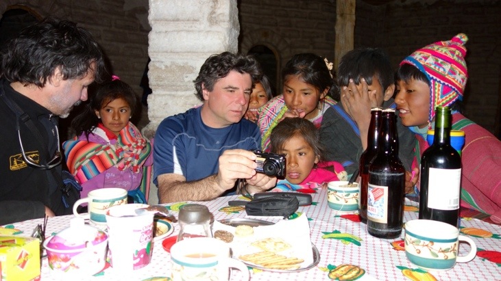
As the news from tourists arriving in town spreads like bush-fire the local children quickly gather to recite songs and poems. They don’t explicitly ask or beg, but do hope for candy or a few Bolivianos…
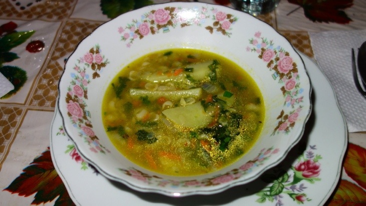
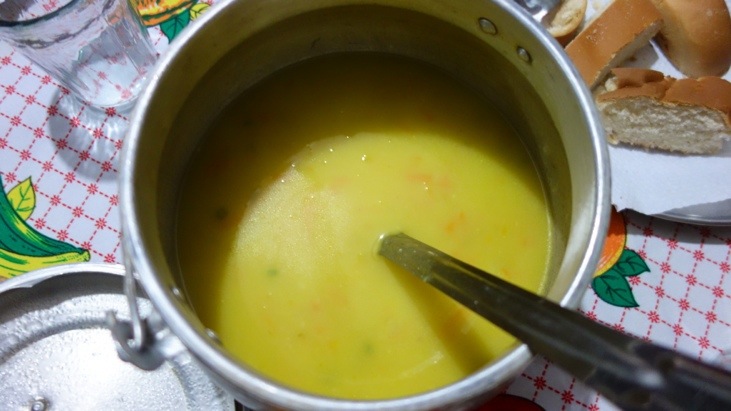
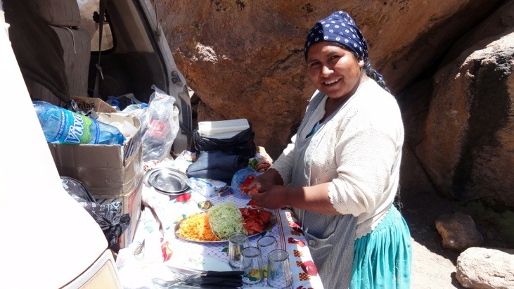
It turned out that unfortunately Bernadina was not as gifted as Ronny (our cook from the Ausangate trek). Our decent meal consisted of a vegetable soup:
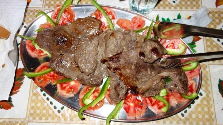
Pork steaks she killed a second time in the frying pan:
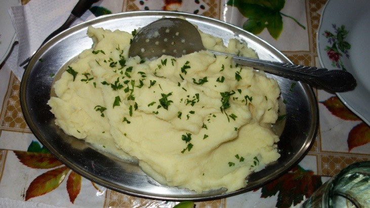
And mashed potatoes:
After dinner Andy tried to capture the incredible sky illuminated with thousands of stars! Rarely have we seen so many stars in the sky by bear eye. Unfortunately the maximum exposure time of the Sony Rx100 camera is 30s. This is one of the first drawbacks we have so far discovered. The best we managed is the following small segment of the sky and just a pale view of what we saw with our eyes:

The next day we got up early and after breakfast we had the first chance to see our hostel and the village by bright daylight:
An alpaca mother with her little one bolting away from our jeep:

The journey continued along more breathtaking landscapes:
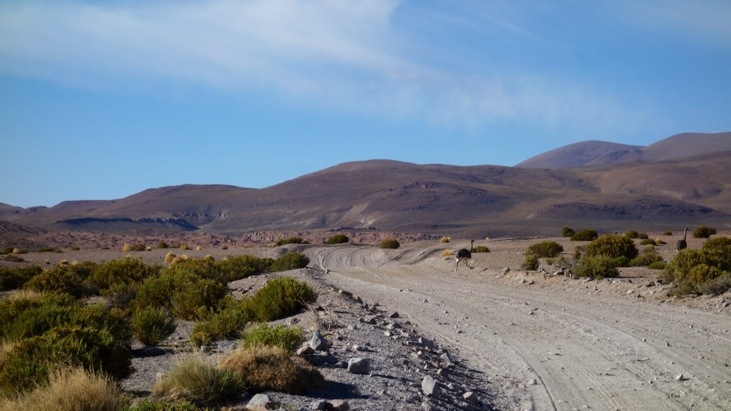
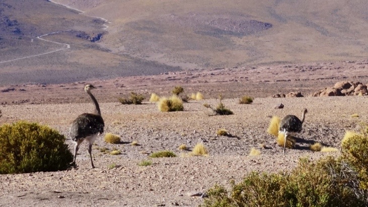
Suddenly two ostriches crossed the street. We had no idea of the speed they can pick up when running and they reminded us of the “road runner” cartoon figure (even though he is a coyote).
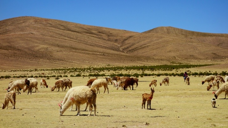
An alpaca and llama farm at the side of the road:
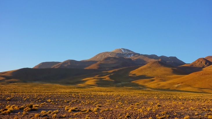
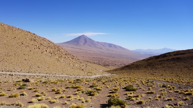
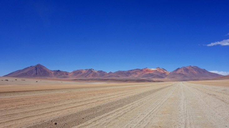
And a lot more stunning landscapes:
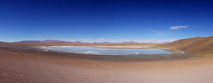
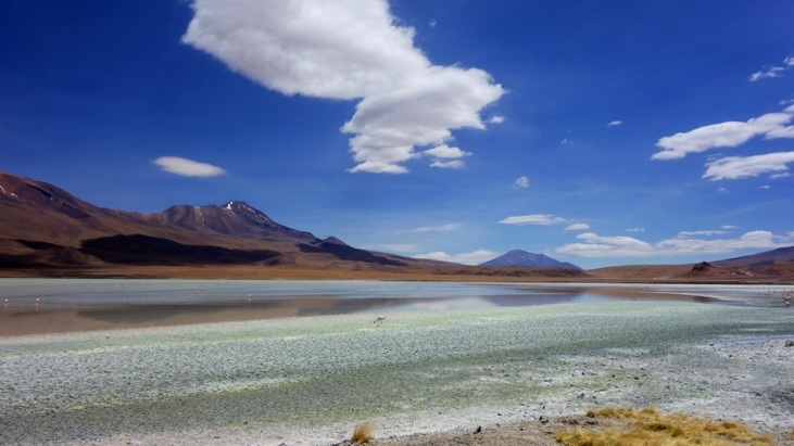
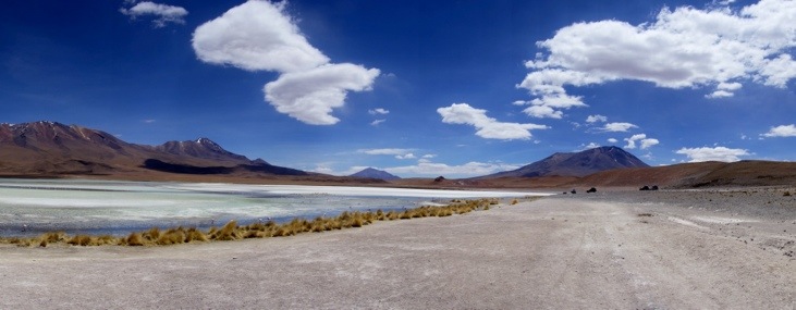
In the distance you can see the Hedionda Sur lagoon:

We only made a very short stop at it and quickly continued on to an even nicer lagoon:
The Hedionda Sur lagoon:
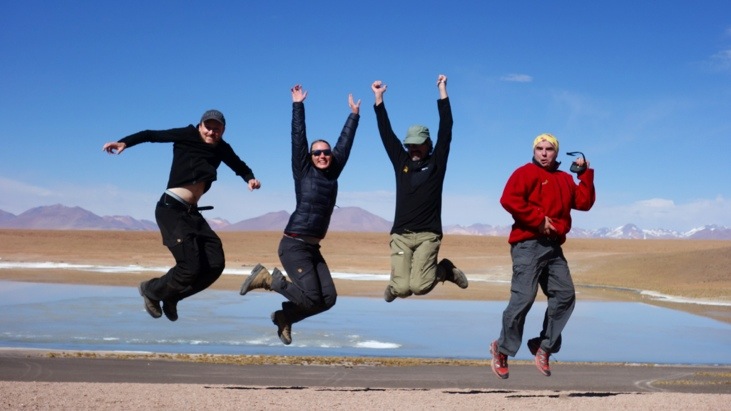
One of those classic jump fotographs in front of the Hedionda lagoon:
The intense colors of the red rock and the blue sky were just amazing:
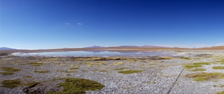
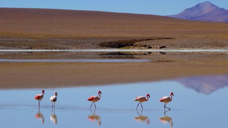
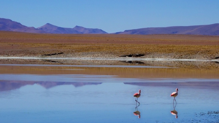
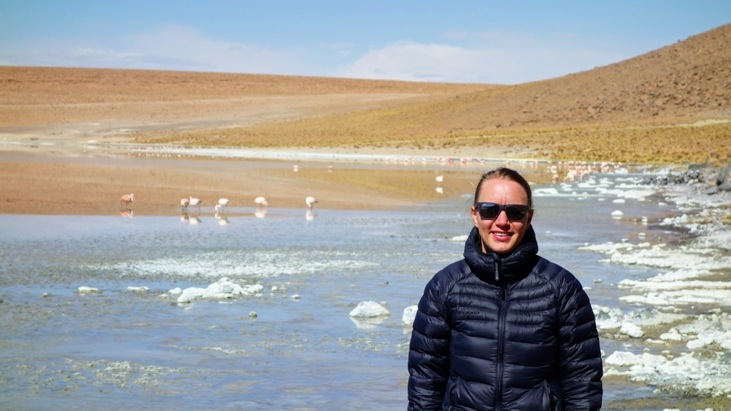
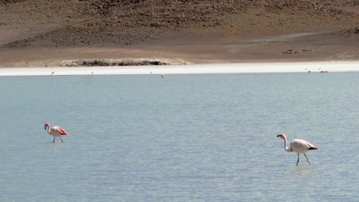
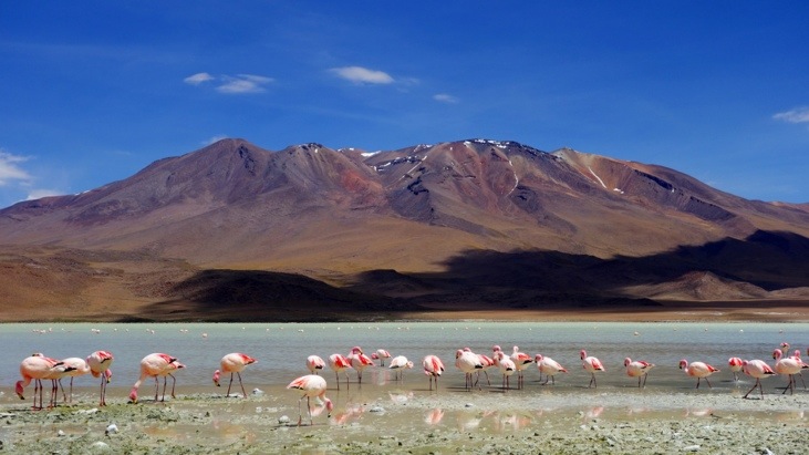
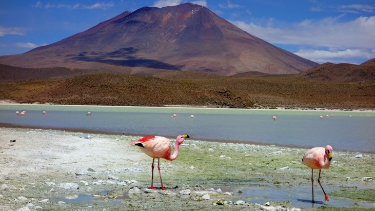
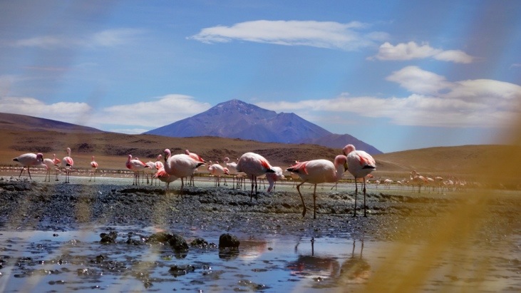
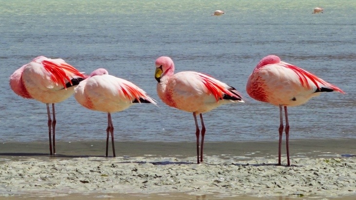
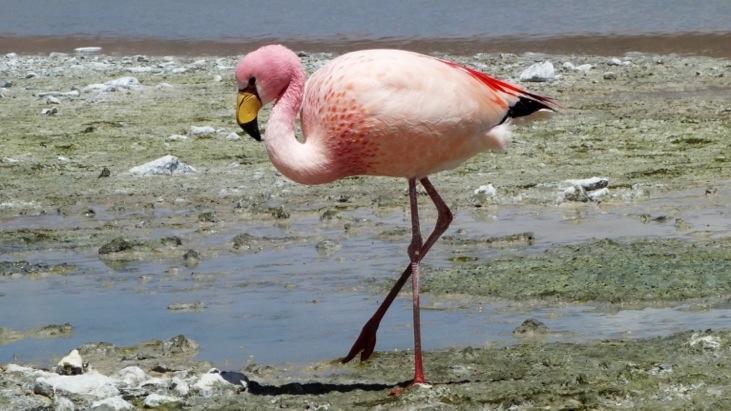
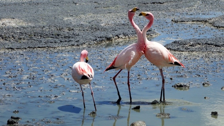
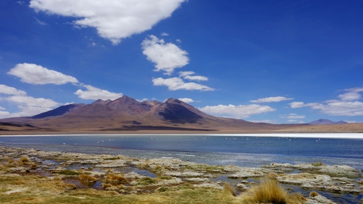
Another great thing was the wildlife that was abundant in most of the lagoons, particularly the pink flamingos. Laguna Hedionda had at least a hundred pink flamingos chilling out in the shallow waters, many of them sticking their heads underneath the water and eating:
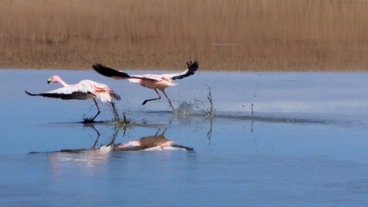
Ready for take-off! Flamingos picking up speed to fly to the other side of the lagoon!
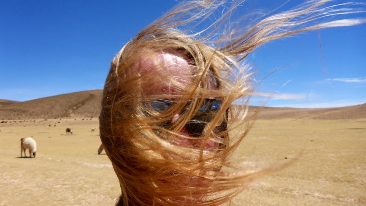
The sun was very strong and made it necessary to wear sun screen but the chilly wind didn’t let the sun warm you much. Luckily we had our down feather jackets with us!
After walking to the other side of the lagoon where David picked us up, we continued on and passed by several other lagoons (Kollpa lagoon, Salar De Chalviri and Termas de Polques):

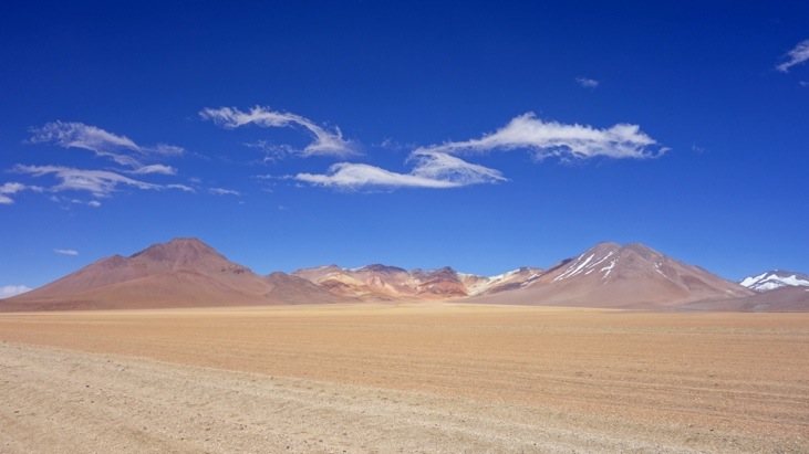
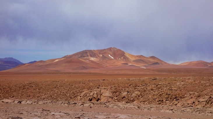
On our way through the Altiplano to the Laguna Verde (the green lagoon) we passed the desert of Dali. It is named after the painter Salvador Dali because many of his works feature surreal background landscape elements that are similar to this desert with huge rocks placed in it:
Approaching the “painted mountains”:

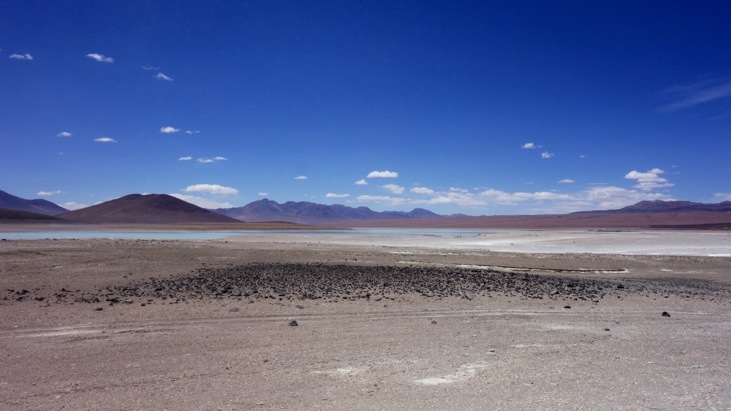
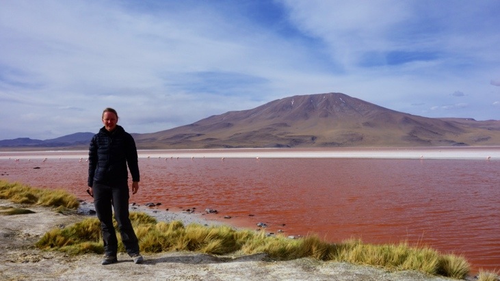
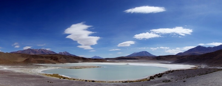
And the Laguna Blanca in the distance, neighboring Laguna Verde. The name originates from its white color and is due to the mineral borax.
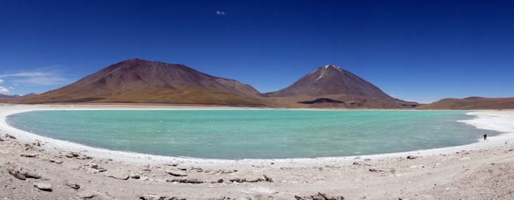
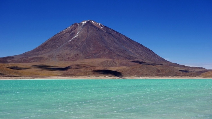
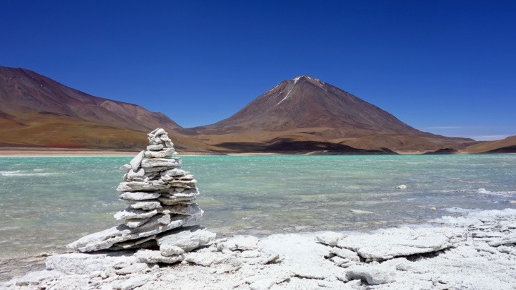
Laguna Verde is the probably most spectacular lagoon. While it looks beautiful and the turquoise water makes a perfect match with the blue sky, white sand and stone around it and the brown-reddish Licancabur Vulcano (5950 m) with its perfectly shaped cone, the water is highly toxic. The rich color in the lagoon is caused by high arsenic, lead, copper and other heavy metal concentrations which is why even the flamingos avoid it.
Picture from Sergio (and taken by Mario).
Volcanic stones from around the lake:
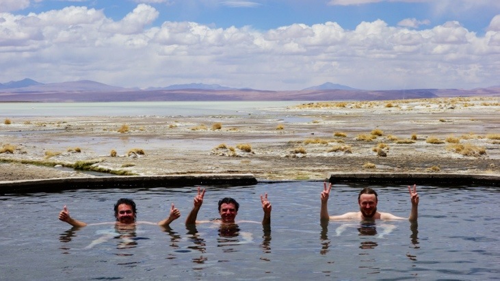
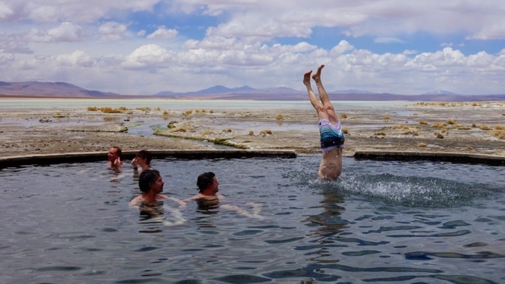
Heading back for lunch and a swim at the Aguas Calientes spring.
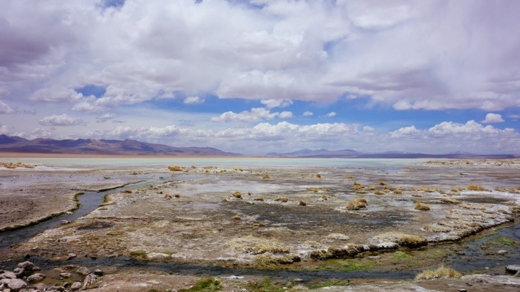
Very close to the Salar de Chalvari is the Termas de Polques, a natural spring of hot waters. Here we enjoyed the naturally made hot spring and washed off the sweat and dust of the past days. The water was really nice and warm and is constantly replaced by fresh water from the spring. This was just the right treatment after sitting in a jeep for six hours:
In the mean time Bernadina prepared lunch:
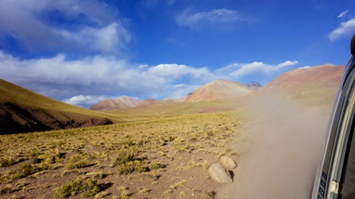
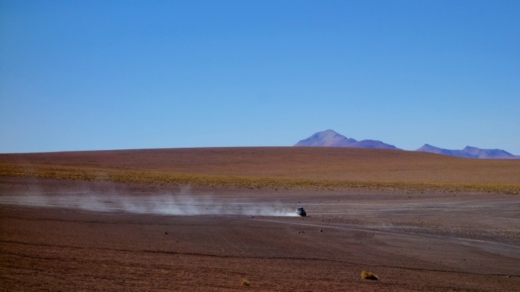
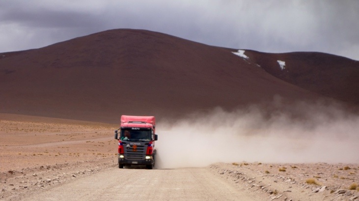
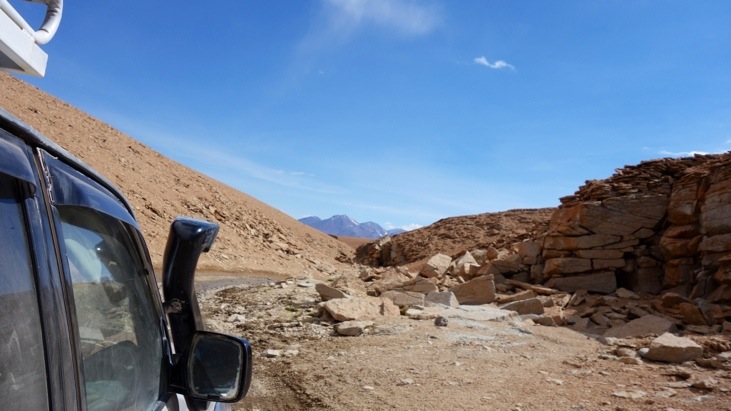
Back on the road which is an important connection between Bolivia and Chile large trucks came heading towards us whirling up a lot of dust behind them. Depending on the wind we would quickly close all windows. Nevertheless, after a few days there was dust and sand in almost all cracks of the car.
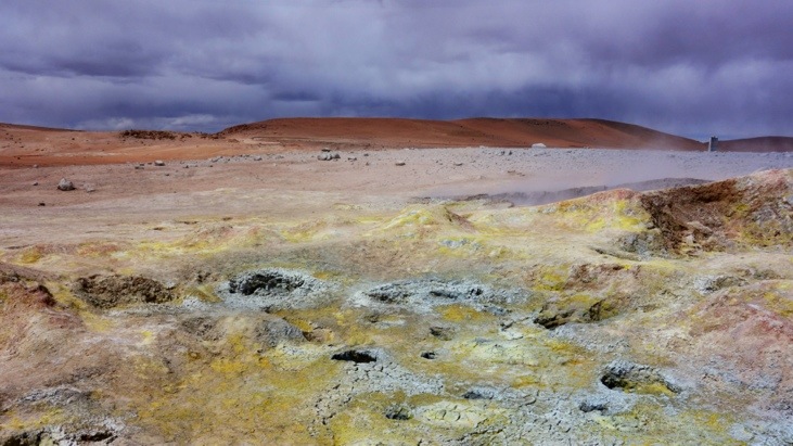
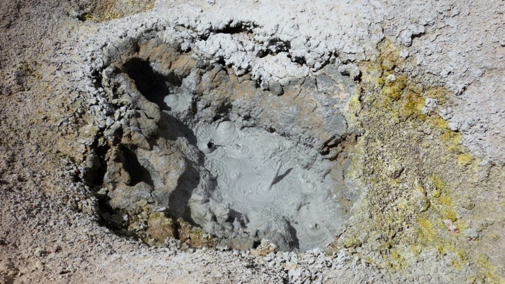
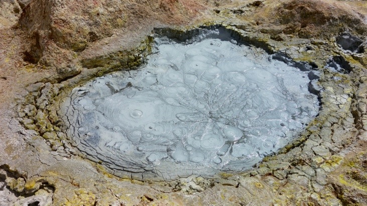
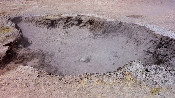
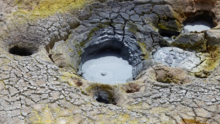
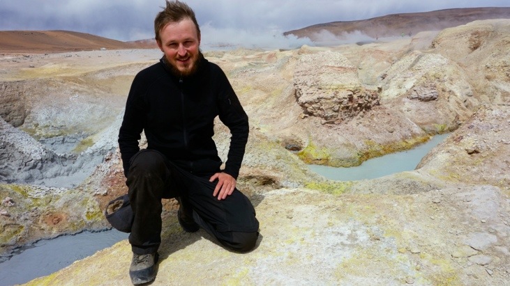
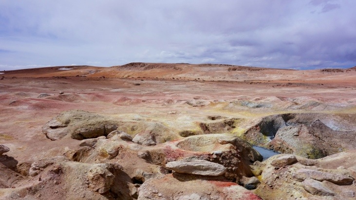
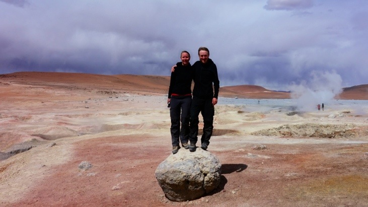
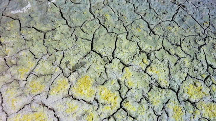
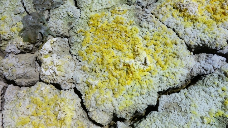
In the afternoon we arrived at the Sol de Mañana Geyser located at an altitude of almost 5000 m.
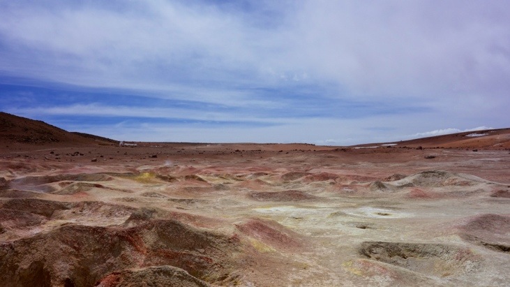
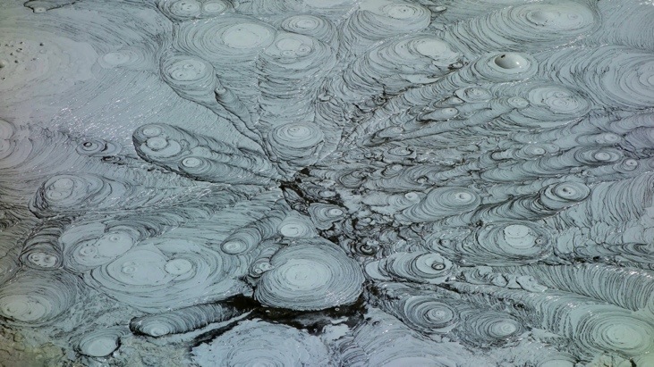
We felt strongly reminded of Yellowstone as there was intense volcanic action with steaming vents and bubbling mud pools:
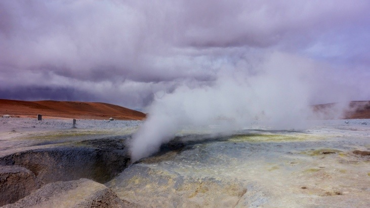
One distinct advantage of this hot-spot compared to Yellowstone is that you can get really close to any pool or vent. You’re not kept at distance. However I don’t know how many people get seriously hurt/burnt here either…
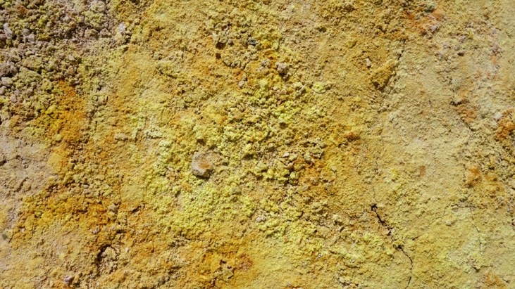
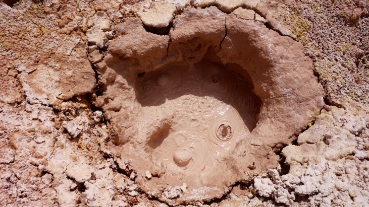
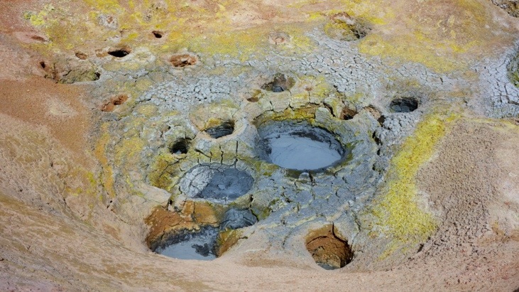
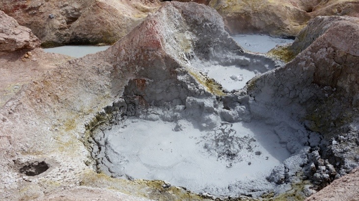
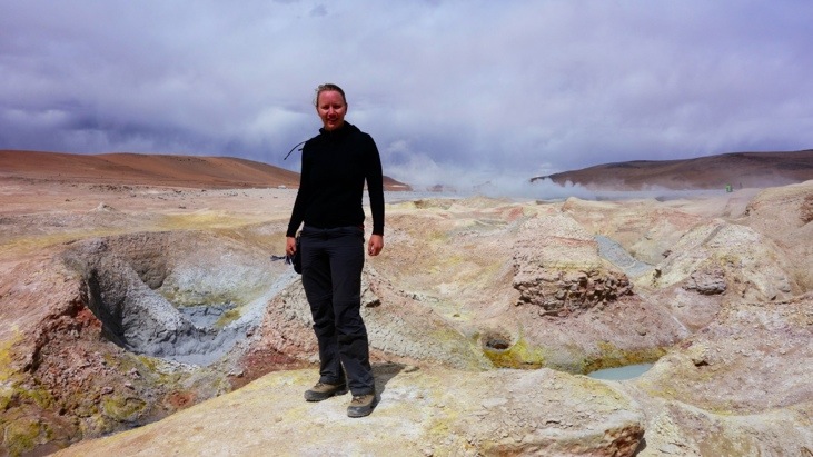
The different varieties and shades of colors were just amazing and we find it unbelievable that nature has such a large paint-pot!
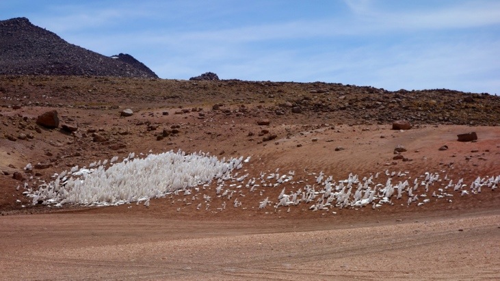
These white fields indeed consist of a sort of ice stalagmites! The ice fields melt very irregular and result in fields of pointy ice spears:
Another colored rock formation:
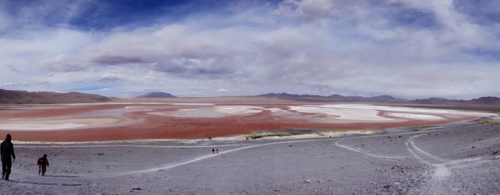
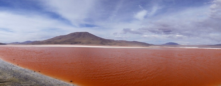
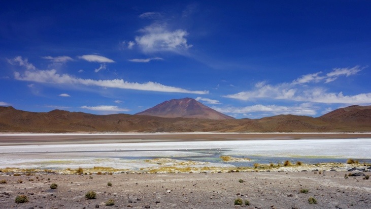
In the early afternoon we dropped off our luggage and Bernadina at the hostel and headed on to the famous Laguna Colorada (4278 m):
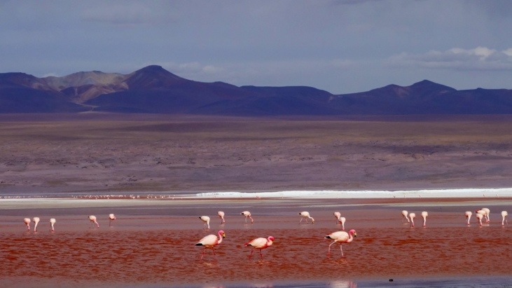
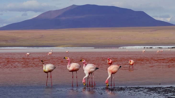
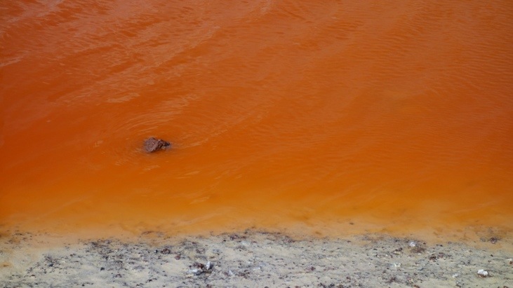
Laguna Colorada translates to “Red Lagoon” and is a shallow lake with white colored islands and orange-red colored water. The reddish color is caused by red sediments, red algae and other microorganisms and the white islands consist of borax. It is definitely one of Bolivia’s salt wonders of the Altiplano and a home to thousands of the nearly-extinct flamingo population. When you first visit the bizarre landscape it simply seems otherworldly!
The craggy rock shores surrounding the deep red-orange water with its white islands and the rolling mountains framing this scenery, Laguna Colorada is doubtlessly an immaculate and beautiful wildlife area.
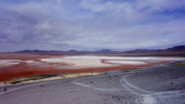
Although they seem plentiful in the Laguna Colorada the James’s Flamingo is a rare breed of flamingo and has flocked to the area for centuries. During the mid-1950s, scientists had already written them off as extinct, until a pack was found roaming South America. Today they are classified as an endangered species.
A closer view of the red-orange water:
On our way back to the hostel:
Dinner time! A soup as a starter:
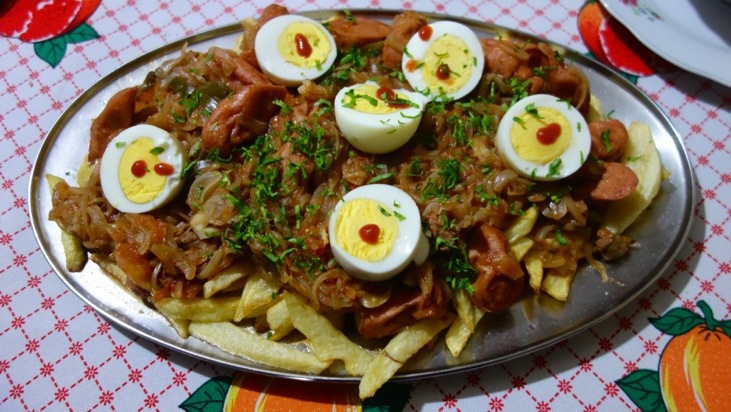
A Bernadina style Pique Macho:
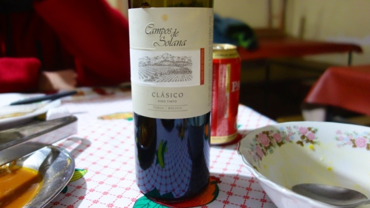
And some Bolivian wine we organized:
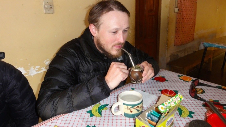
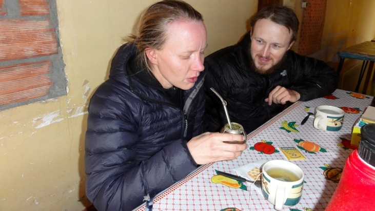
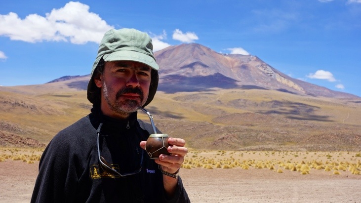
That evening we also tried our first mate. Mate is a traditional South American caffeine-rich infused drink, particularly popular in Argentina. It is prepared from steeping dried leaves of yerba mate in hot water and served with a metal straw called “bombilla” in a shared hollow calabash gourd. You keep adding hot water to the mate, then you take a few sips and add more water. You keep repeating this procedure until the taste becomes too weak, you run out of water or have had enough mate…
The taste depends on the leaves you buy and because of the large amount of leaves per serving it is always rather strong. You will find many positive effects attributed to drinking mate when you read up on it on the internet. Some of these I found were: Yerba mate tea is very high in antioxidants, enhances your ability to focus, enhances physical endurance, aids digestion, helps you control your weight and supports cardiovascular health!
With all of these benefits we had to try it and Mario was so kind to let us try from his:
Picture from Sergio.
Picture from Sergio.
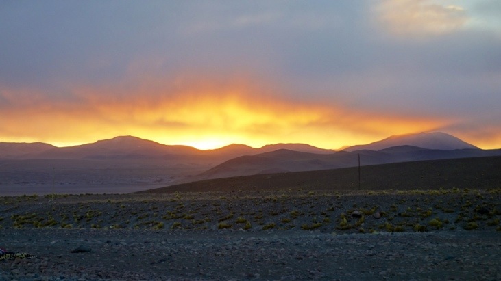
Next morning we got up very early and when we looked out of the hostel we first thought the mountains had caught on fire:
After a short breakfast we headed off for a famous park of stone formations.
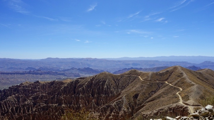
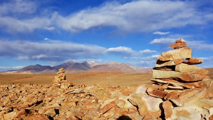
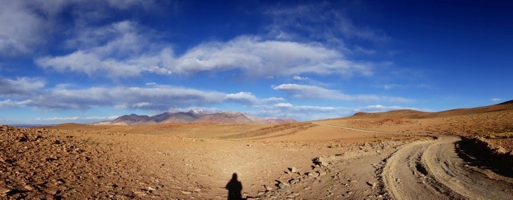
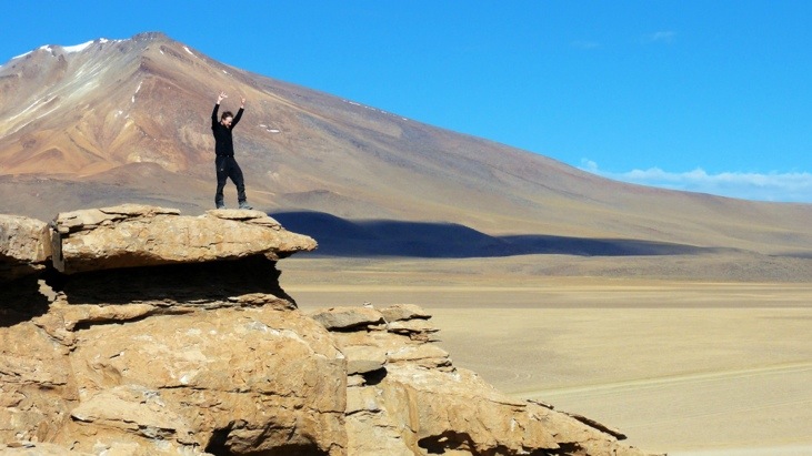
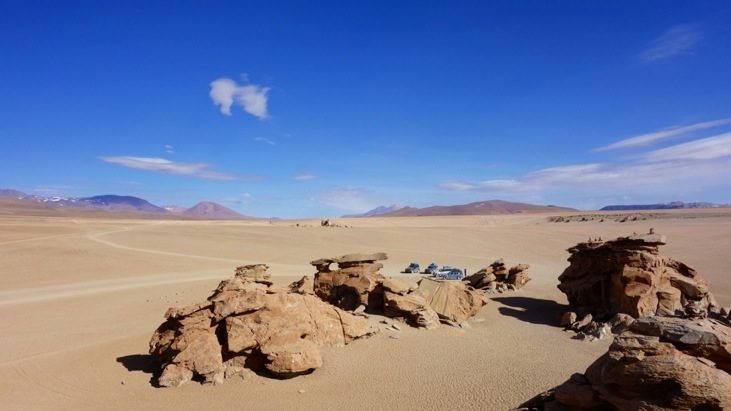
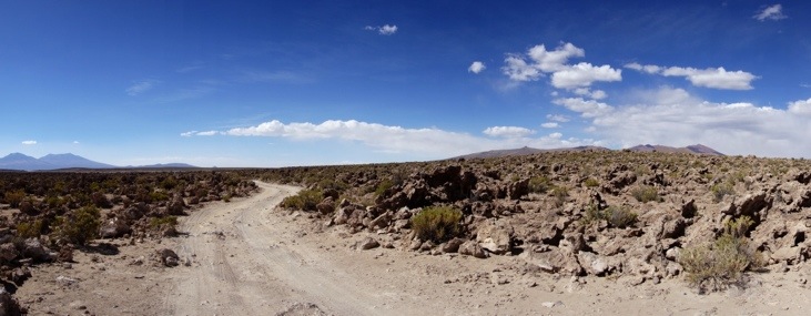
We left the national reserve and kept driving on this entirely flat desert of stones called Desierto de Silolia:
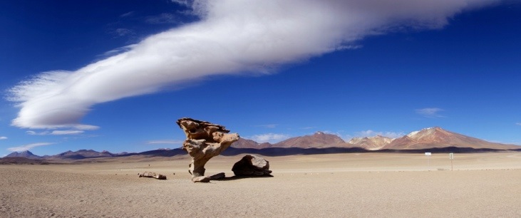
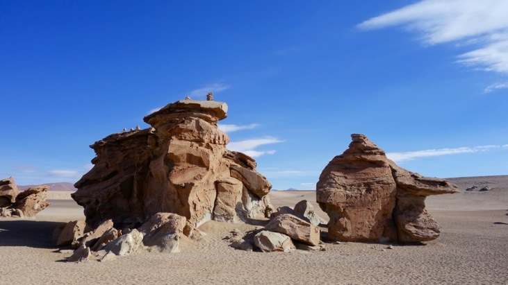
With David as our fearless driver we managed were the first visitors at the stone park. Certainly the most famous formation is the Árbol de Piedra (stone tree) which is shaped like a stunted tree. The shaping of the relatively soft sand stone is done mostly by the sand and the strong winds which sand blasted the rock into this structure:
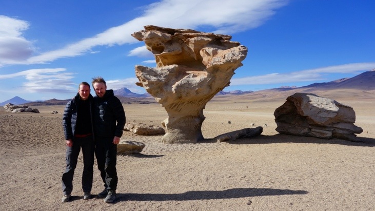
Its setting in the landscape is perfect and Andy could probably take pictures of it all day…
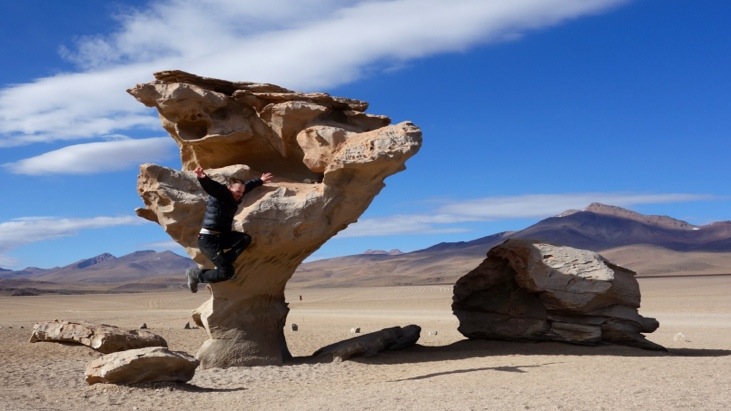
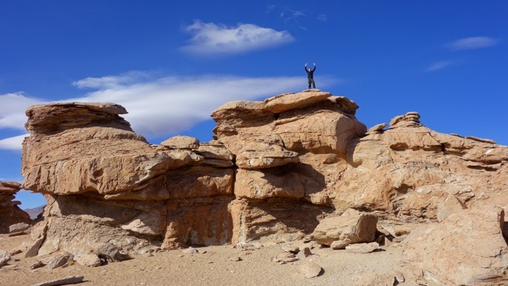
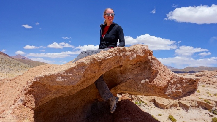
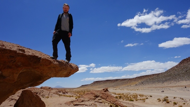
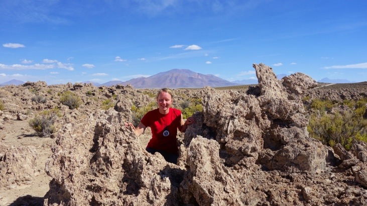
Close by there are other rocks which are better protected and a lot of fun to climb:
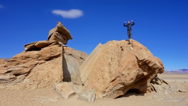
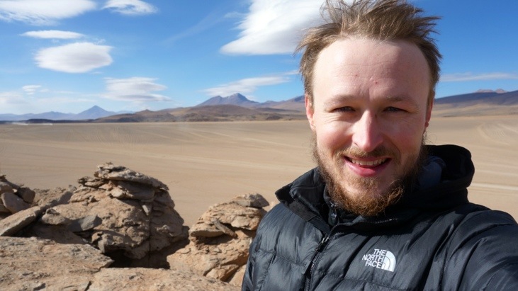
Andy chose this formation:
Picture from Sergio.
His view from the top:
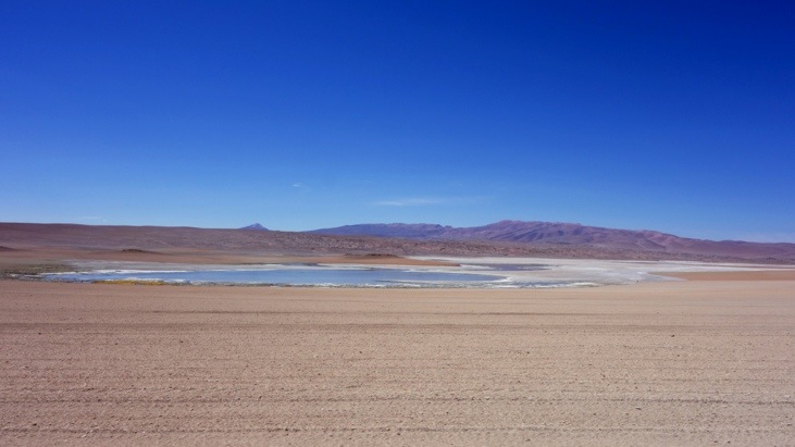
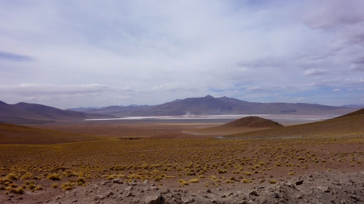
After leaving the Desierto de Silolia we headed on for a series of 5 smaller lagoons.
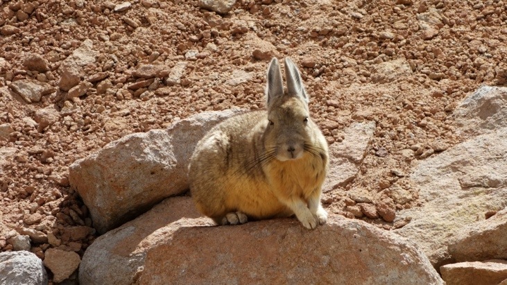
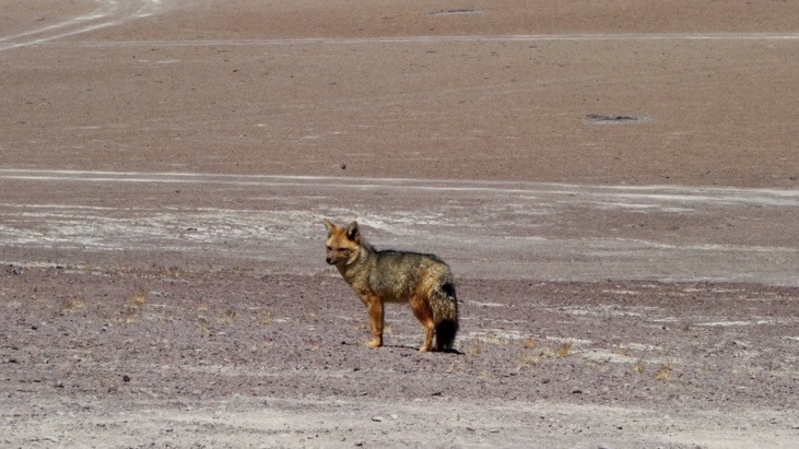
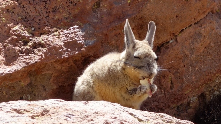
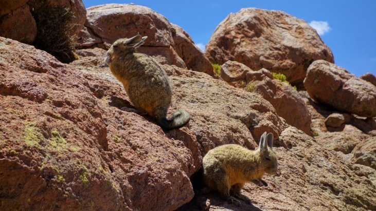
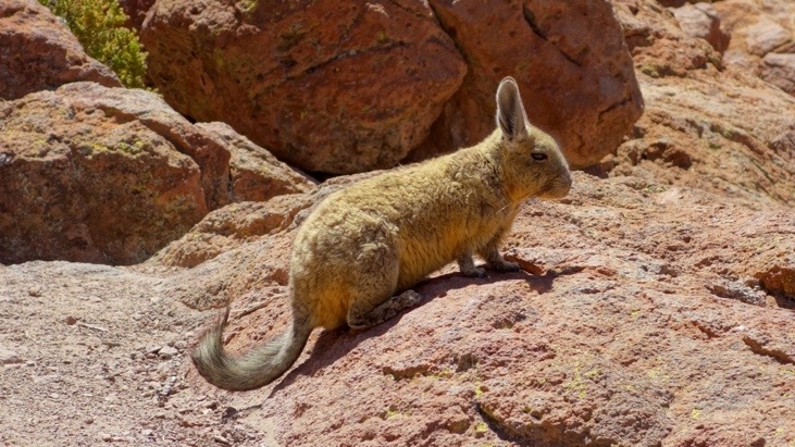
On the way we saw viscachas:
And even a fox which is called “zorro” in Spanish:
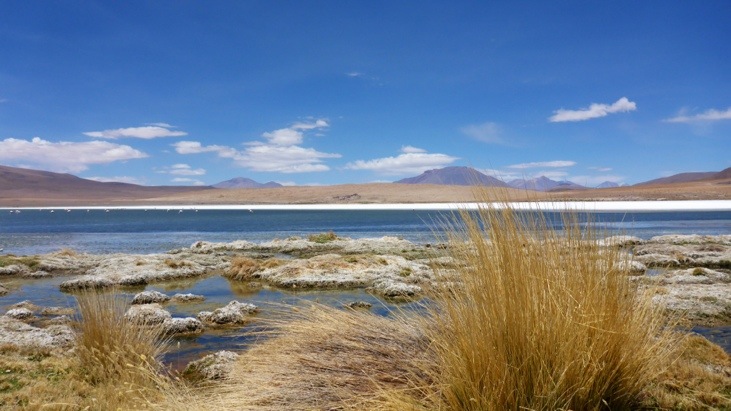
At the Laguna Ramaditas we had a stop and walked around parts of it:
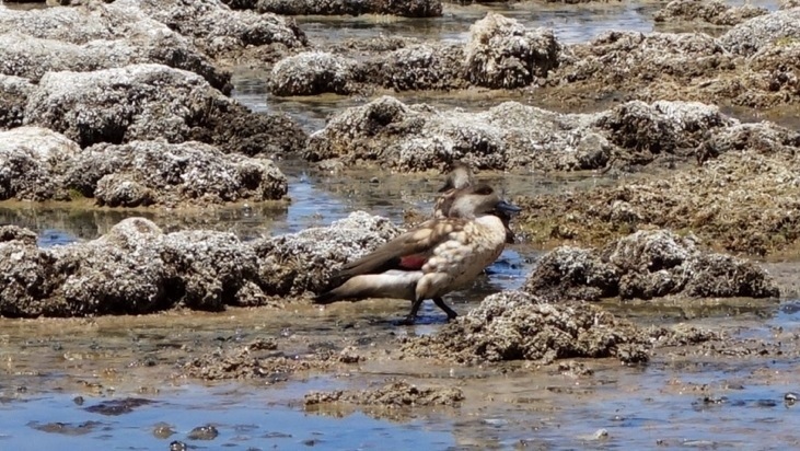
On the way we got a close up shot of this inhabitant of the lagoon:
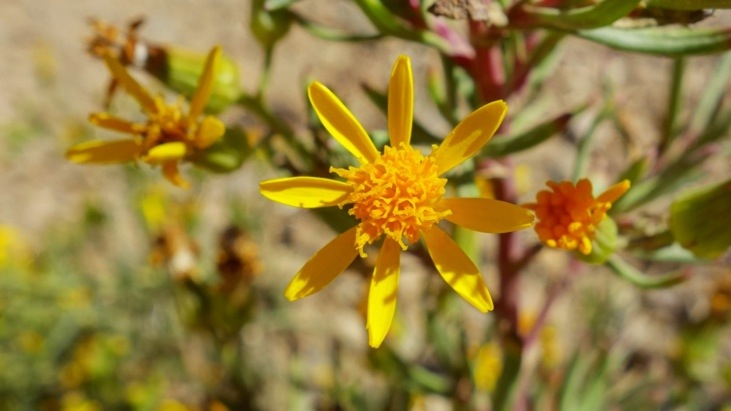
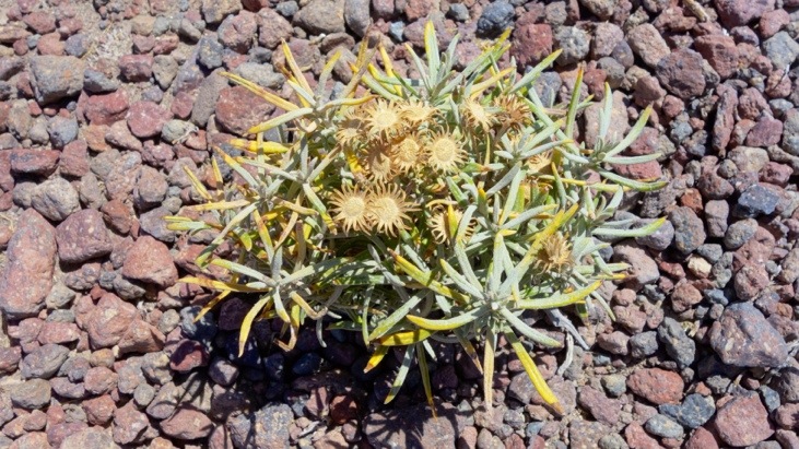
And some flowers we had never seen before:
The colors of the shore line were once again astonishing:
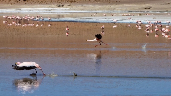
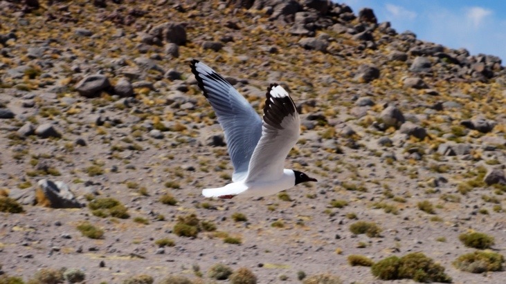
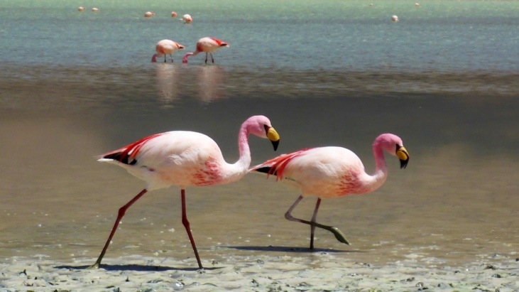
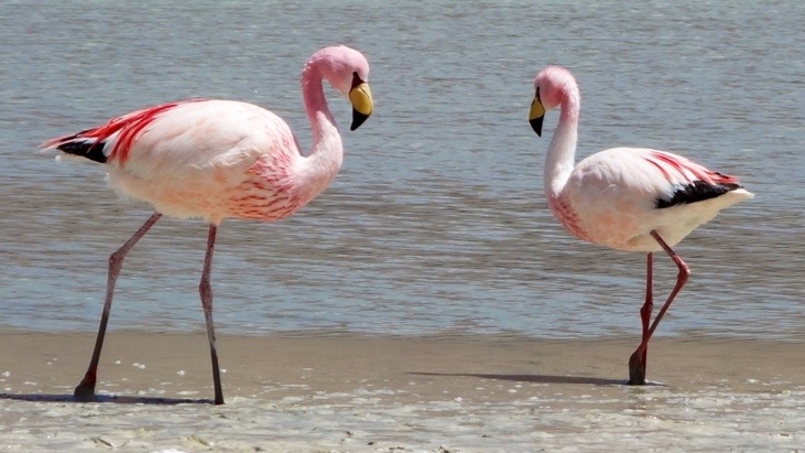
This lagoon too was a habitat to flamingos:
Without getting out of the car we passed by the second lagoon, Laguna Honda:
And passed lagoon Charcota from the distance:
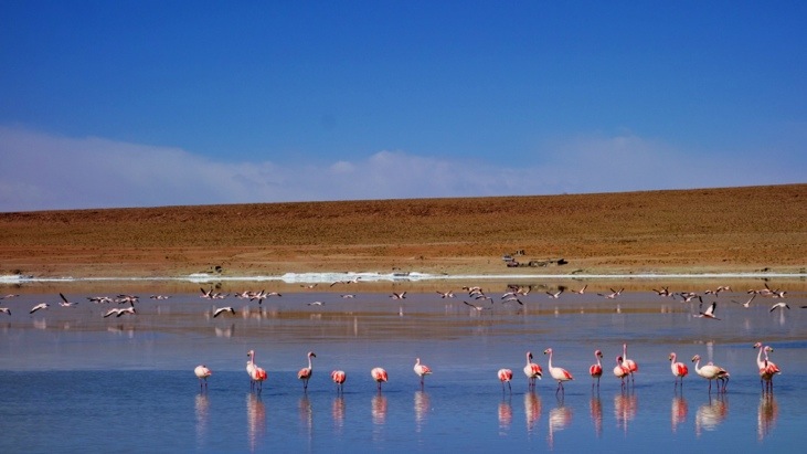
Finally we arrived at the fourth lagoon, Hedionda. Hedionda translates to stinking and has its origin in the high sulphur content of the lake.

Here we could again enjoy hundreds of flocking flamingos in front of the Ollague volcano:
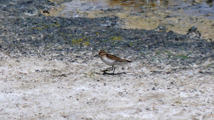
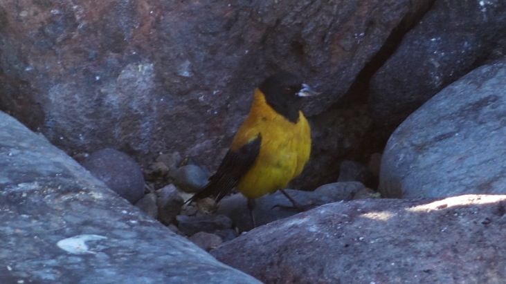
A little fellow often seen whizzing around the flamingos feet (Cinereous Ground-Tyrant):
Amazing how good some birds can hide with their camouflage feathers:
The last and fifth lagoon of this series and our journey, the lagoon Cañapa:
Around noon we stopped for lunch.
While we waited for Bernadina to prepare lunch, …
Picture from Sergio.
Mario enjoyed his mate in a perfect scenery:
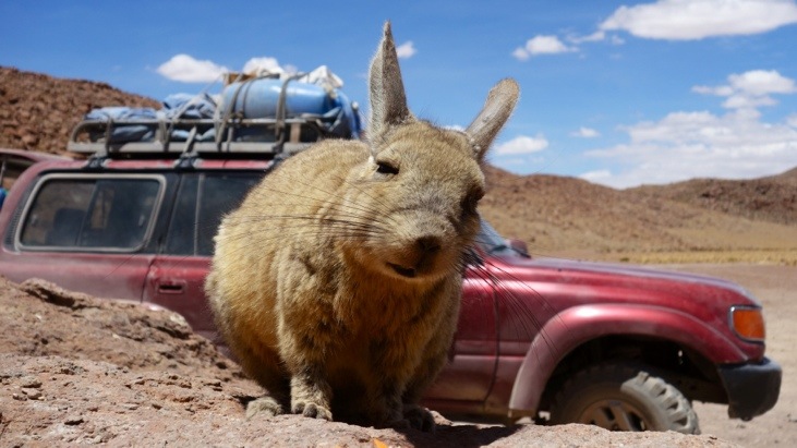
Nearby we found a viscacha family which feasted on the peels and scraps Bernadina through them:
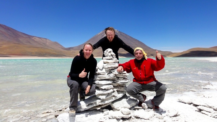
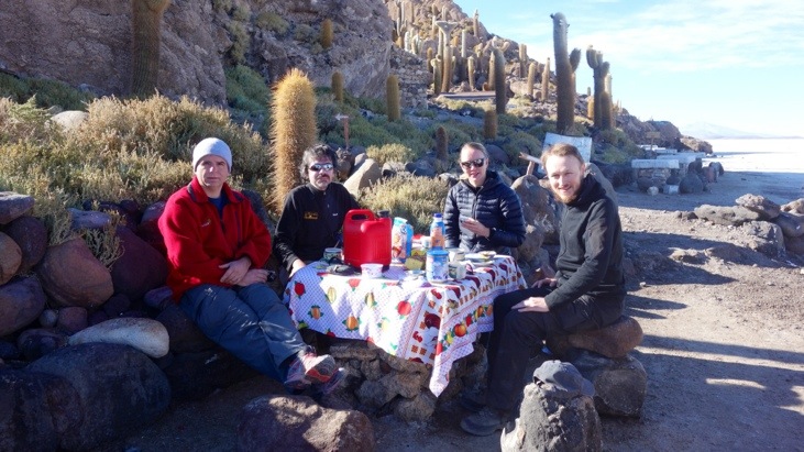
Our little tour group from left to right consisting of: David, Mario, Sergio, Bernadina, Tini and Andy:
After lunch we headed on north.
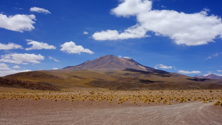
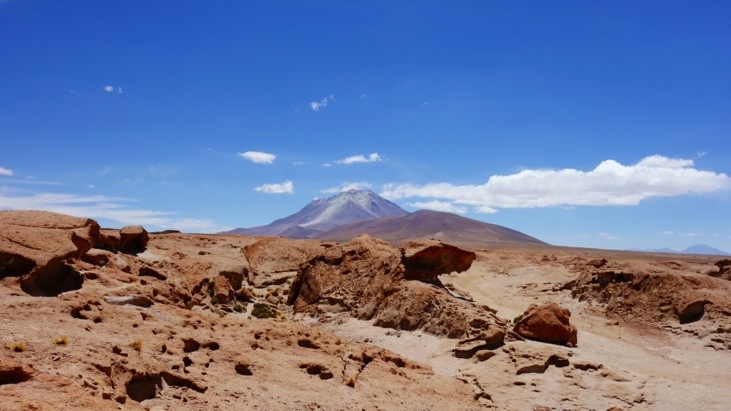
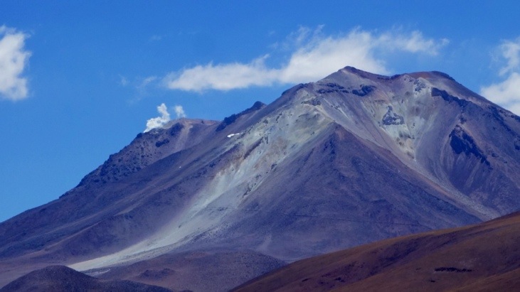
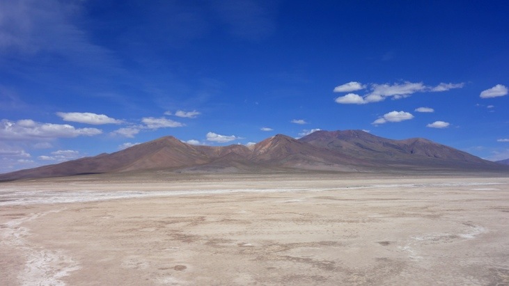
Until we finally reached the still active volcano Caquella (5947 m).
On this close-up you can see a small smoke and ash cloud leaving one of the craters:
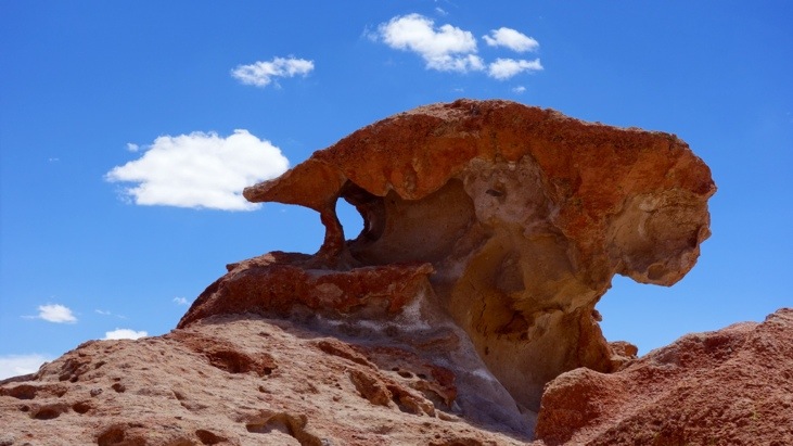
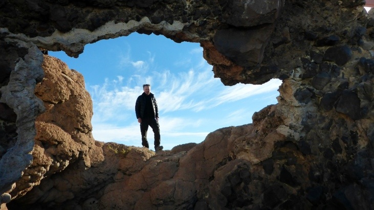
We stopped in the Valle De Rocas, a valley of interesting rock formations we spent some time wondering around:
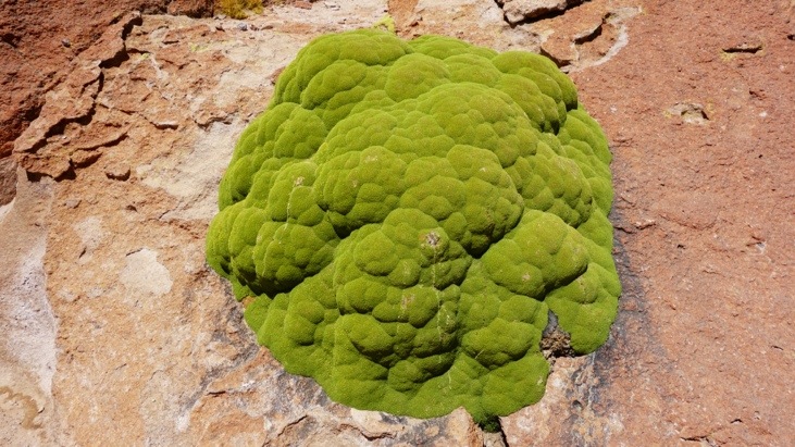
Very slow growing (1 mm/year) and extremely green moss:
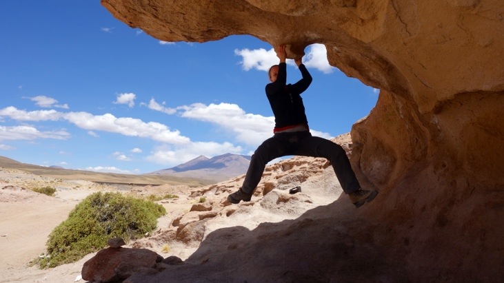
Tini trying to bolder on one of these structures. Being volcanic the surface is very rough and you have great grip, but it also quickly cuts your skin:
We left the Valle De Rocas and kept heading on:
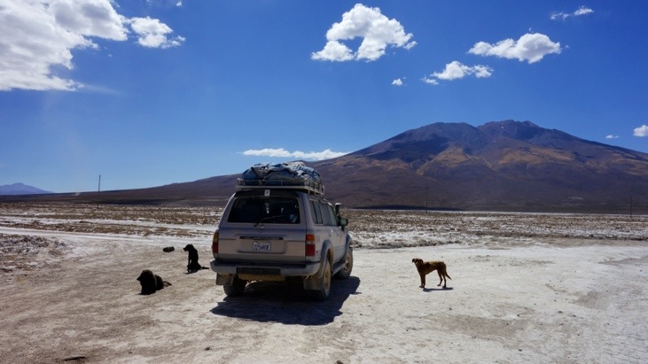
At a short photo-stop our car was quickly surrounded by wild dogs. But none of them were aggressive and they just kept sitting close to the car and chased it once we started driving again:
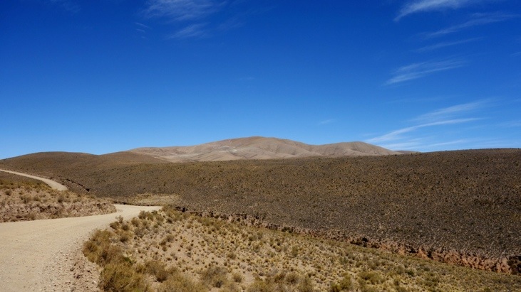
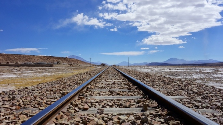
Then we entered a small salt desert called Salar de Chiguana:
Leaving the salt desert we stopped at its edge for structures at the side of the road which first looked like volcanic rocks with strange shapes:
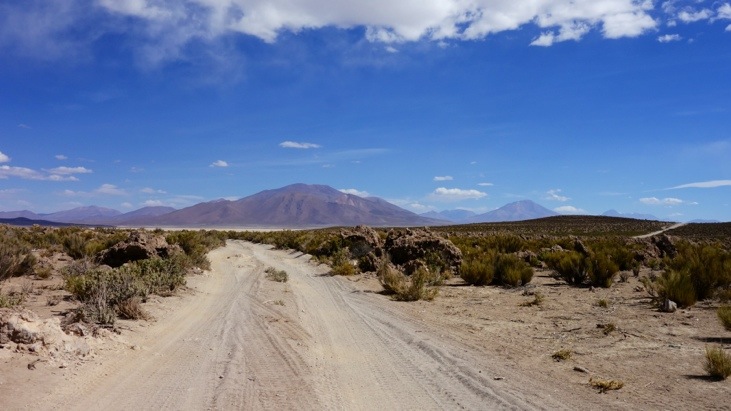
However as the salt desert had formerly been an ancient ocean with its shores occupied with coral reefs, the edge of the desert was now lined with these fossilized coral reefs:
A closer look reveals the coral like structure:
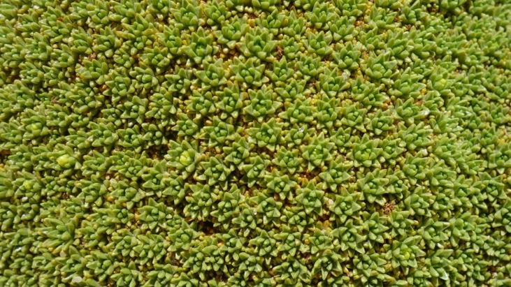
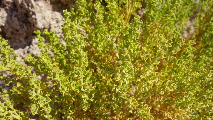
One of the plants growing among these very sharp edged structures:

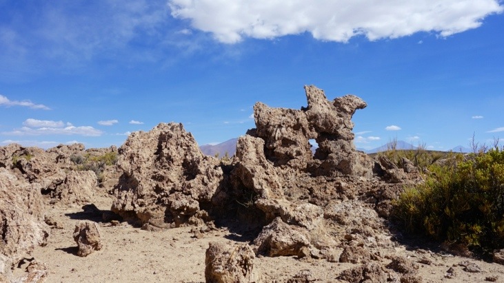
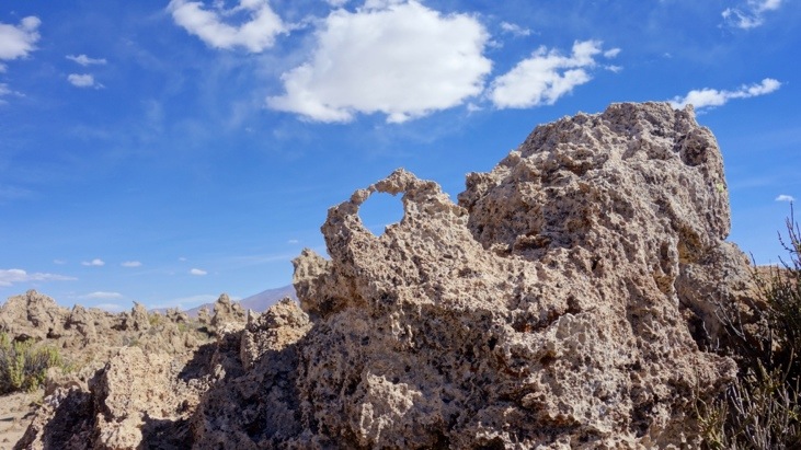
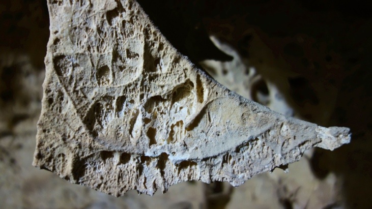
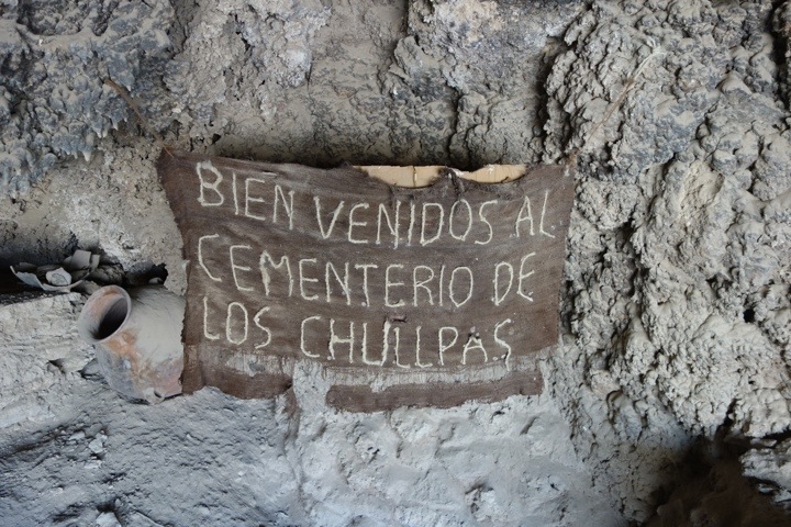
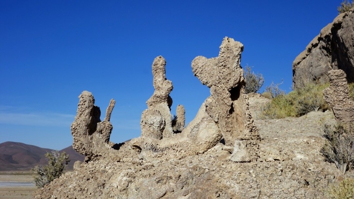
After some more driving we arrived at the “Gruta De Las Galaxias”. The outside has stone structures and reminded us of fossilized cacti, but these too are fossilized corals.
On the inside of the cave there are amazing rock formations which were created 225 million years ago when the Thunupa volcano came into contact with water (the salt flats were still an ocean back then).
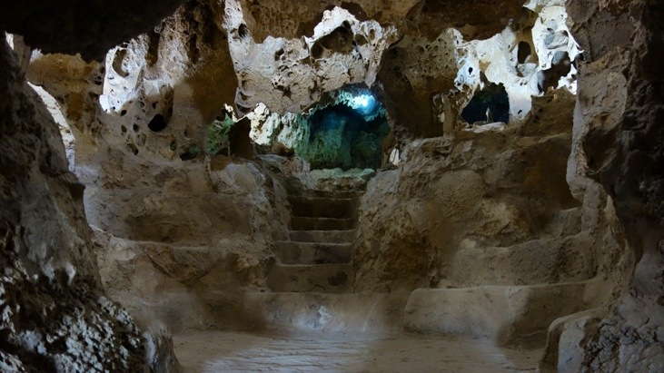
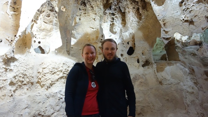
Every shape and pattern is unique and lets your imagination run wild:
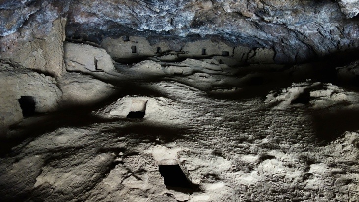
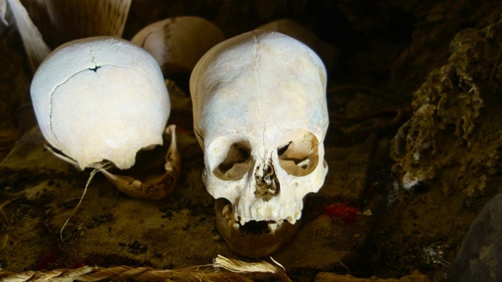
The Cueva del Diablo located at the same site is a sacred burial ground surrounded by many myths and in the tombs one can still find human remains:
One the outside some more cactus-like fossilized corals:
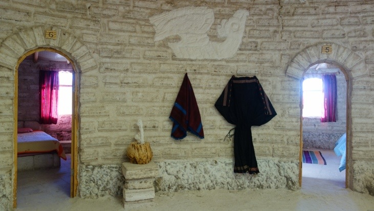
From here it was only a short drive to our hostel for the last night of our journey. It was a hostel almost entirely built of salt:
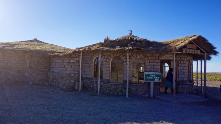
Salt everywhere: salt tables, salt floors, salt walls, …
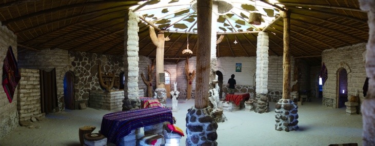
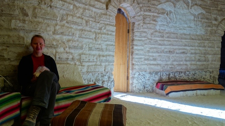
Luckily the beds had regular mattresses on them and Andy (loving salt) did not start licking any of the interior… 😉
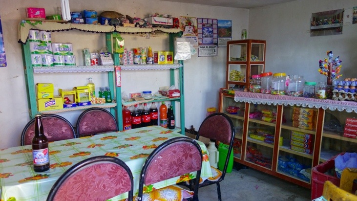
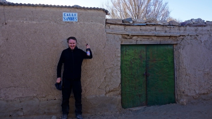
Still being early we decided to head into the nearby village of Chuvica to buy few life-enhancing goods.
We quickly spotted the local supermarket with the help of its big advertisements:
But had a hard time choosing beer and wine products from the huge selection 😉
(We actually had to ask around quite a bit to find the supermarket and they only had one last bottle of wine and one beer brand to choose from…)
More views from within the village:
And Andy in front of the Saint Andres street proudly presenting our beer purchase:
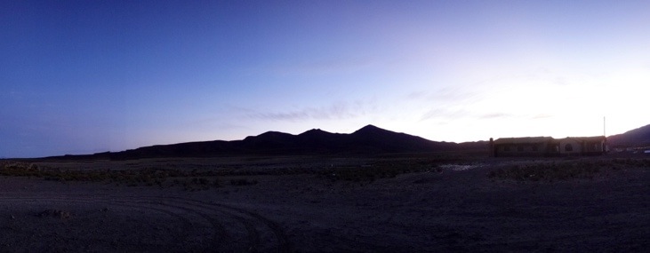
View from our hostel to the surrounding landscape:
In the evening we were again visited by the local kids of the town who recited various songs for us. Here Sergio showed them some pictures from our past trip:
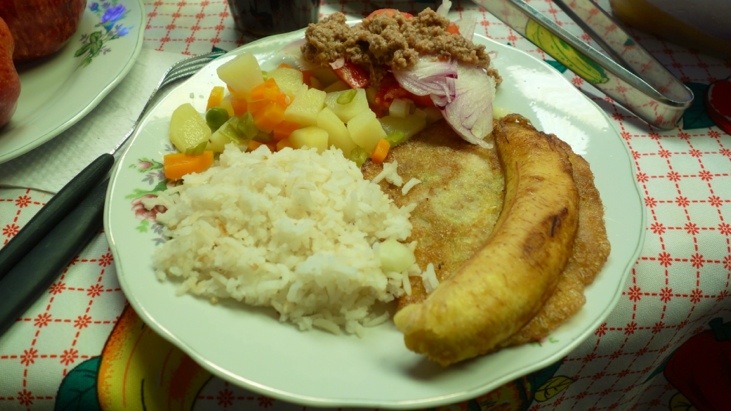
Bernadina outperformed herself with this onion, mushroom spaghetti sauce on very soft noodles…

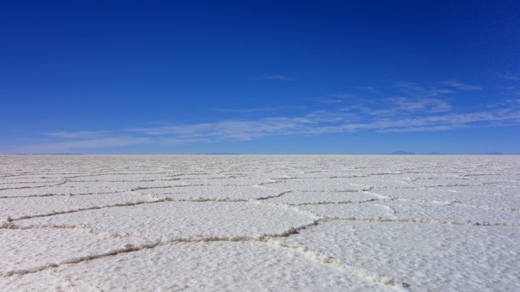
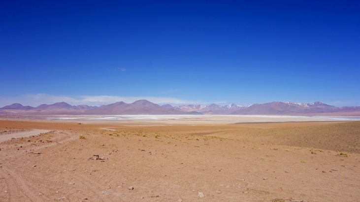
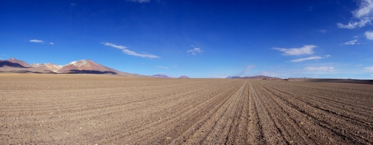
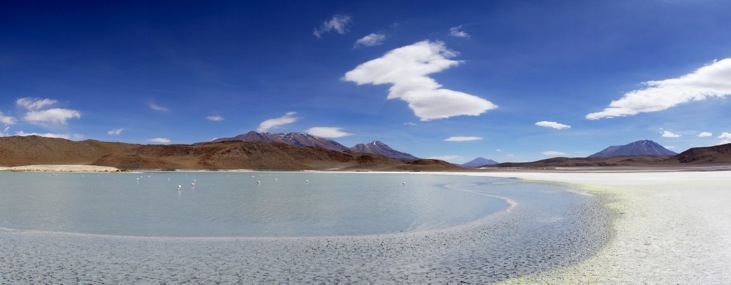
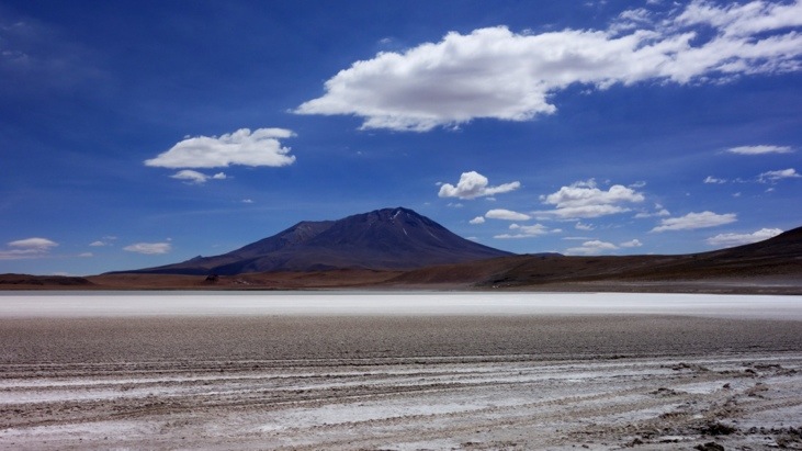
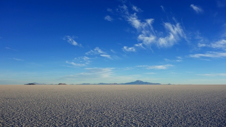
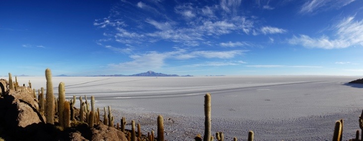
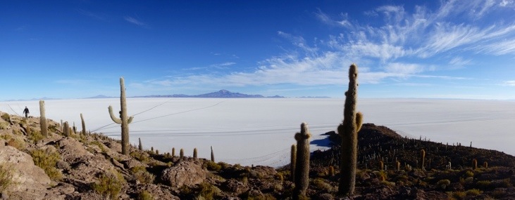
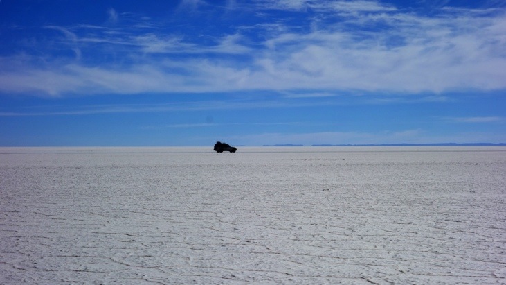
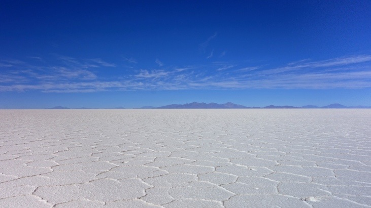
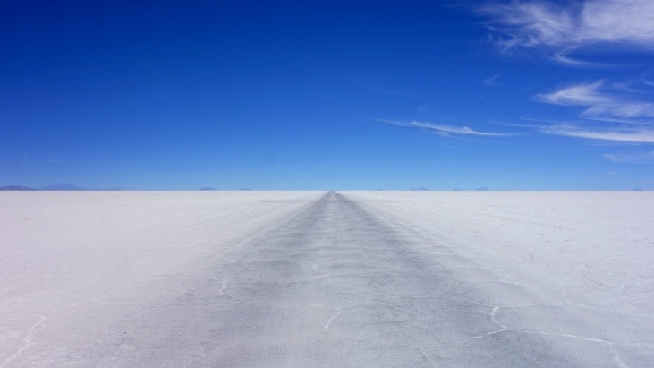
The next day we got up before sunrise and headed towards the highlight of our trip, the Salar de Uyuni. At an altitude of 3656 m the Salar is the world’s largest salt flat covering an area of 10’582 square kilometers. The Salar was formed as a result of transformations between several prehistoric lakes. It is covered by a few meters of salt crust, which has an extraordinary flatness with the average altitude variations within one meter over the entire area. The crust serves as a source of salt and covers a pool of brine, which is exceptionally rich in lithium. It contains 50 to 70% of the world’s lithium reserves, which is currently in the process of being extracted.
The large area, clear skies, and the exceptional flatness of the surface make the Salar an ideal object for calibrating the altimeters of Earth observation satellites. The Salar also serves as the major transport route across the Bolivian Altiplano and is a major breeding ground for several species of pink flamingos.
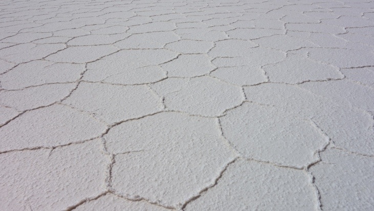
In the center the salt is over 10 meters thick. In the dry season, the salt plains are completely flat and covered by dry salt, but in the wet season, it is covered with a thin sheet of water. In this condition it forms a perfect mirror for the sky and can also be visited as it is still drivable.
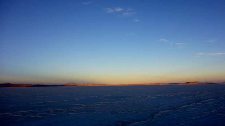
We managed to reach the salt flats just before sunrise.
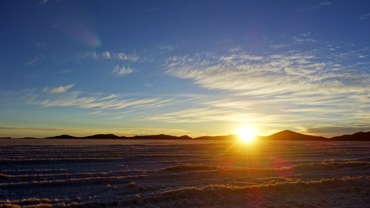
As the sun rose we admired our very long shadows:

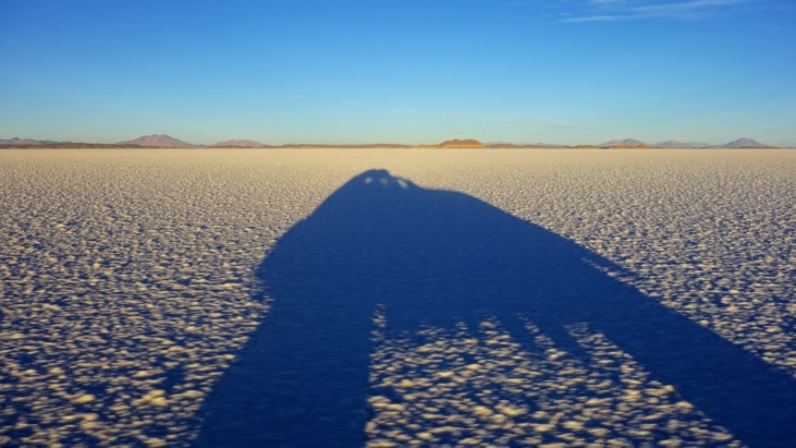
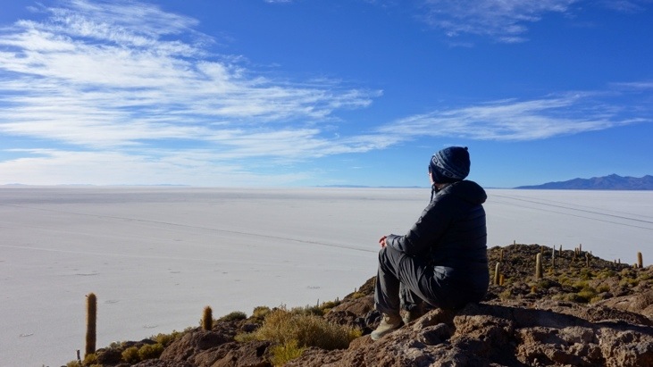
The view of this entirely flat landscape was simply stunning. We had never seen anything this large and this flat before:
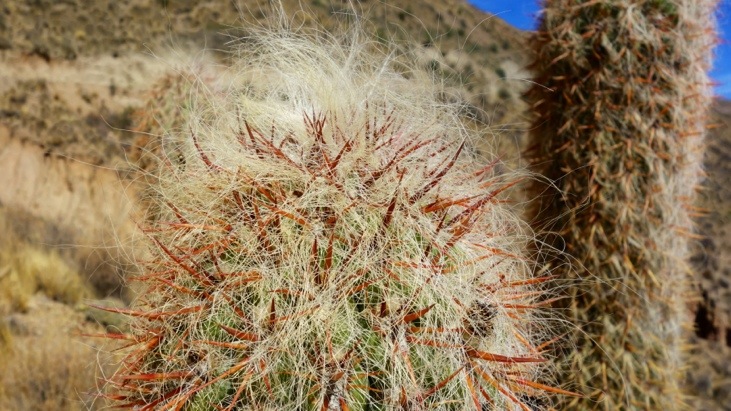
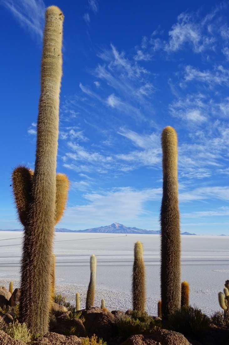
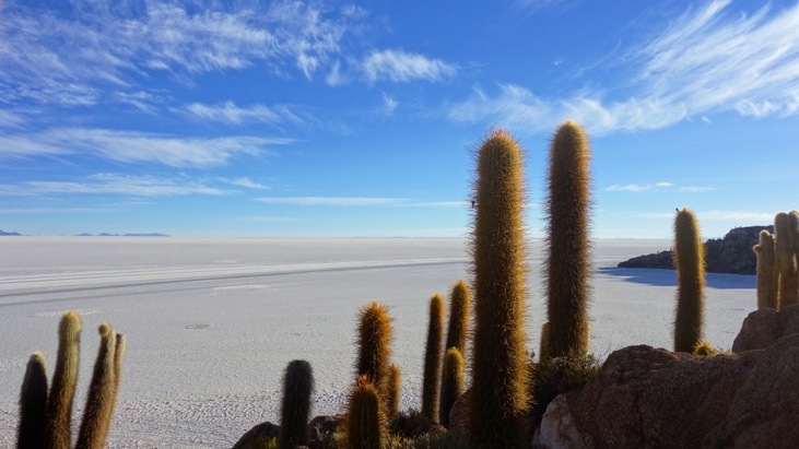
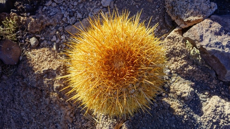
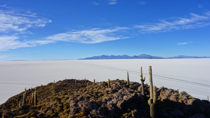
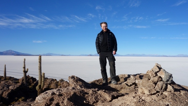
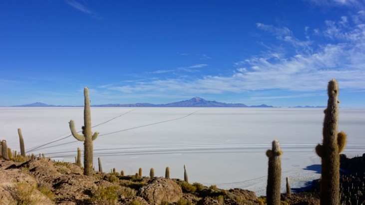
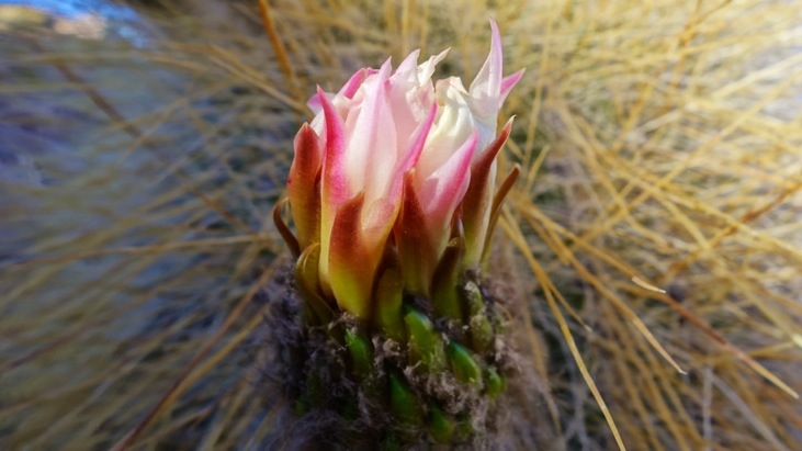
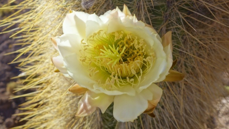
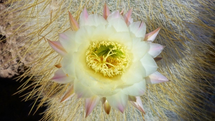
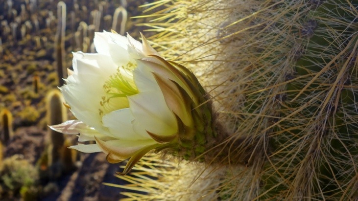
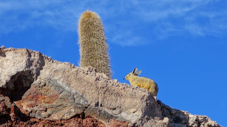
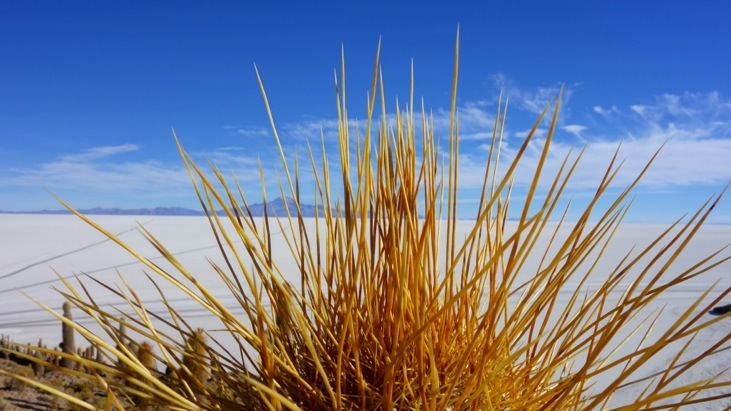
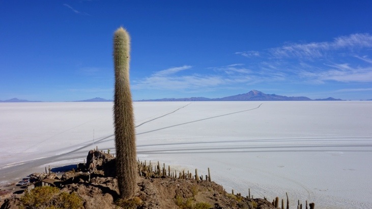
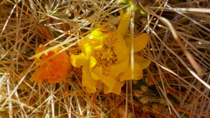
After driving some more we arrived at the “Isla del Pescado”. The name originates from the fish-like appearance of the island’s reflection in the wet season. It is covered with cacti and a great platform to view the otherwise flat surroundings:
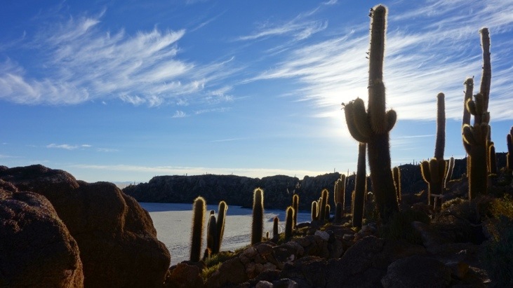
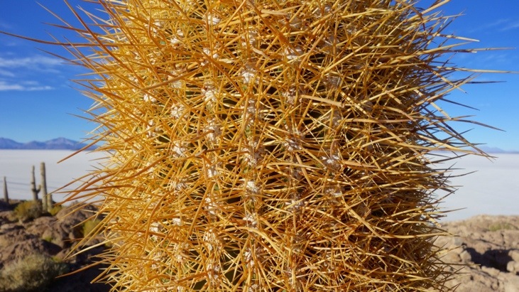
Some of the cacti are more than 900 years old and reach nearly 10 m height (with a growth rate of approx. 1 cm/year):
The very top has been and is still used as a place to perform the ancient Aymaran Huayna Capa ritual on the first of August.
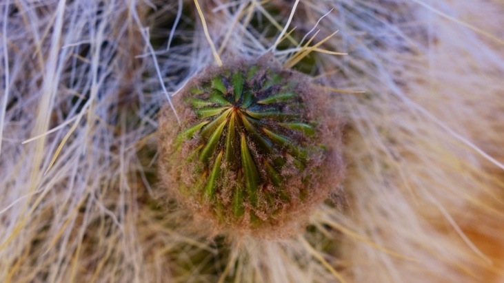
Andy and a very prickly cactus:

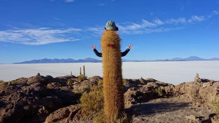
With his beard Tini almost mistakened the one for the other:
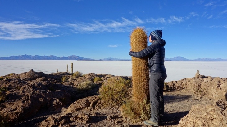
The needles are very very prickly:
The view from the top of the island is really fantastic. No matter in which direction you look, you see white salt everywhere:
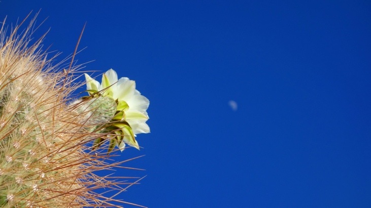
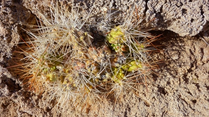
Cactus blossoms in different stages:
Of course also viscachas live on this island:

After we finished exploring the cactus island we had a delicious breakfast with coffee and cake:
Another little inhabitant of the island:
After breakfast we took off and headed for Colchani:
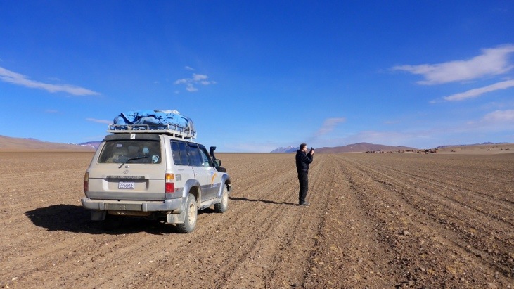
In the middle of nowhere we stopped for a series of pictures.
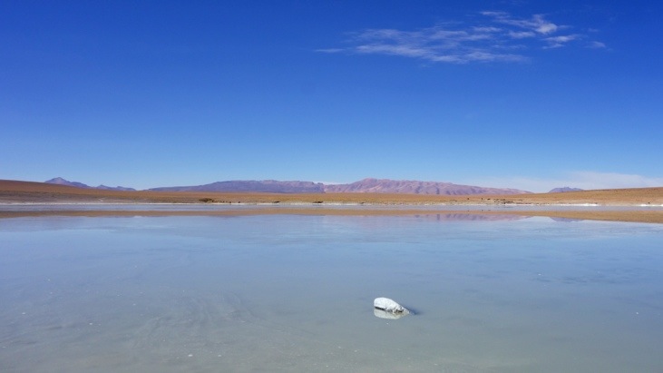
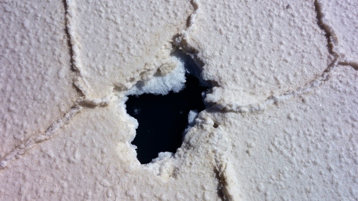
In some places we found holes in the thick salt crust revealing the brine underneath:
What happened to Andy here?
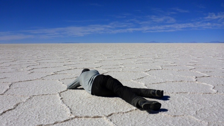
Of course he’s taking pictures…
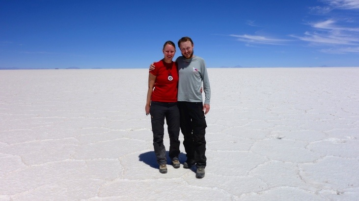
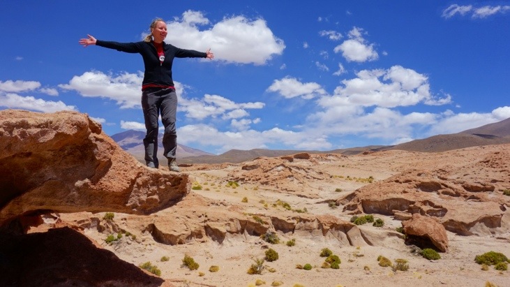
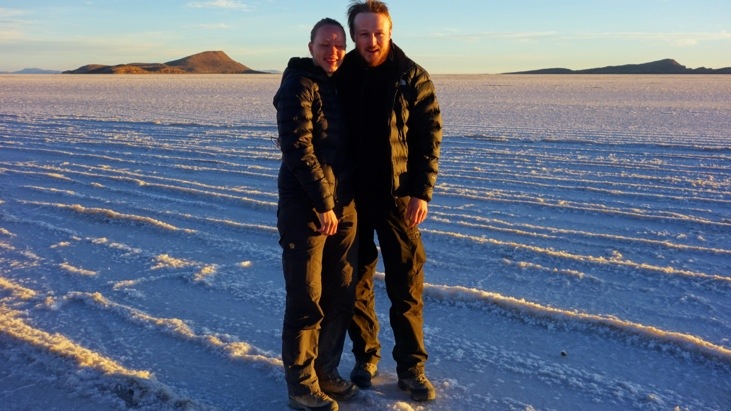
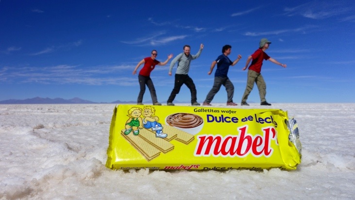
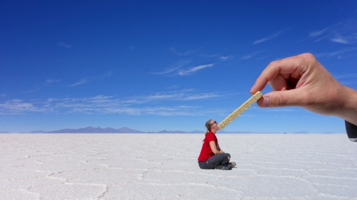
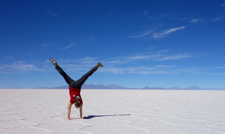
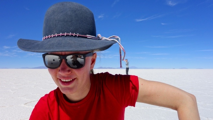
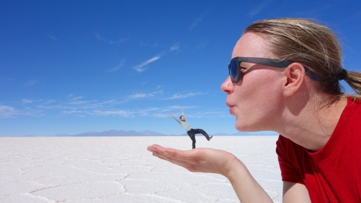
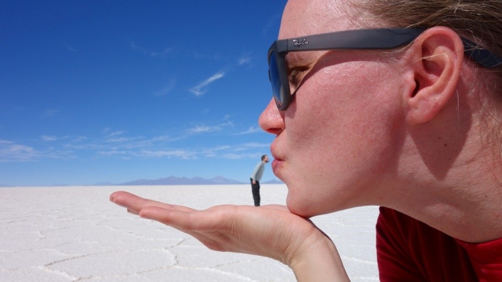
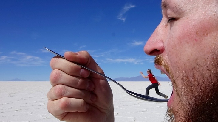
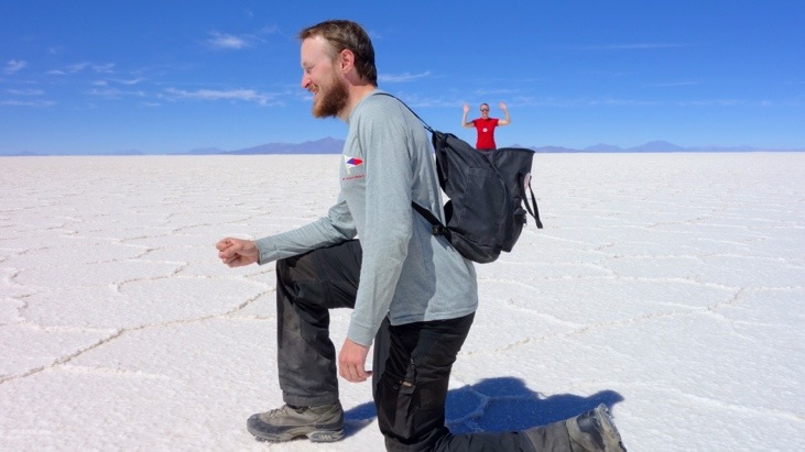
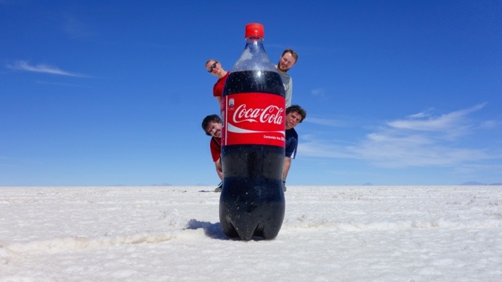
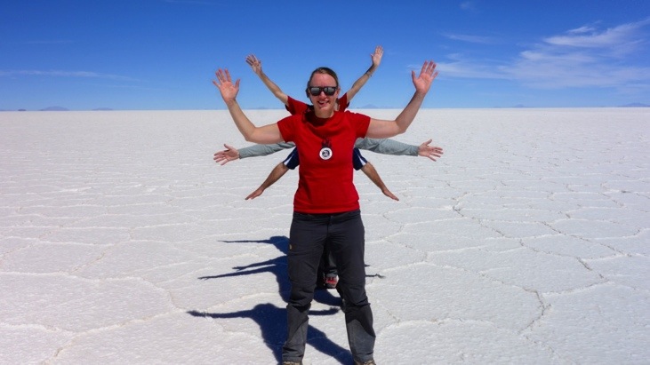
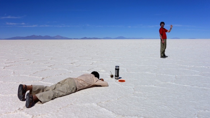
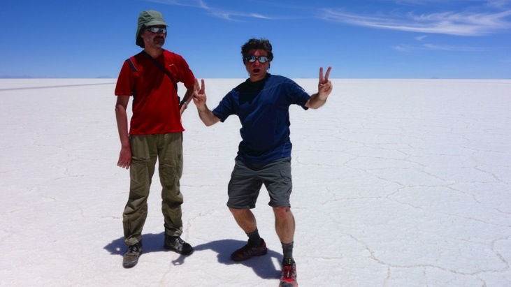
This wide plane of salt just invites to take pictures and play with the perspective…
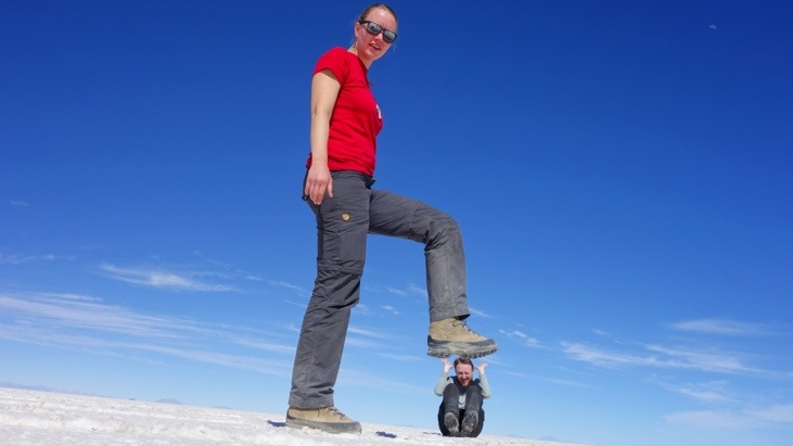
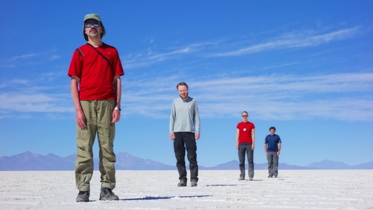
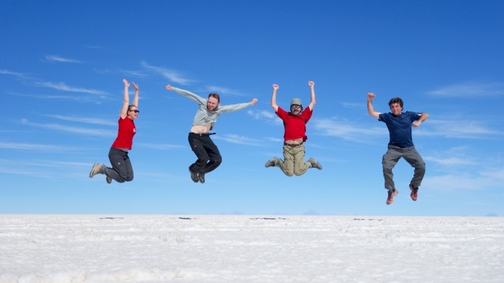
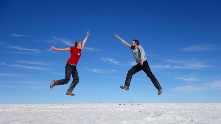
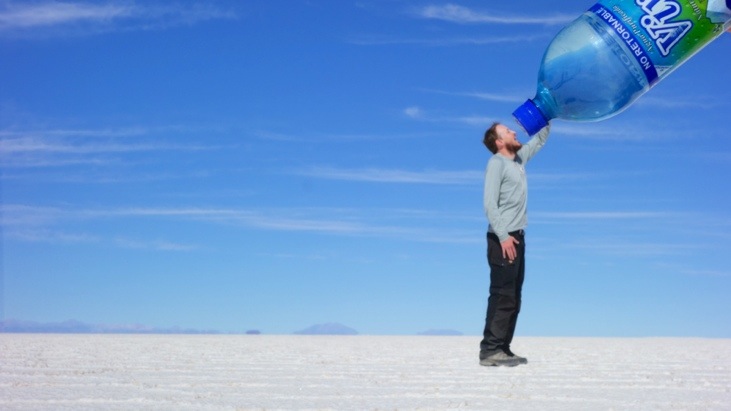
The only thing limiting the number of pictures is your creativity and the number of objects you have with you:
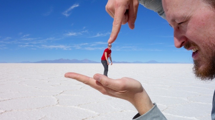
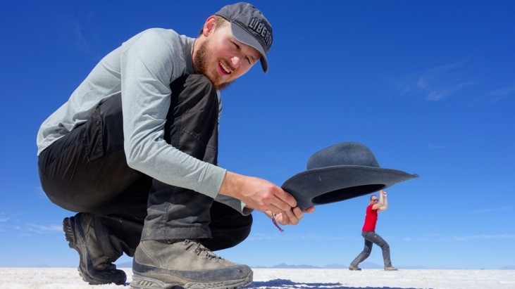
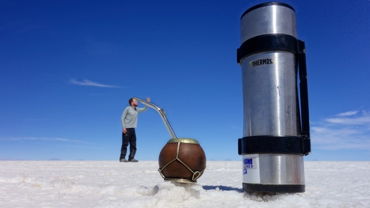
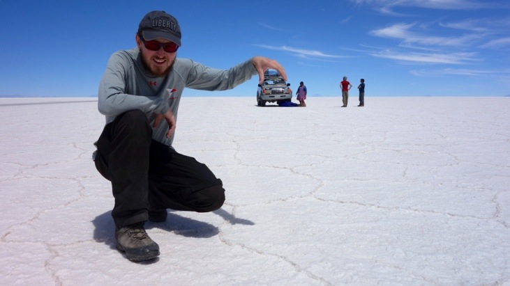
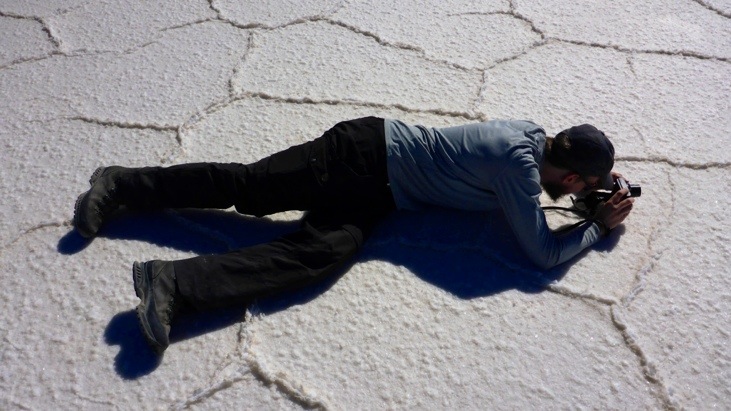
Here David, our driver and photographer of the countless nonsense-ideas we had. He always had an improvement for our ideas and never got tired of taking the pictures for us:
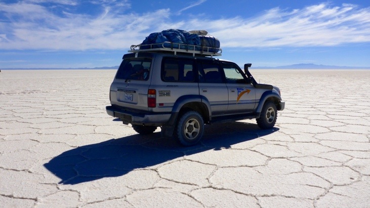
The road out of the Salar, colored black from the tires:
On the entire trip David had helped other driver countless times with their car problems. So far we had not had a single problem. But in the middle of the desert David started hearing a strange sound. After taking the front wheel suspension apart David found a damaged ball bearing. His assistant Bernadina handed him all the tools:
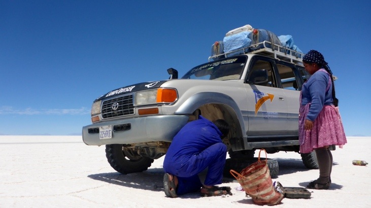
Finally the car was back in a drivable state:
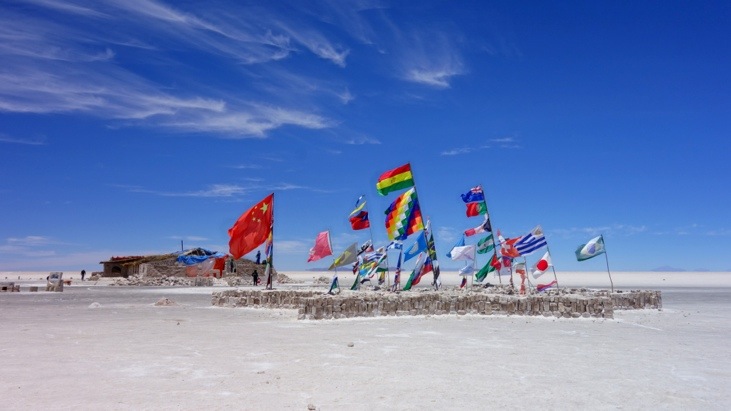
We passed the first and famous Hotel De Sal which is now a museum:
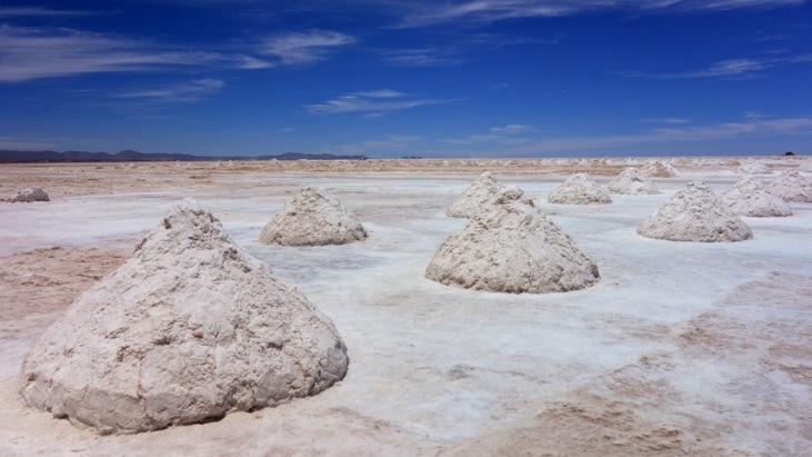
And shortly after we passed the salt mining area. Here salt is dug from the plane and heaped up into piles each weighing a ton. It is left to dry in the sun before it is transported to a refinery and then to our tables.
In Colchani Bernadina prepared the final lunch of our journey for us while we went strolling around the gift market:
After another half hour drive we arrived in Uyuni, our final destination. Here we said goodbye to Mario and Sergio who continued on back to Tupiza. We agreed to visit them when we pass through Buenos Aires and Sergio promised us one of his legendary asados.
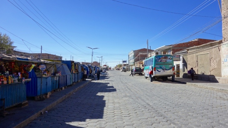
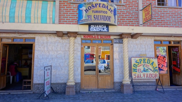
We chose a cheap 12 USD hostel and waited for our bus to leave for Calama/Chile the next day. Most of the time we were without electricity and of course without internet…
The next day we rose before sunrise in order to catch our bus to Chile.
Bye bye Bolivia!
P.S.:
Our Coca Leaf Experience:
Coca is a plant with many mineral nutrients, essential oils, and varied compounds with greater or lesser pharmacological effects – one of which happens to be the alkaloid cocaine, which in its concentrated form is a stimulant with possible addictive properties.
The coca leaf has been chewed and brewed for tea traditionally for centuries among its indigenous peoples in the Andean region – and does not cause any harm and is even beneficial to human health.
The traditional method of chewing coca leaf, consists of keeping a saliva-soaked ball of coca leaves in the mouth together with an alkaline substance that assists in extracting cocaine from the leaves.
When chewed, coca acts as a mild stimulant and suppresses hunger, thirst, pain, and fatigue. It helps overcome altitude sickness and even headaches. Coca chewing and drinking of coca tea is carried out daily by millions of people in the Andes without problems, and is considered sacred within indigenous cultures. Coca tea is widely used, even outside the Andean Amazon region.
Because of its stimulant effect coca leafs were originally used in the soft drink Coca Cola. In 1903 it was removed and a decocainized coca extract is now one of the flavoring ingredients.
While the coca leaf in its natural form is a harmless and mild stimulant comparable to coffee, cocaine can be extracted from the coca leaf. Without coca there would be no cocaine. The easy extractability of cocaine from coca leaves is currently the major argument to justify the current illegal status of the leaf outside of South America. The cocaine alkaloid content in a coca leaf ranges between 0.5 and 1.0 percent. This means that chewing the leaves or drinking coca tea does not produce the intense high/euphoria people experience with cocaine.
We also gave the coca leafs a try while we were in Peru and Bolivia and drank many cups of the coca tea. The tea is quite tasty and very helpful in assisting against altitude sickness.
Later on Andy also tried chewing the leafs. Shortly after adding the alkaline substance to the saliva-soaked ball of coca leaves his cheek and tongue went slightly numb for several minutes. Otherwise it is difficult to judge if Andy was more concentrated or less hungry. Probably a habit one could get used to instead of drinking coffee as it is not more addictive or harmful and probably more healthy.
Comments
Leave a Reply
You must be logged in to post a comment.
Absolutely stunning – trip, landscape, close-ups, panoramas, creativity in taking pictures .. you managed to install a longlasting smile back to cold Berlin! And Andy? Stick with your beard! 😉
My dears,
It’s great to see how much fun you had while taking those photos. It’s pretty cool. I like the one Martina steps on the bearded man. 😉 And the flamingos.