08.02.2014Northland – Ninety Mile Beach & Cape Reinga
The most famous sight in the far North of New Zealand is without doubt the Ninety Mile Beach. It’s not really ninety miles long, but we’ll get back to that in a moment.
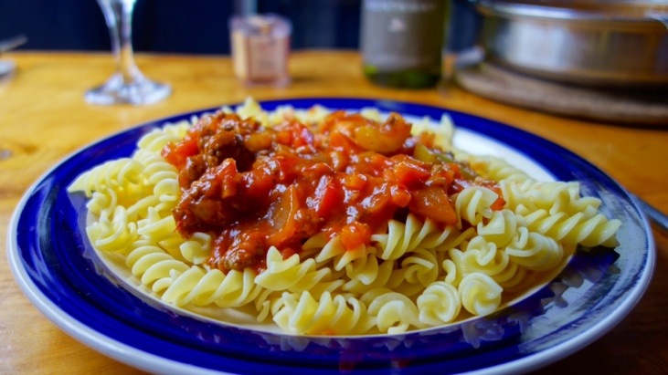
After we arrived at our little YHA-cabin in the beach town of Ahipara we organized a trip to one of the most northern tips of New Zealand, Cape Reinga. Then we cooked up a tomato-pepper-bolognese-sauce with pasta and enjoyed a delicious dinner:
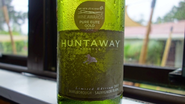
With one of our favorite Sauvignon Blancs:
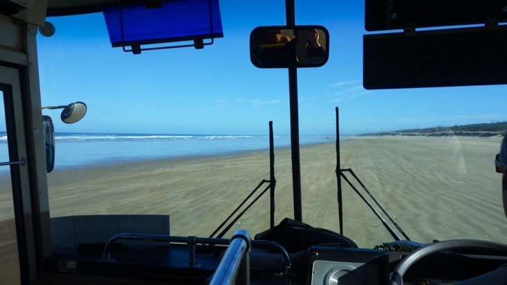
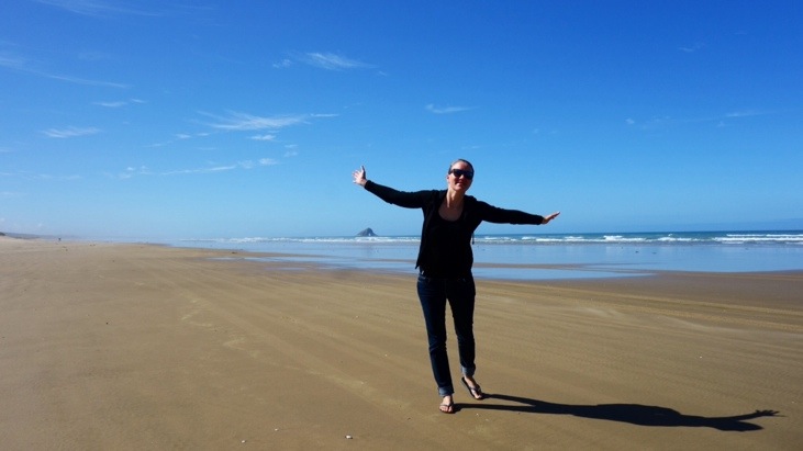
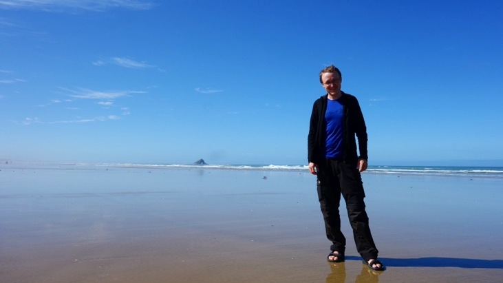
After a good night’s rest we started our day trip along the Ninety Mile Beach. The beach runs from Ahipara Bay in the south to Scott’s Point at the northernmost end and when the tide permits, the beach can be used as a regular road.
The interesting thing regarding the name is that the beach is actually only about 58 miles long. It got its name from the estimate of the early farmers in the area when they brought their cattle to the market. They figured they could drive their livestock 30 miles per day and it would take them three days to travel the beach. Thus the ninety mile name.
We drove along the beach with a sand-safari bus. Our friendly local guide gave us some informative commentary from time to time, and even began to teach us some Maori. One of the highlights was definitely when he began singing several Maori songs while driving along the beach!
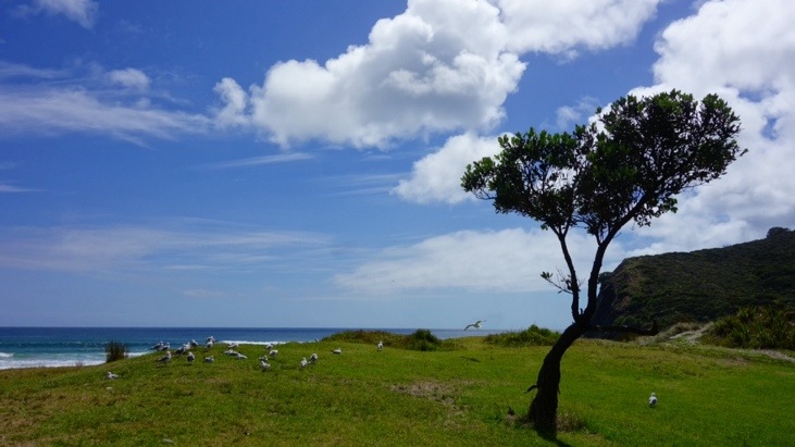
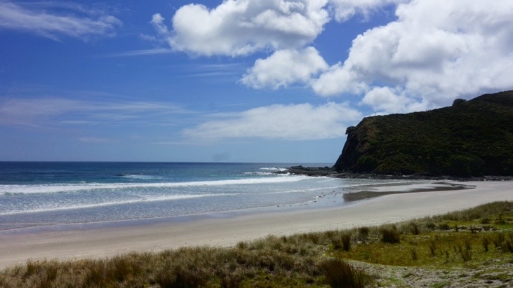
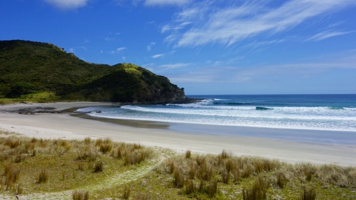
Every once in a while we stopped at an interesting landmark and had a chance to leave the bus and enjoy the beach or take pictures:
With our GPS tracker we recorded the entire day track and you can nicely see the part were we had been driving along the beach:
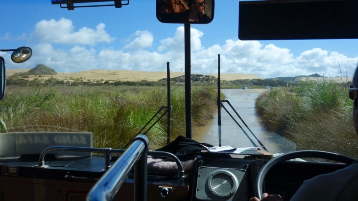
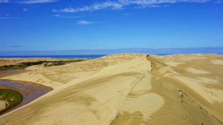
At the end of the Ninety Mile Beach we turned inland and crossed the Te Paki quick-sand streams. Since they are fairly shallow we used them as a road and drove up the stream-bed.
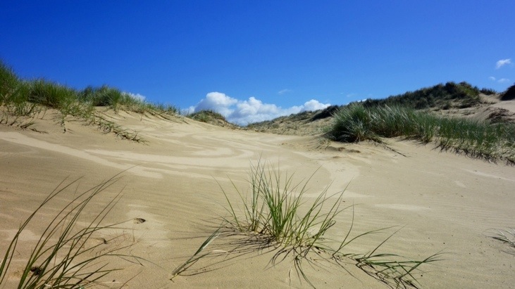
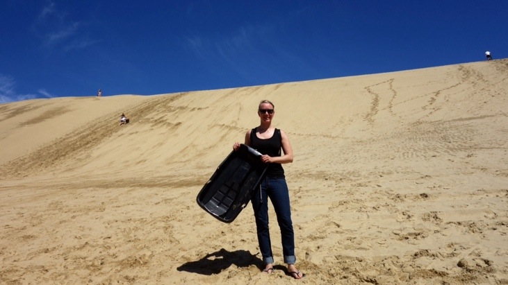
When we reached the center of the giant Te Paki dune area the fun part started: Sand sledding down the giant dunes 🙂
Once we climbed the huge dunes with the sledges in tow, we enjoyed a great view over the other piles of sand and the Tasman Sea in the background:
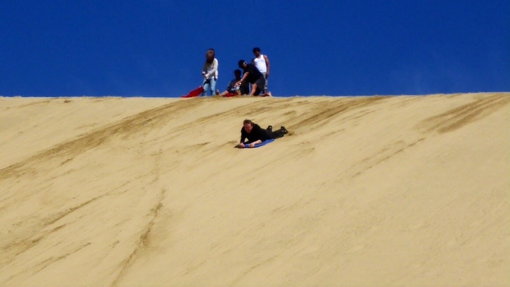
Tini went first and it was a ton of fun. We had not expected to pick up so much speed and we quickly learned the most important rule: Keep your mouth closed at all times! 🙂
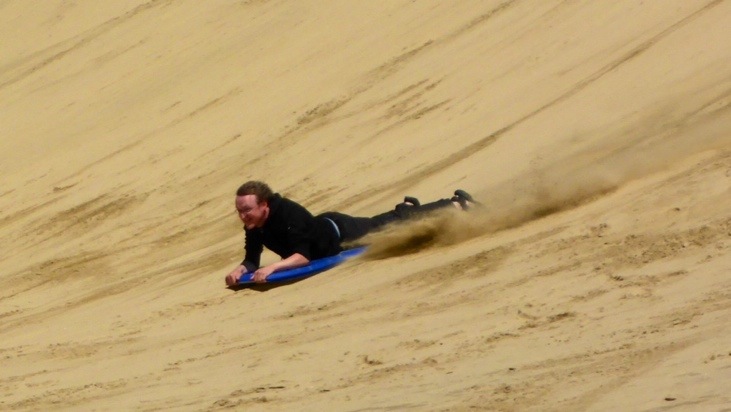
Of course we had sand nearly everywhere after our rides… Andy went second and chose the “more male” version of the sledge, the boogie board. Riding down lying on the board he picked up so much speed he almost shot over the little stream at the bottom:
After everybody had enough of sand-sledging we continued further north and made our way to Tapotupotu Bay for a lunch stop. The bay lies on the western shore and therefor on the South Pacific Ocean side:
We enjoyed our sandwich lunch and walked around the beach:
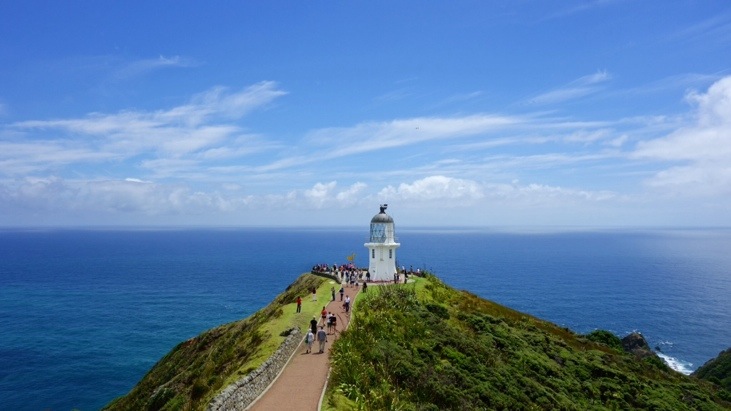
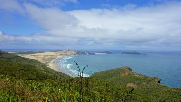
From our lunch stop it was only a short ride to Cape Reigna. On the way down to the lighthouse we had some great views of the Tasman Sea on the left, the Pacific Ocean on the right and the beautiful beaches all around them:
Cape Reigna (Te Rerenga-Wairua) is an important spiritual place for the Māori. According to their mythology the spirits of the dead travel to Cape Reinga on their journey to the afterlife to leap off the headland. Here they climb the roots of the 800 year old tree and descend to the underworld to return to their traditional homeland of Hawaiiki-a-nui, using the “Te Ara Wairua” (spirits pathway). They turn briefly at the Three Kings Islands for one last look back towards the land and then continue on their journey.
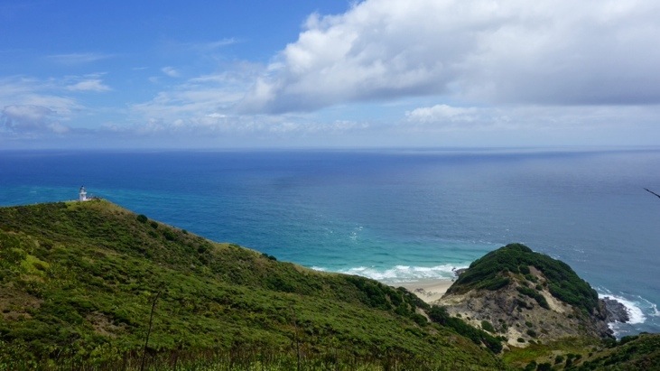
We continued down towards the light house. This point is considered the separation marker between the Tasman Sea to the west and the Pacific Ocean to the east. To be entirely correct Cape Reinga is not the northernmost point of New Zealand. The North Cape’s Surville Cliffs, about 30 km east of Cape Reinga are slightly further north. But the two seas clashing against each other at the foot of the cliffs is no minder impressive here:
This was the most northern we traveled in New Zealand 🙂
After a short walk back up to the bus we drove back south and arrived in Ahipara in the late afternoon. Our day-outing on the Beach-Highway to the Māori “Stairway to Heaven” had not only brought us to some beautiful places, but also gave us some more interesting insights in the Māori culture.
Comments
Leave a Reply
You must be logged in to post a comment.
This cliff reminds me so much on Cape Finisterre (http://esys.org/rev_info/Spanien/spanien-kap-finisterre-leuchtfeuer-hq.jpg) where I used to go after we stayed in Santiago a few days. These kind of capes are magical as most of them have their very own story .. like the one you visited seperating the Tasman Sea