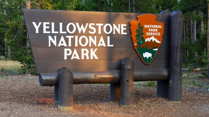
19.08.2013Yellowstone National Park

Yellowstone National Park is the first national park in the world and was established by U.S. Congress and signed into law by President Grant in 1872. Native Americans have lived in the Yellowstone region for over 10,000 years.
The Park spans an area of 8,983 km2 and is mostly located in Wyoming, but also extends into Montana and Idaho. It lies over the Yellowstone Caldera, the largest super-volcano on the continent which is still considered an active volcano since it has erupted several times in the last two million years. Half of the world’s geothermal features are located in Yellowstone and fueled by its ongoing volcanism. Lava flows and rocks from volcanic eruptions cover most of the land area of Yellowstone.
That’s about the guidebook knowledge we had read up about Yellowstone before we entered the park. At this point we had no clue of all the amazing things we were about to explore…
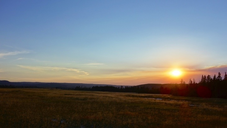
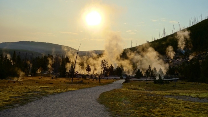
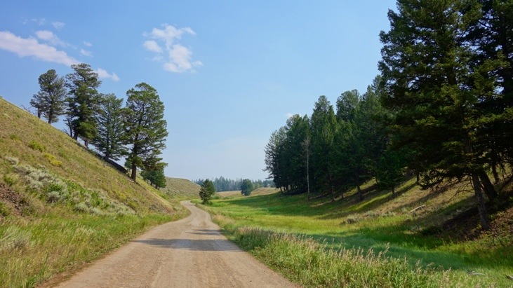
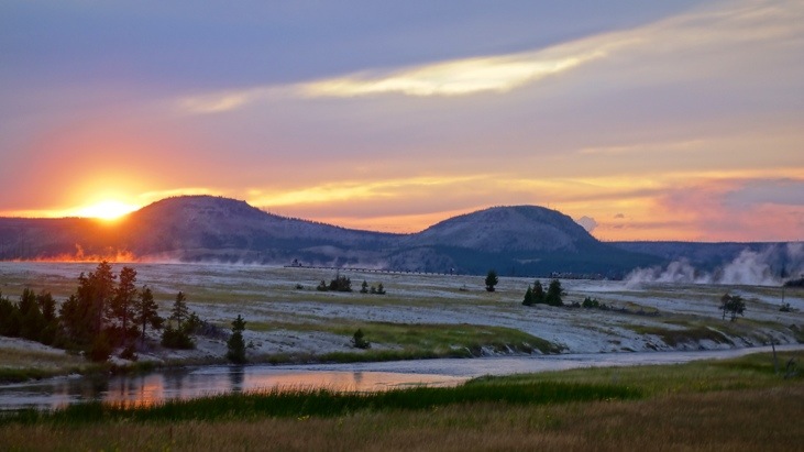
Since the days got considerably shorter compared to Alaska, we decided to cease the days ahead by starting them at sunrise. As a bonus one avoids tourist crowds which tend to stream to the sights in the later morning.
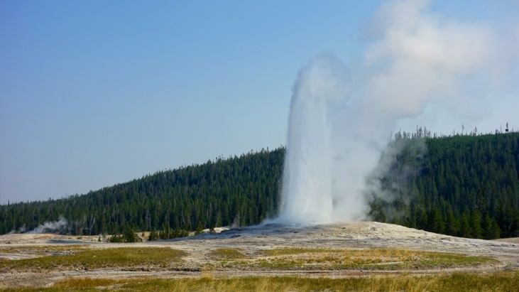
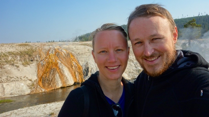
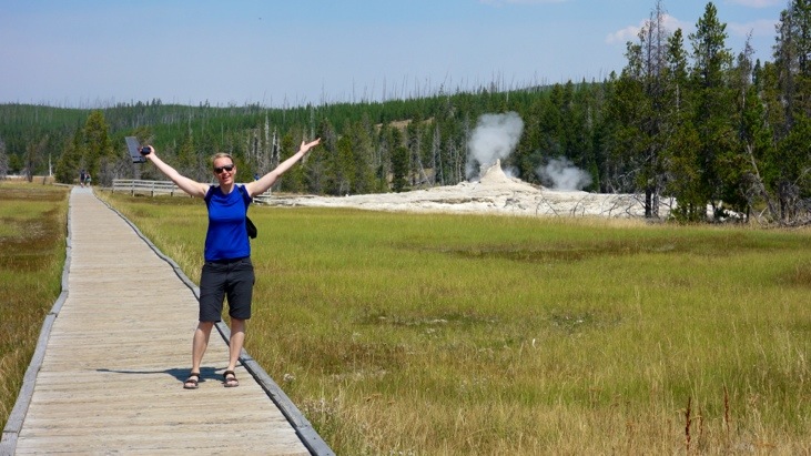
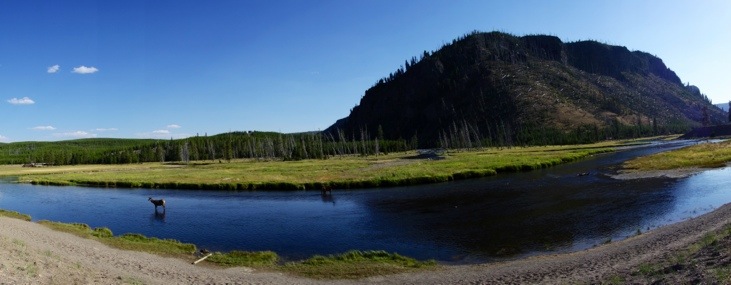
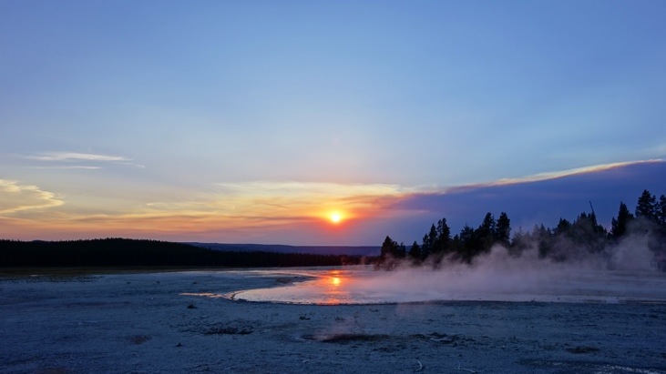
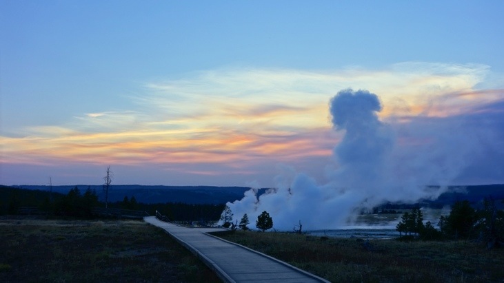
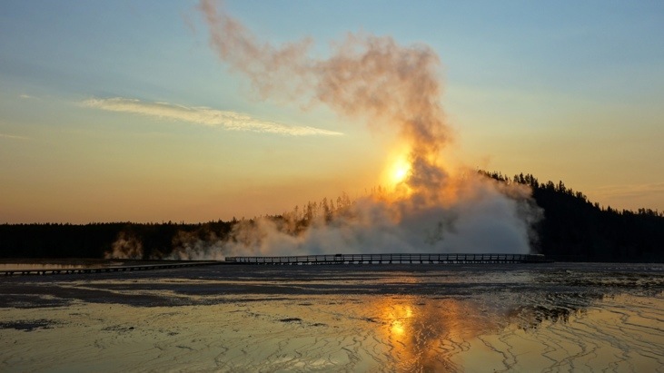
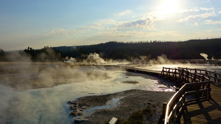
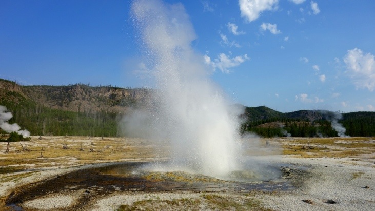
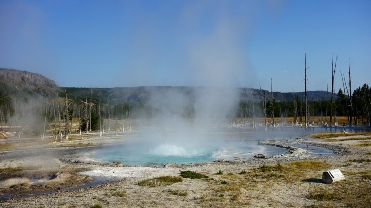
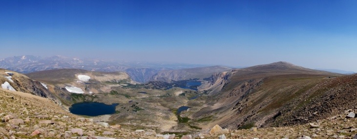
After entering the park and reserving a site at Madison campground which would be our base for all of Yellowstone we took off for the most prominent and famous geyser, Old Faithful. On our way we spotted a lonesome wolf, a scarce sight due to their shy nature.
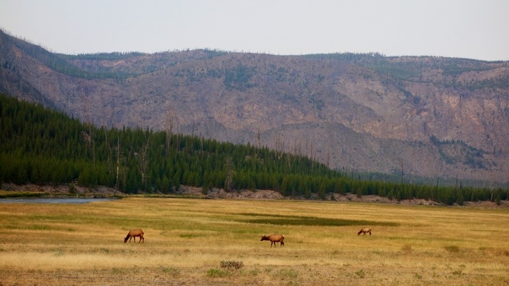
Several elks grazing in the meadows are far more common.
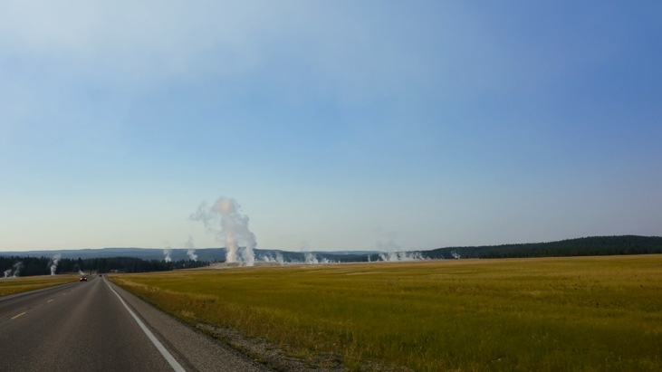
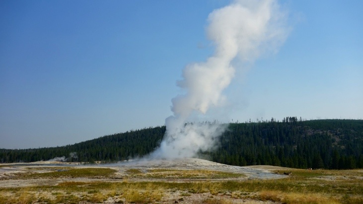
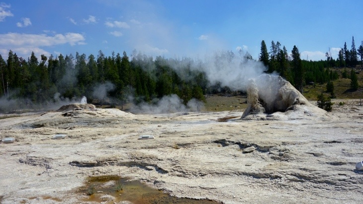
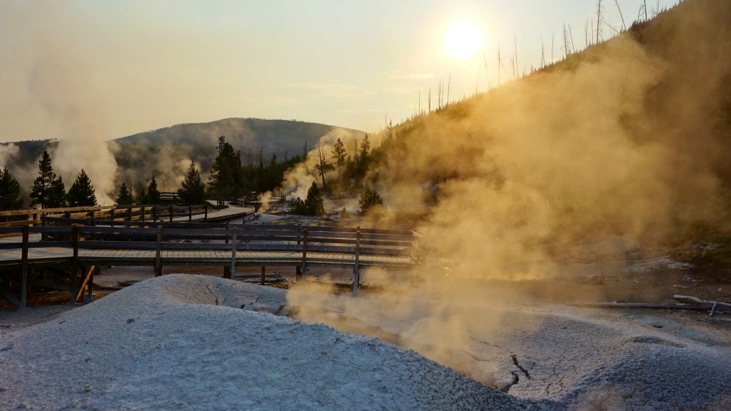
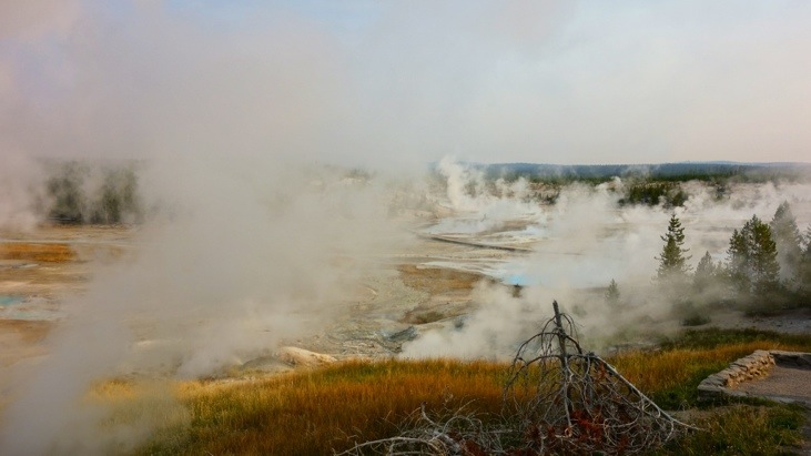
As we approached the geyser basins, the number of steam vents kept continuously increasing. Another bonus of starting in the cool (~2-3C) early mornings is the more impressive visibility of the warm steam rising up into the sky. In the hot afternoons with temperatures reaching 32C the steaming vents fade to a far less remarkable state.
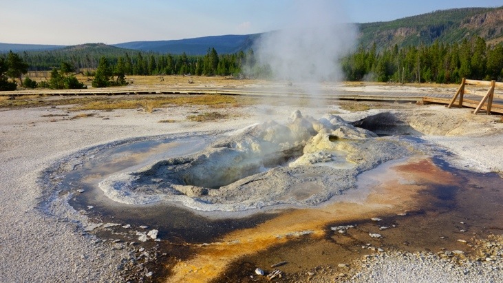
The three ingredients for thermal features can be summarized as:
1) Heat: It is provided from the magma as close as 5-13km underground.
2) Water: Supplied by rain and snow it seeps down more than a kilometer where it is heated.
3) Natural “Plumbing”: Underground cracks allow the hot water to rise and produce hot springs and geysers.
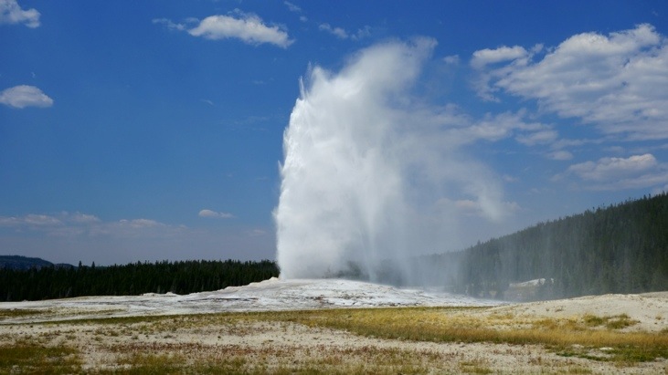
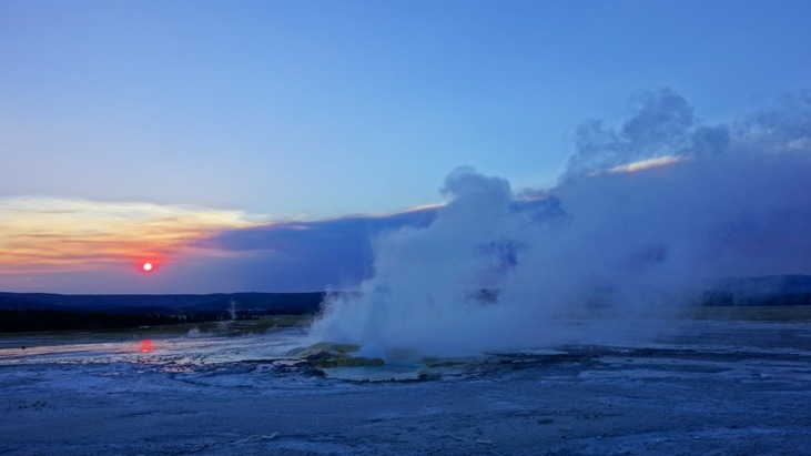
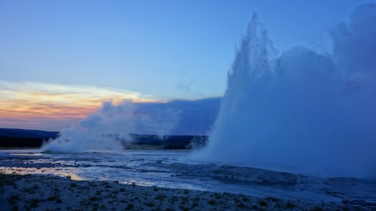
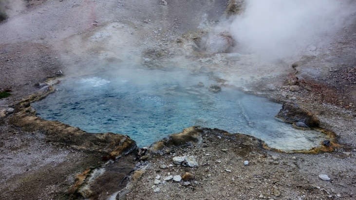
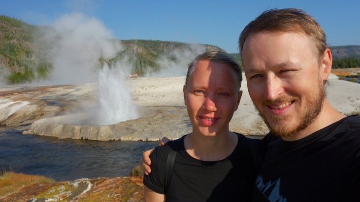
The Old Faithful geyser is the most often visited geyser in Yellowstone and owes its fame to its regular and predictable eruptions around every 90 minutes. It then can spout up to 32’000 liters of boiling water up to 55 meters in height.
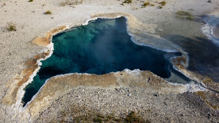
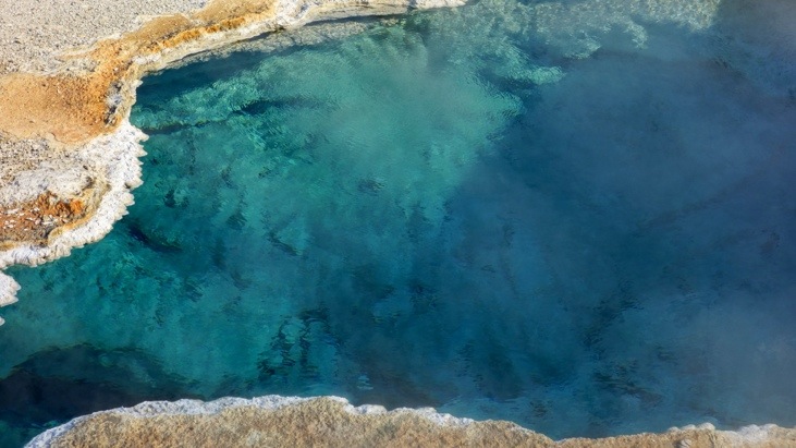
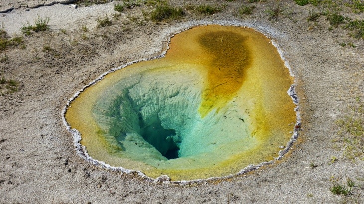
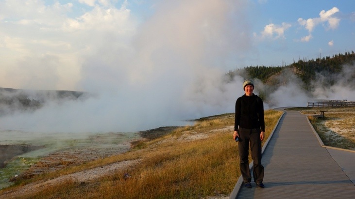
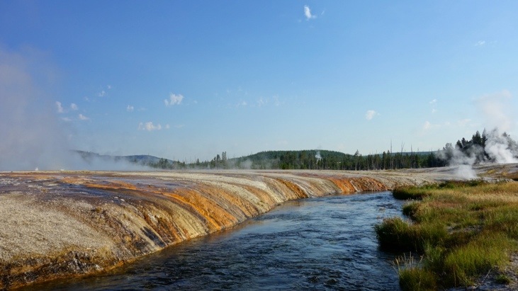
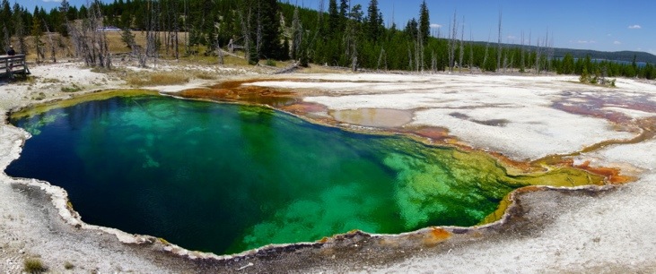
Around Old Faithful there are paths leading to numerous geysers and springs of the “Upper Geyser Basin”, each uniquely beautiful and almost impossible to capture on a picture. Here a few handpicked shots.
The “Blue Star Spring”:
The “Aurum Geyser”:
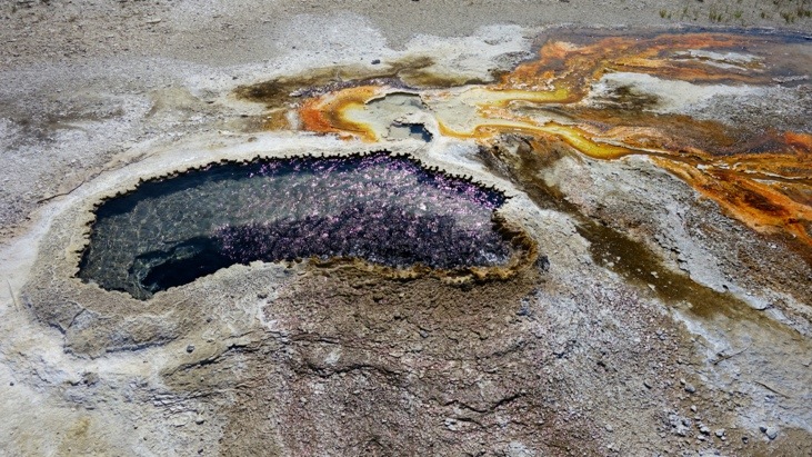
The “Solitary Geyser” is one of the most beautiful and colorful geysers. It is interesting that this geyser had previously been a hot spring. Back in 1915 people wanted to make use of the spring’s hot water and connected a pipe system to the spring. As the water level in the spring lowered by 3 feet it immediately became a geyser erupting every few minutes. Even after the original water level was restored geyser activity continued. This case illustrates the delicate balance in place and that once tampered with, often can never be restored.
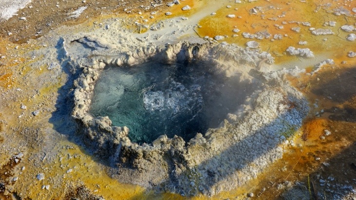
The “Anemone Geyser”:
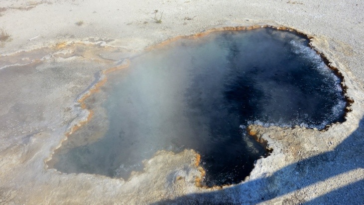
The “Ear Spring”:
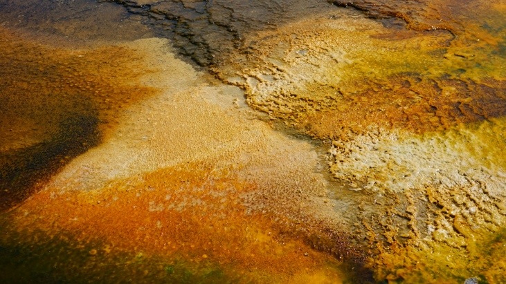
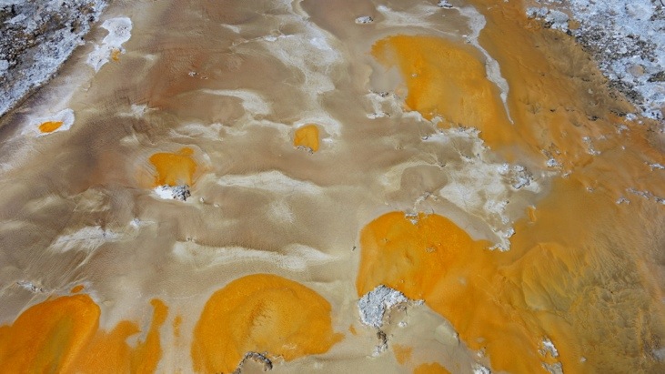
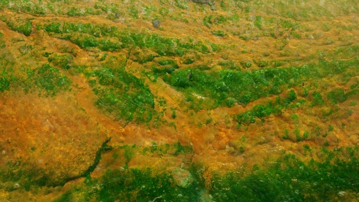
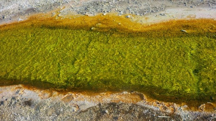
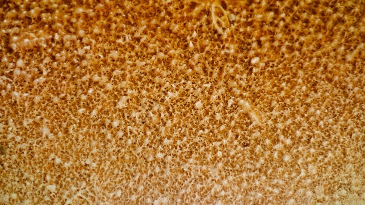
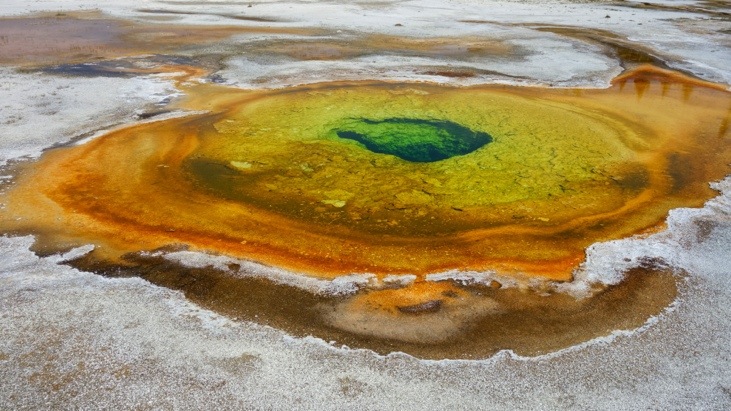
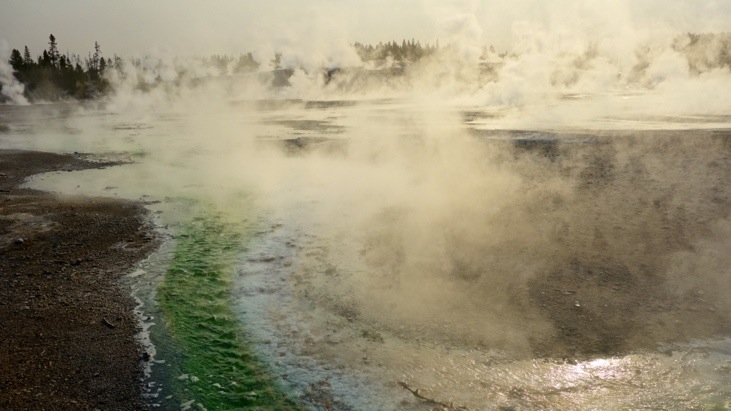
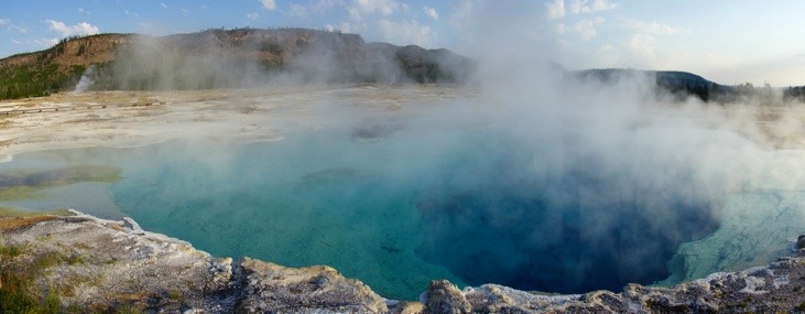
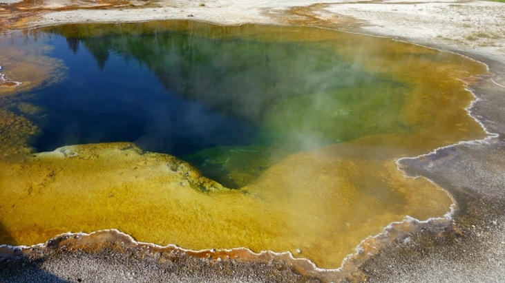
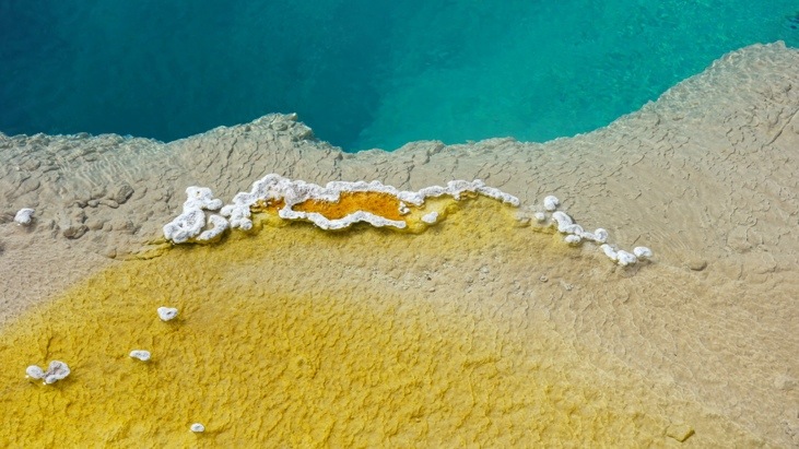
The amazing colors are a function of temperature and set the condition for the microorganisms which live and grow in the basins and runoff channels of the thermal features.
The colors range from blue and white (~93C, Archaea), over yellow (~73C, Cyanobacteria), green (~62C, Fungi) and reddish (~56C, Protozoa) to a brownish color (~50C, Mosses). The intensity of the colors is amazing and one gets a feeling for natures paintbox.
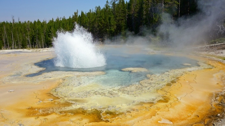
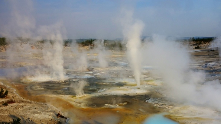
The “Spasmodic Geysers”:
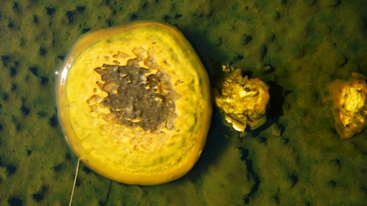
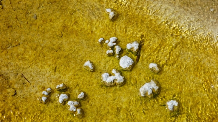
A colorful spring without a name yet. A funny story told is that some time ago a young bison fell into a pool and after an undoubtedly painful death the entire area started to smell like bison broth…
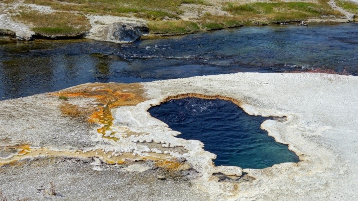
The “South Scalloped Spring” right next to Firehole River.
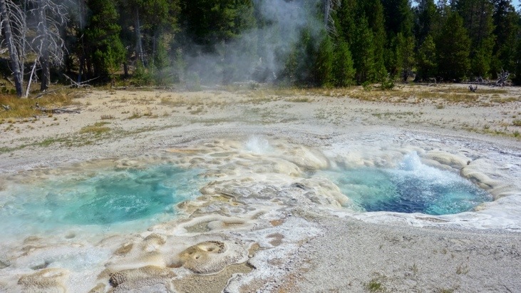
The “Crested Pool”, constantly boiling above 93C. The extreme heat prevents most bacterial growth, resulting in exceptionally clear blue water.
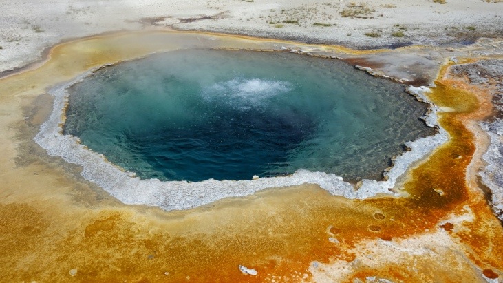
“Chromatic Pool”:
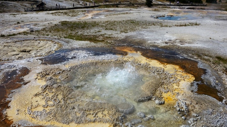
Approaching “Giant Geyser” which last erupted in January 2010.
Giant Geyser has been reported to erupt up to 50 times a year, as in 2007, or only once, as in 2010. When active, Giant Geyser is one of the largest in the world with eruptions soaring up to 85m height and lasting for 1 to 1.5 hours while expelling more than 1 million gallons of water!
“Grotto Geyser”:
And the famous “Morning Glory Pool”:
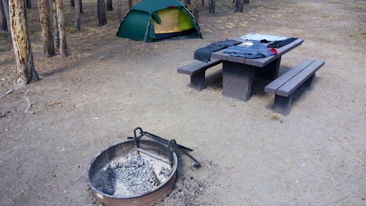
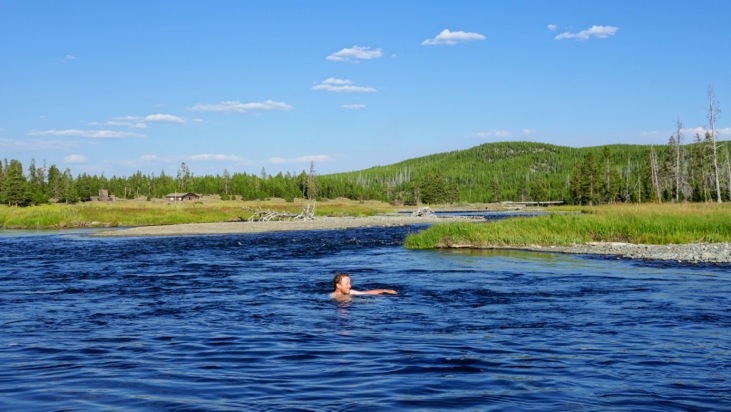
Back at our campsite we dried some of our clothes out in the sun before we planned on heading to the nearby river for a swim.
As we arrived at the river we saw 3 elks cooling off in the river as well! One of them being a mother with its young one.
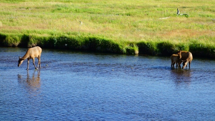
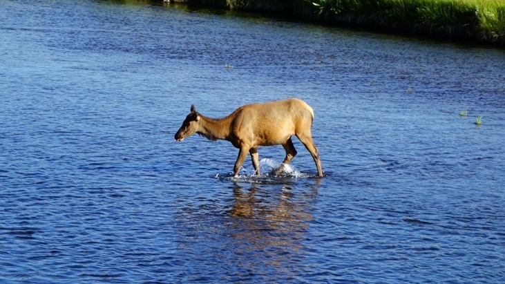
And since it can’t be bad for us, if it’s good for the elks, Andy also took a swim in the river warmed to bathing temperature by the numerous hot springs. The part to watch out for the most, were the sharp volcanic rocks at the bottom and the shore.
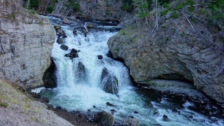
Towards the evening we visited the “Firehole Falls”.
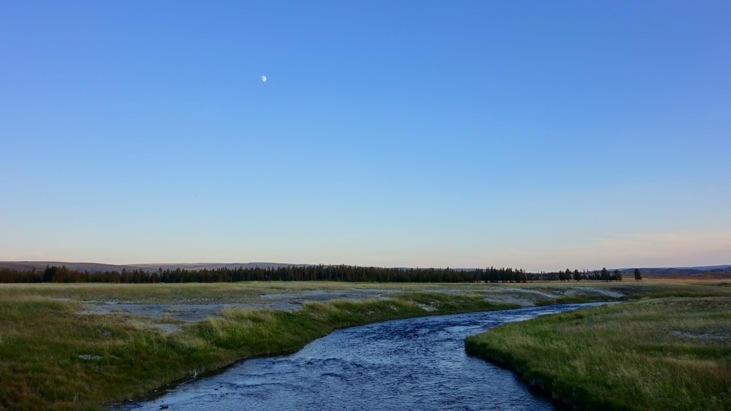
And continued on towards the “Lower Geyser Basin”. The setting sun transformed even the ordinary landscape into picture-perfect motifs.
We arrived at the almost deserted basin and were reworded with a beautiful scenery.
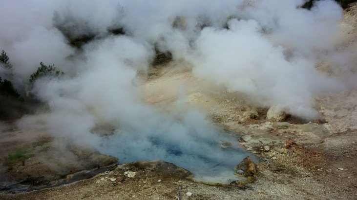
The peacefully in the afterglow steaming “Celestine Pool”.
“Clepsydra Geyser”:
“Fountain and Morning Geysers”:
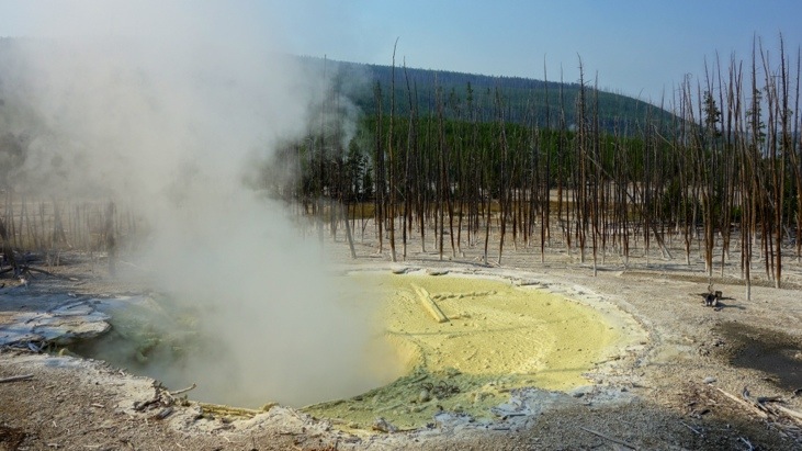
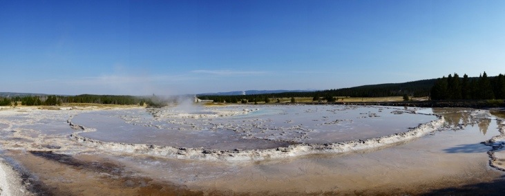
And the “Fountain Paint Pot”:
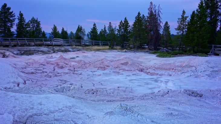
Next day we headed towards the “Norris Geyser Basin”.
We stopped at the “Monument Geyser Basin” that morning.
And here the same geyser photographed some days later in the afternoon.
Still being early in he morning we reached the “Artists Paintpots”:

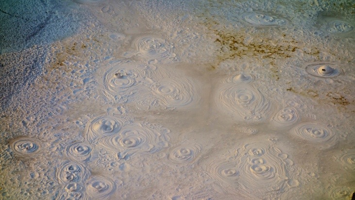
The “Norris Geyser Basin” is another large area with countless thermal features.
Deep green colors often originate from chlorophyll.
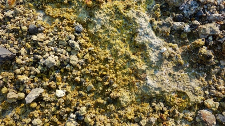
We passed by the impressive “Cistern Spring”. The various yellow color shades form when hydrogen sulfide gas is converted to sulfur.
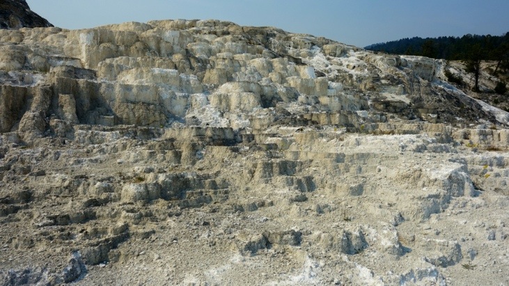
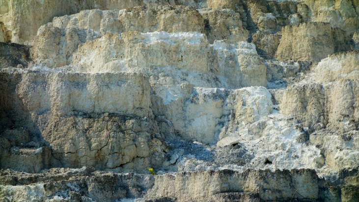
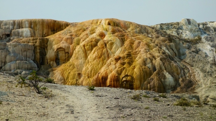
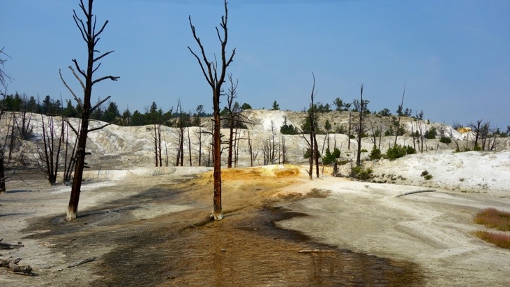
After hours spent on strolling around the different paths we headed further north on to the “Mammoth Hot Springs Terraces”.
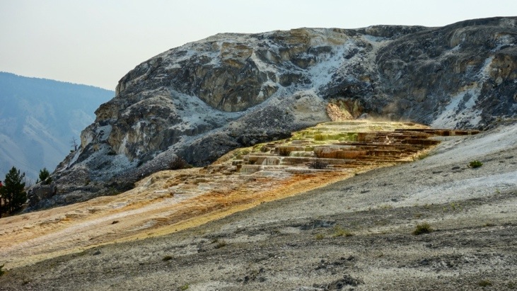
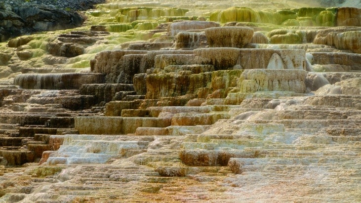
“Minerva Terrace”:
“Palette Spring”:
And “Angel Terrace”.
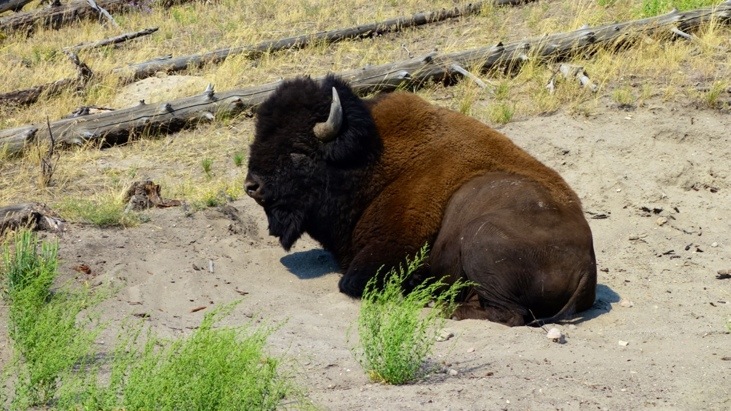
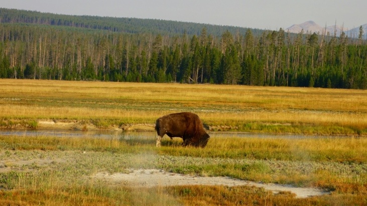
On the way to Tower-Roosevelt we took the Blacktrail Plateau Drive, were we missed the blooming meadows, but got to see a beautiful landscape and a bison resting in the sun right at the edge of the road.
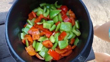
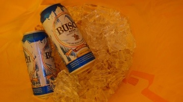
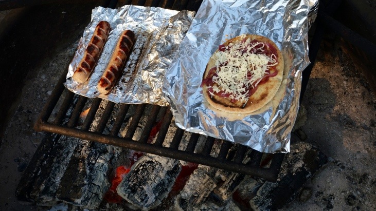
All this exploring had worked up quite an appetite for us. Back at our campsite these were the ingredients to an incredibly delicious dinner:


We prepared the onions according to the recipe of a hot dog booth in Anchorage. First we fried them in a little olive oil and then we added half a cup of coke to them and left them sizzling until the onions had soaked up the coke. This gives them a great sweetish taste!
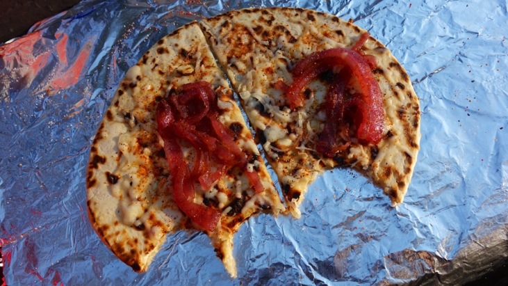
Then we barbecued the Stadium Brats and made the flatbreads in all variations.
For example with tomato sauce, onions and cheese:
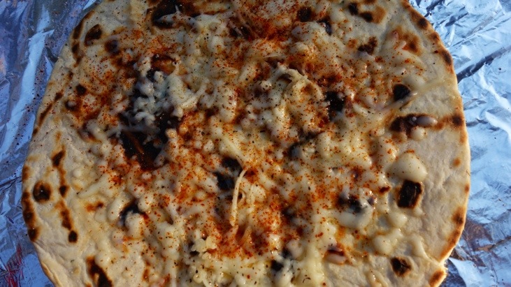
Or only cheese and onions.
Or simply with cheese and some hot red pepper. I think you got the idea by now 😉
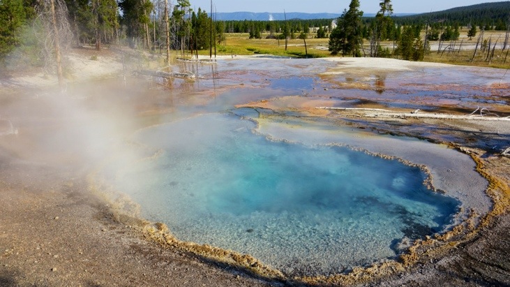
The next morning we visited the “Midway Geyser Basin”. Here we watched the sun rise behind “Excelsior Geyser”.
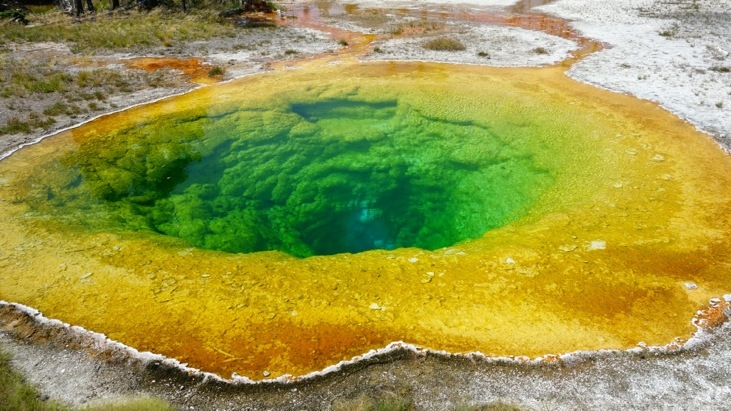
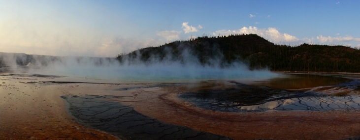
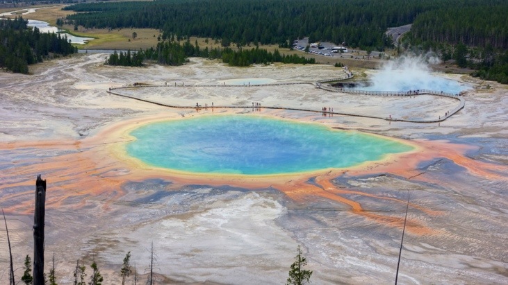
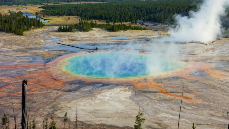
Next we continued on to “Grand Prismatic Spring”. As you can see we were wearing hats in the mornings and as temperatures gradually increased from 2C to 35C we pealed off layer after layer.
Looking at the “Grand Prismatic Spring” from the side was almost disappointing. The brilliance of its colors and the huge dimensions of the spring can not be appreciated appropriately from this perspective. For this reason we decided to revisit “Grand Prismatic Spring” from the ridge behind on one of the next days and get a good overview of this amazing spring. By the way this spring has even been selected as the image representing Yellowstone which according to National Geographic is one of the worlds 100 most beautiful places.
But for now we continued on to “Biscuit Basin”.
Finally the sun picked up enough strength to start warming us up again.
We saw “Avoca Spring”:
And together with “Jewel Geyser” are probably the two most impressive thermal features in “Biscuit Basin”.
Next we visited the “Black Sand Basin”, which has its name from the black colored volcanic glass sand.
We walked up to “Emerald Pool”. Again the colors originate from the thermopile microorganisms and are dependent on the temperature.
“Spouter Geyser”:
We managed to take our picture just at the right moment in front of “Cliff Geyser”.
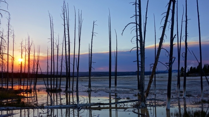
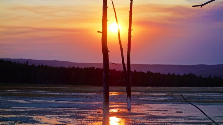
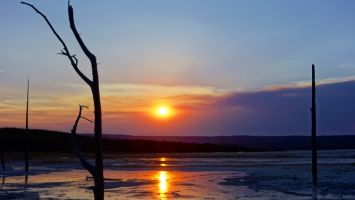
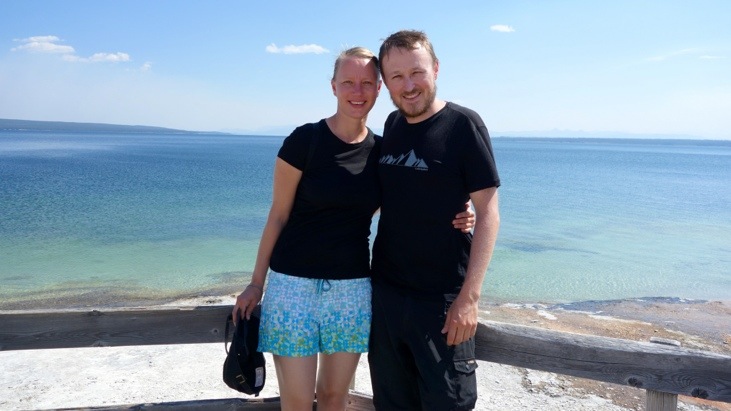
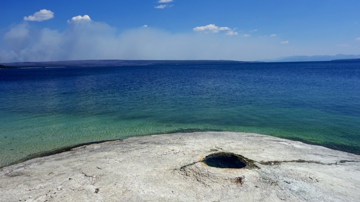
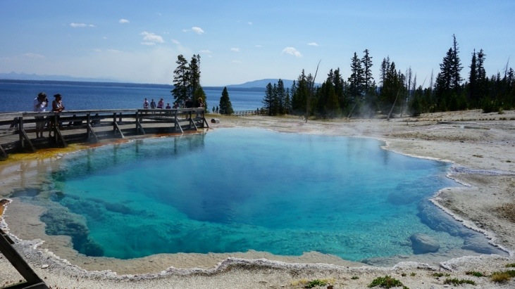
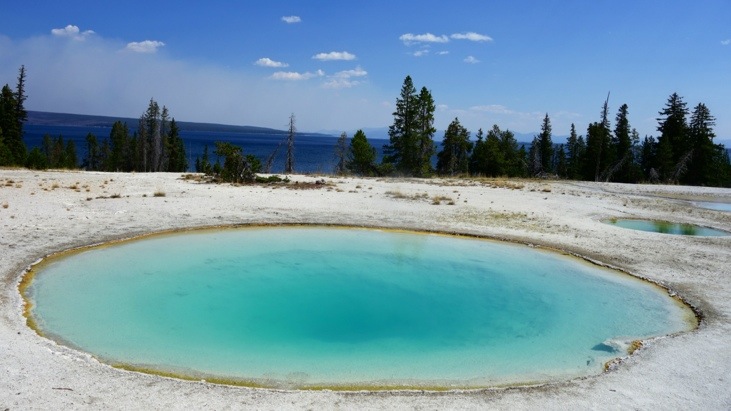
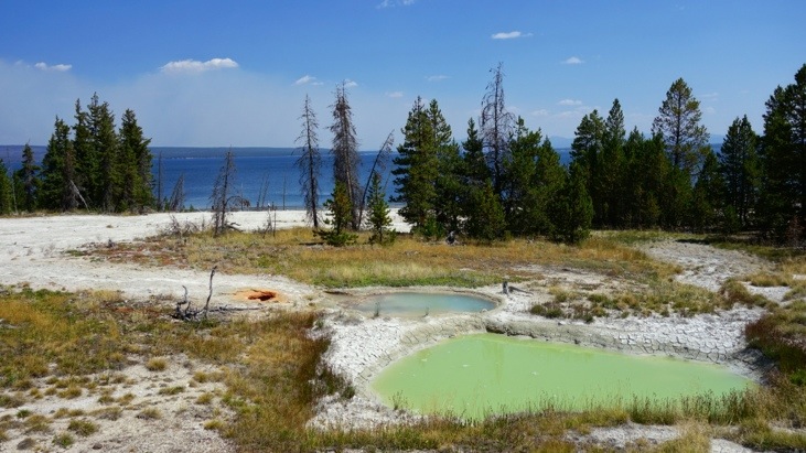
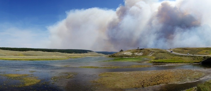
Slowly starting to feel saturated by geysers, springs, pools and steam vents, we headed south to the “West Thumb Geyser Basin”. It was formed during a volcanic explosion around 150’000 years ago and lies directly at the Yellowstone lake.
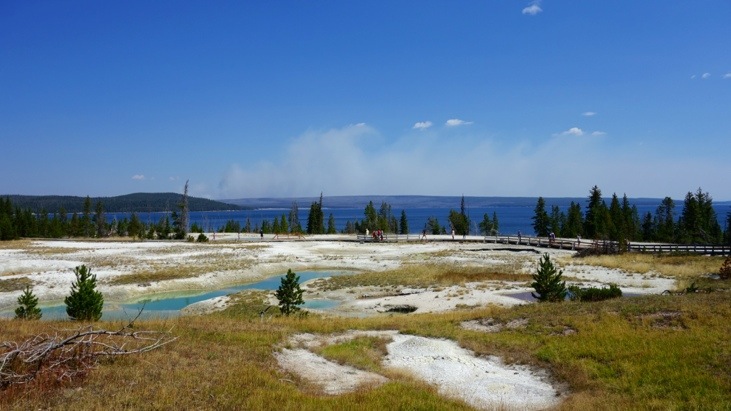
Behind the lake you can see a smoggy cloud which was caused by recently broken out wildfires.
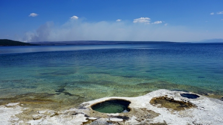
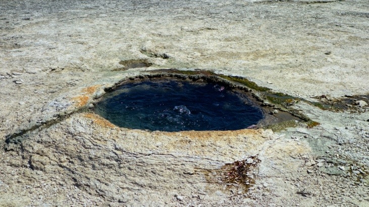
Some of the cones are directly inside the lake.

This one is called “Big Cone” and was used to immediately cook the caught fish by the fishermen, so the guide says…
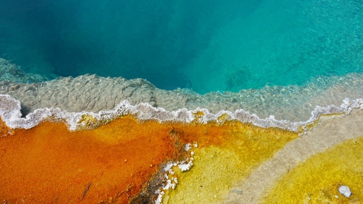
Again the colors are so vivid it’s almost not believable they are of natural origin.
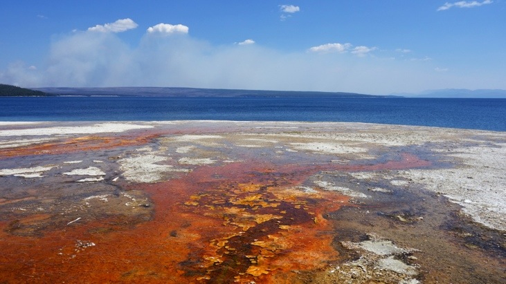
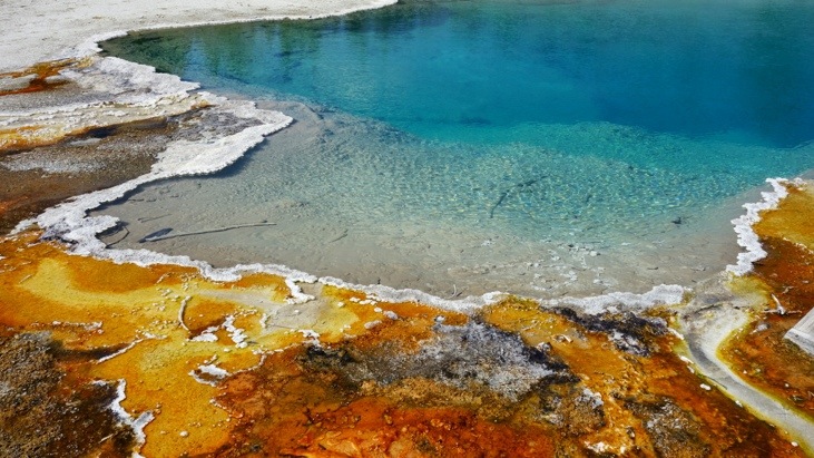
Very impressive is also “Black Pool” which has transformed from a muddy black to a clear blue pool due to an increase in water temperature.
Even more spectacular is the colorful edge of this pool!
Also beautiful, the “Abyss Pool”:
The “Blue Funnel Spring”:
And at last the “Thumb Paint Pots” pools.
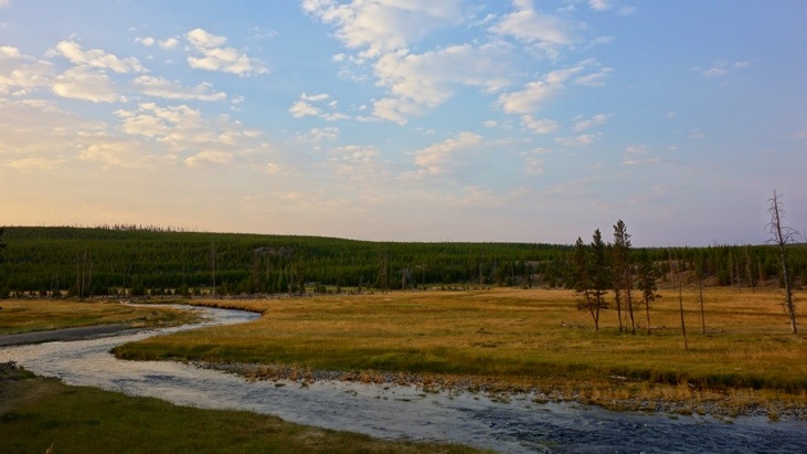
Having had enough of pools for some time we followed the Yellowstone Lake up north and had a break at “Pumice Point”.
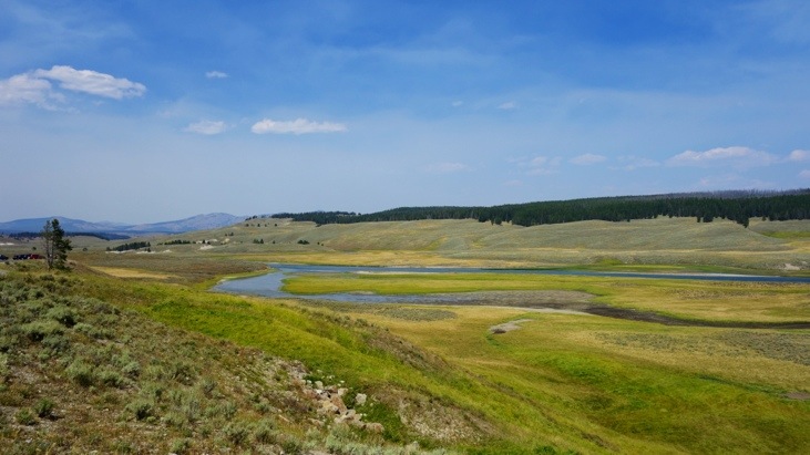
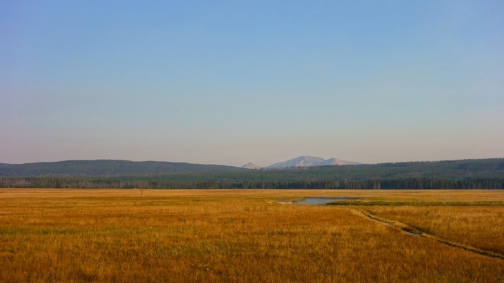
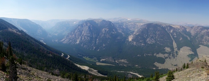
From here we followed Yellowstone River up north towards Canyon Village. On the way we passed beautiful landscapes,
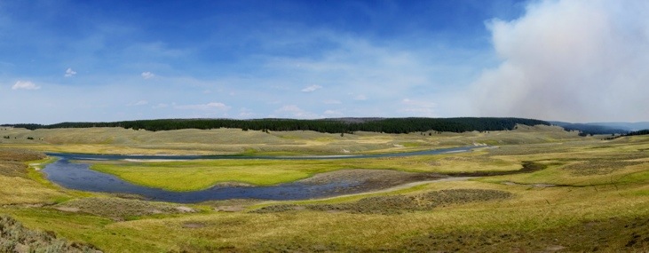
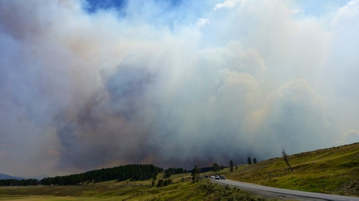
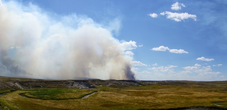
but also unintentionally got very close to some wildfires which had just broken out. We still managed to drive through some quite dense smoke before the firefighters and park rangers closed down the road.
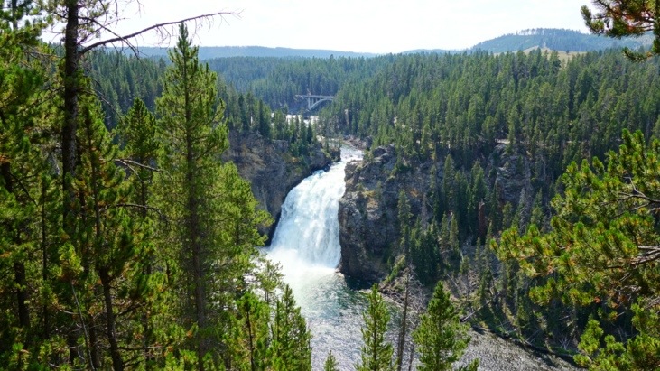
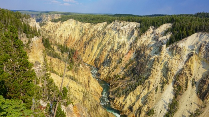
In the afternoon we reached the “Upper Falls” of Yellowstone river (33m).
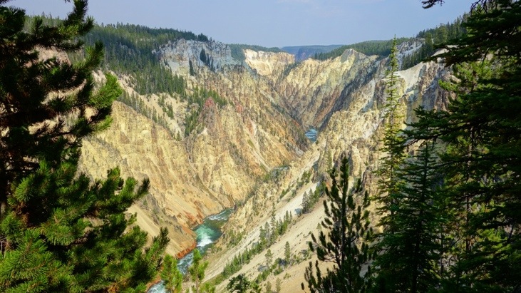
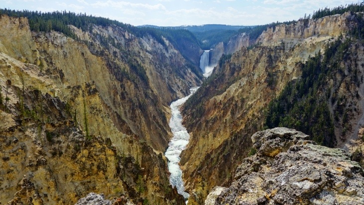
The view from the rim of the canyon:
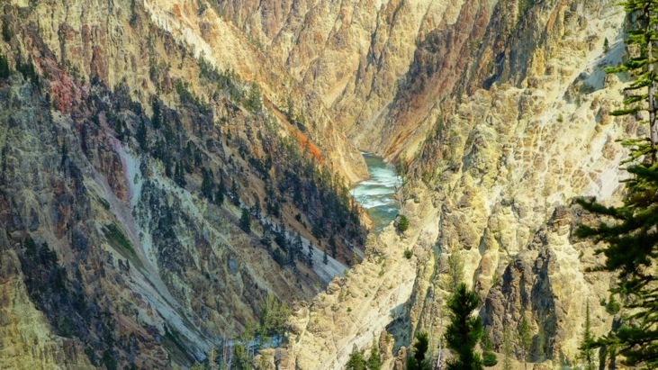
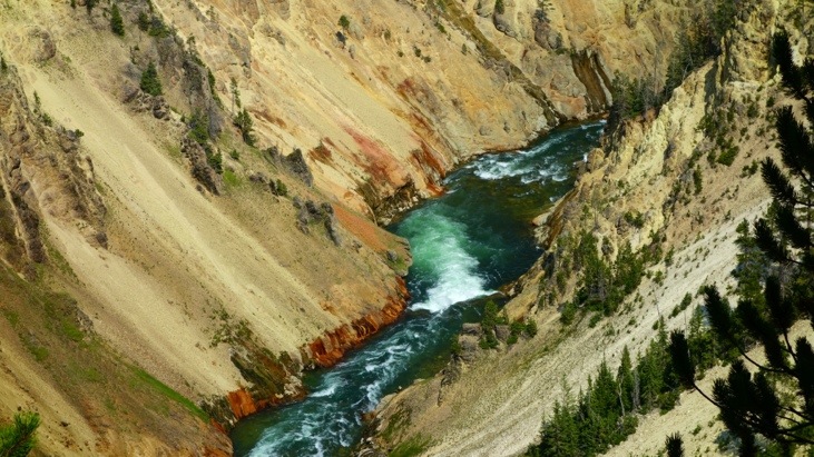
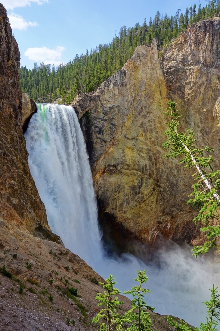
We decided to take “Uncle Toms Trail” down to the bottom of the canyon. From there one is supposed to have great view of the “Lower Falls” which are even more impressive than the “Upper Falls” and span a height of 94m and thus almost twice the hight of Niagara Falls.
On the way down we even got to see a rainbow!
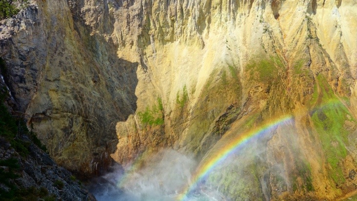
And the view was indeed picture-perfect!
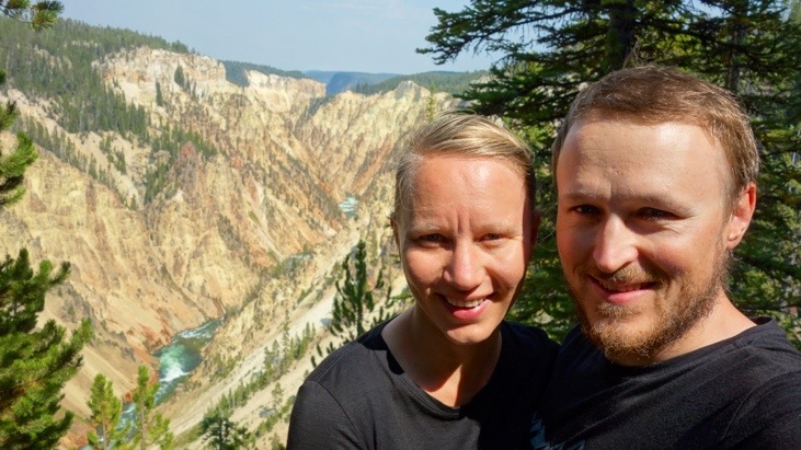
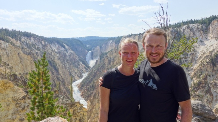
The next viewpoint was called “Artist Point” and it does not take a lot of imagination on how this point got this name…
And also here the unusual colors and shapes have geothermal origin.
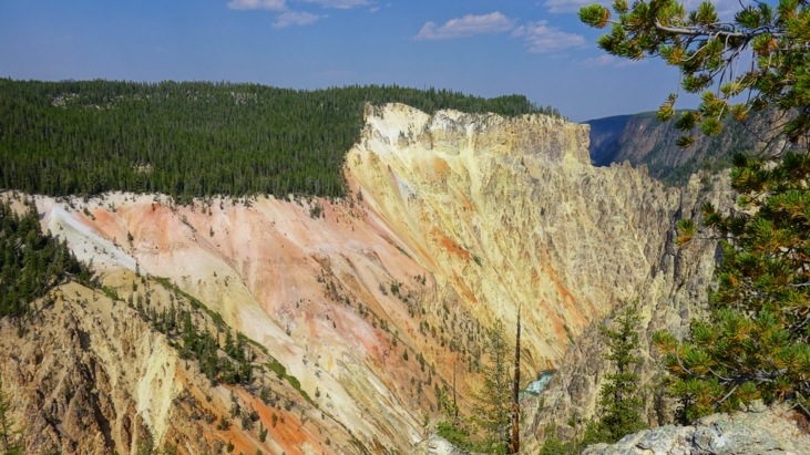
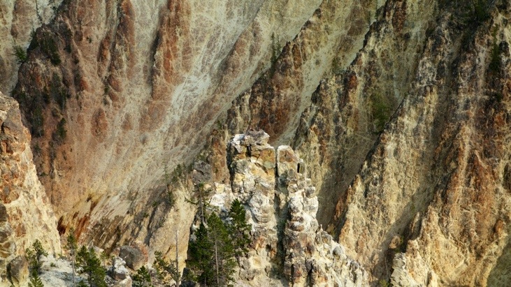
Several other lookout points revealed equally impressive views of the canyon.
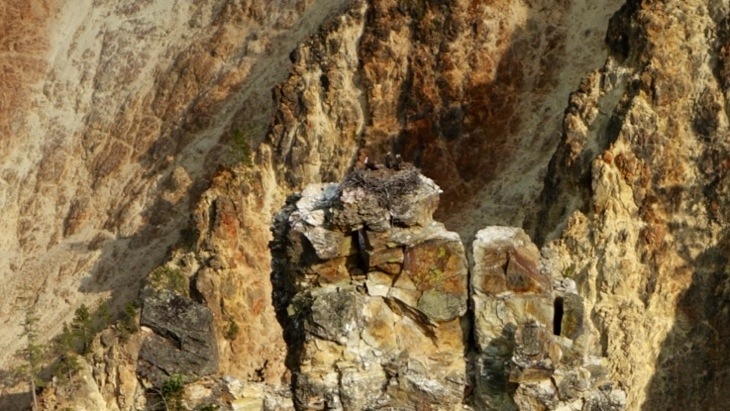
And even here there is wildlife to be spotted! Can you see the bird nest with the three young ospreys inside?

And now?
Here the closest view I could get:
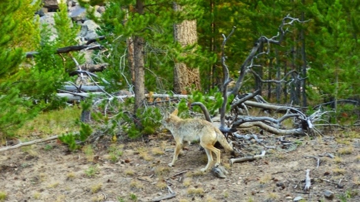
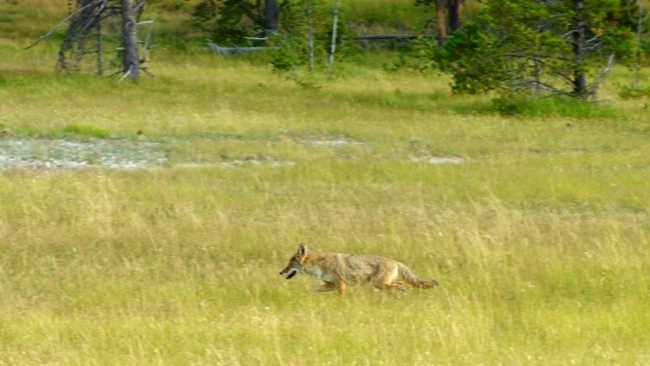
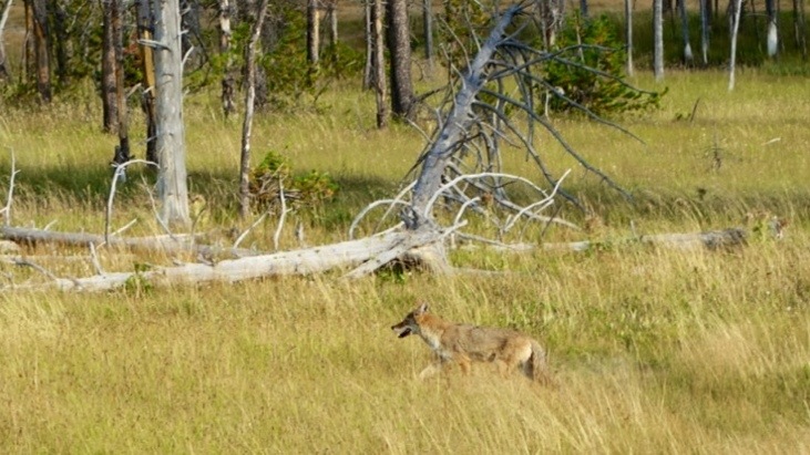
On the way home we believe to have spotted a coyote.
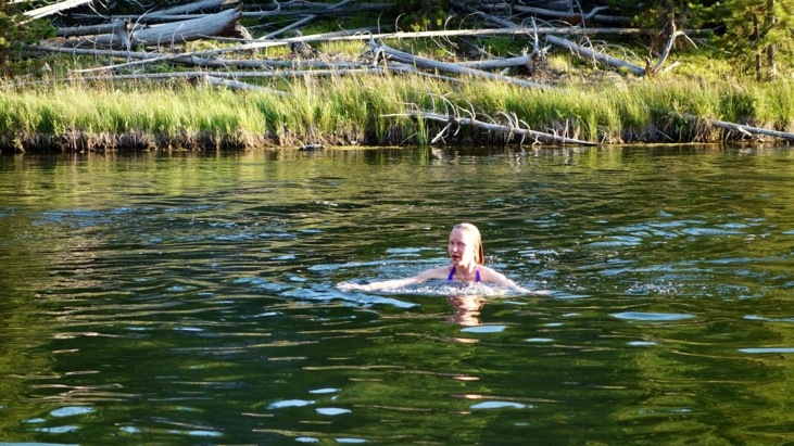
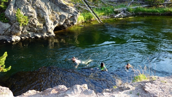
Before getting back to our camp we decided to wash off the day’s sweat with a swim in the Firehole canyon. This was just as refreshing as it looks!
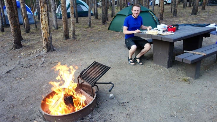
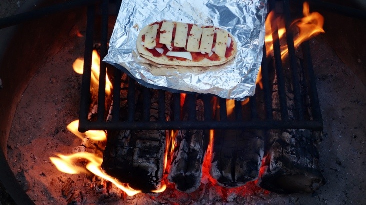
Back at our camp site we fired up our fireside and prepared our prehistoric form of pizza 😉
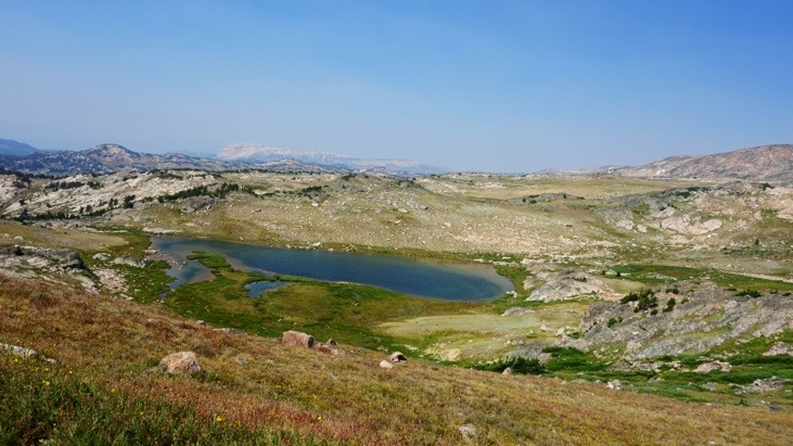
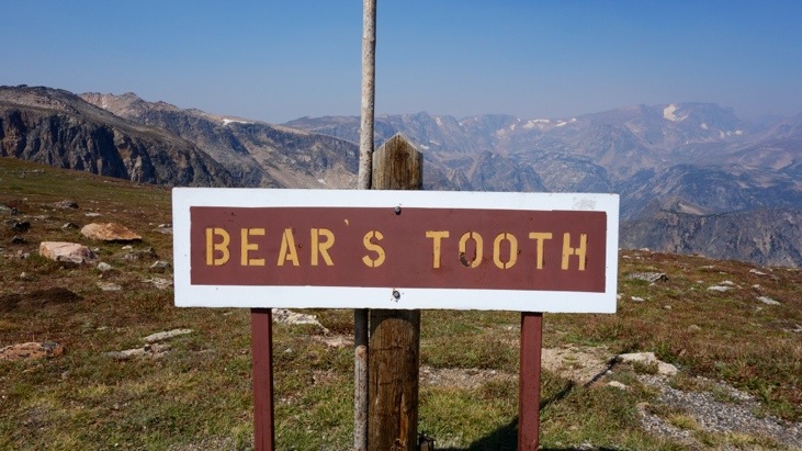
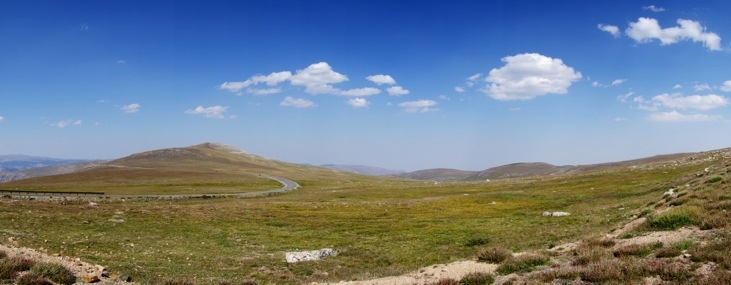
Next morning we started off for the “Bearstooth Highway” which has been called “the most beautiful drive in America”.
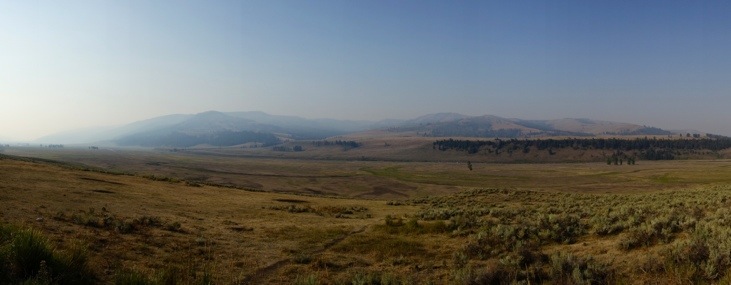
Already on our way there, we had some beautiful sceneries to pass:
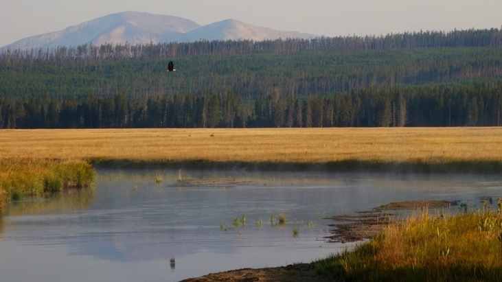
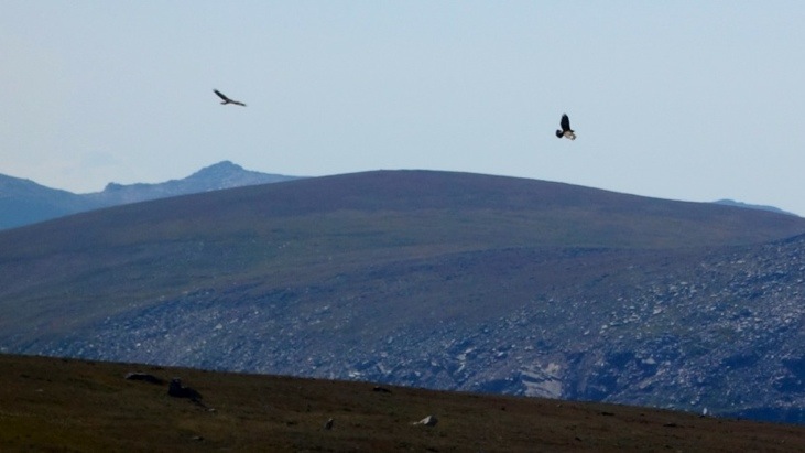
A bold eagle waiting for prey.
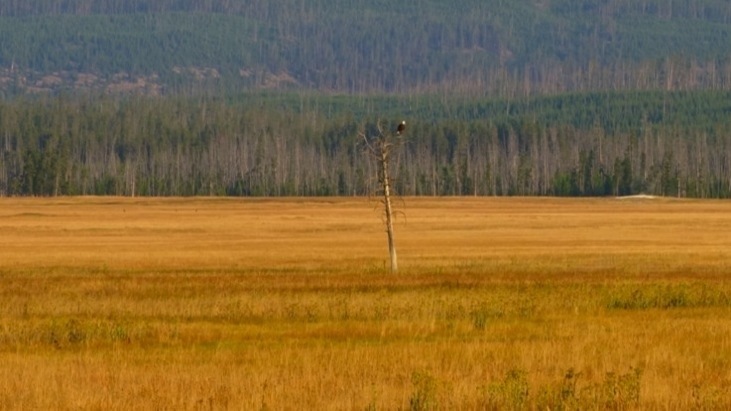
And taking off as he gets suspicious of us…
A bison peacefully grazing.
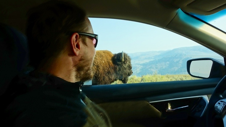
And several miles further, a bison blocking the road!
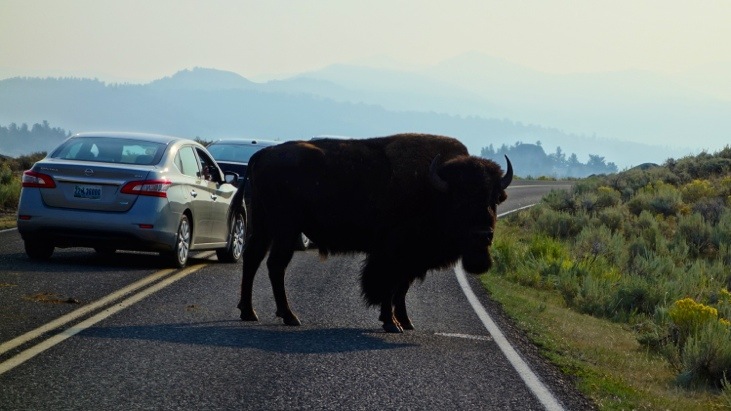
We waited some time, but had to pass him eventually…
Can you see how Andy’s beard and the bisons fur blend in to each other 😉
We continued driving through “Lamar Valley”.
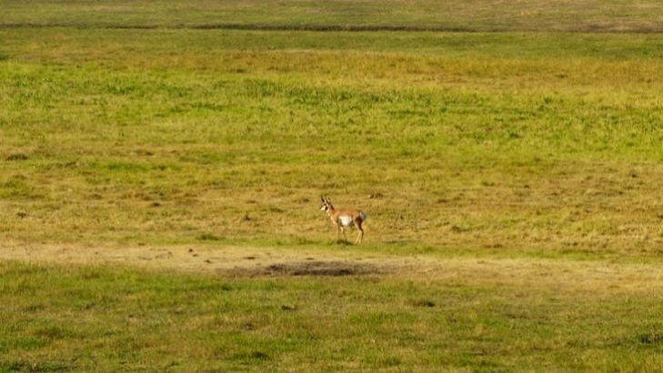
And spotted our first Pronghorn in quite some distance.
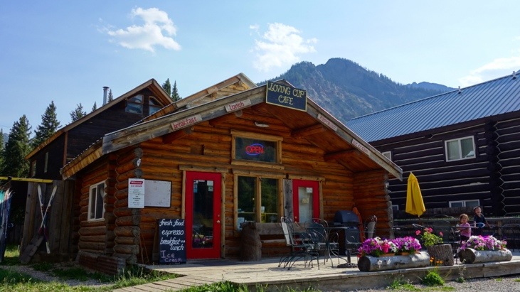
Our next stop was in Cooke city where we stopped in the “Loving Cup Cafe”.
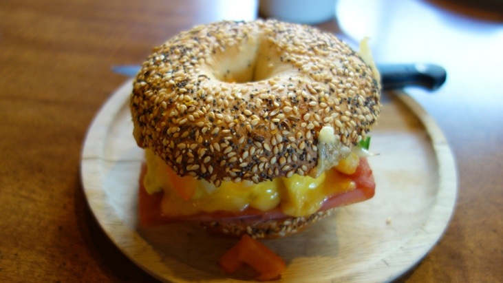
On top of a cup of great coffee and a glass of freshly pressed orange juice Andy had the “Breakfast Bagel”. It was a delicate mixture of 2 slices of ham, 2 eggs, 2 cheeses, onions, sweet peppers and jalapeños on a toasted everyday bagel.
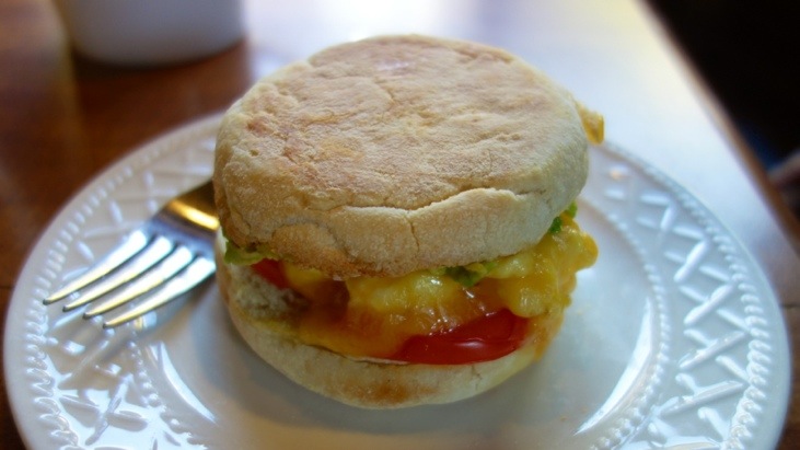
Not any less delicious was Tini’s “Veggie Sammy” conjured of the following simple ingredients: avocado, tomato, scrambled eggs and cheddar served on a toasted English muffin.
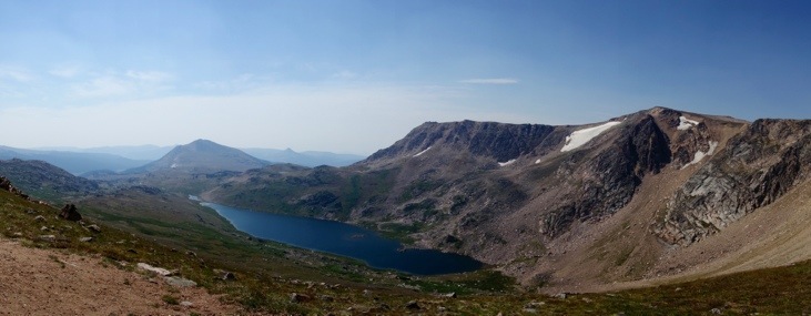
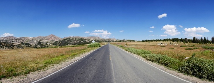
Strengthened for continuing our journey of the Bearstooth Highway, we enjoyed a fabulous scenery. The highway traces a series of steep zigzags and switchbacks to the 3,337 m high Beartooth Pass. See for yourself!
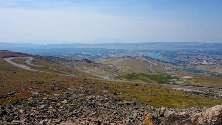
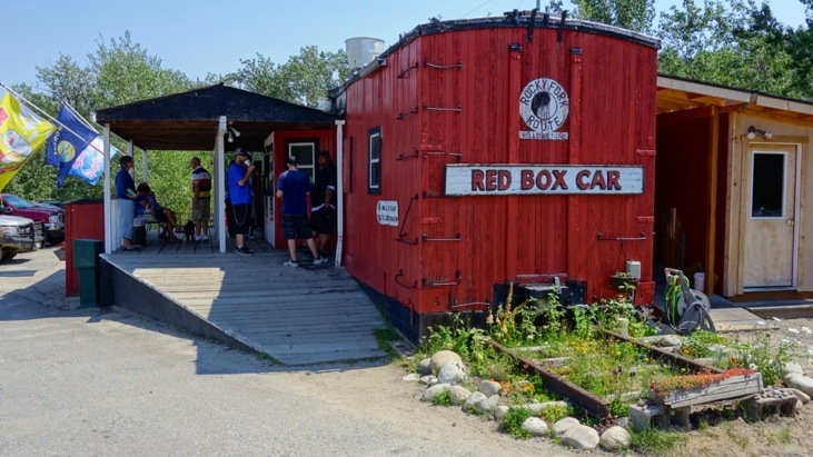
After driving for about 3 hours for only 68 miles we descended down to Red Lodge in Montana. We stopped at the famous, and only fast food place in town, the Red Box Car.
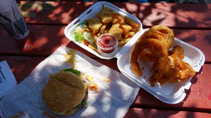
And shared a delicious lunch consisting of a bison burger, onion rings and fried shrimp. For desert we enjoyed an utterly sweet strawberry milk shake.
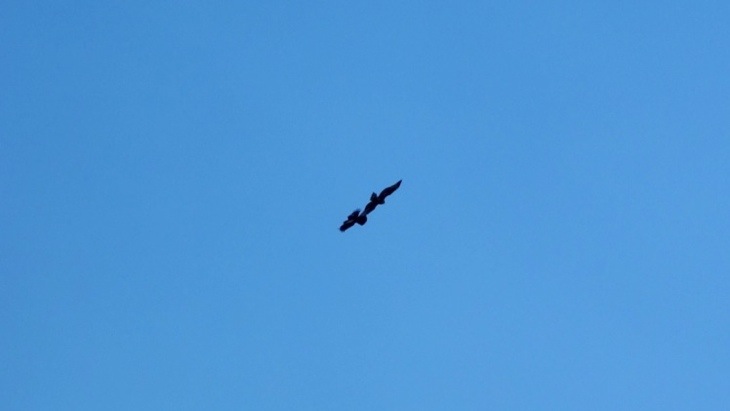
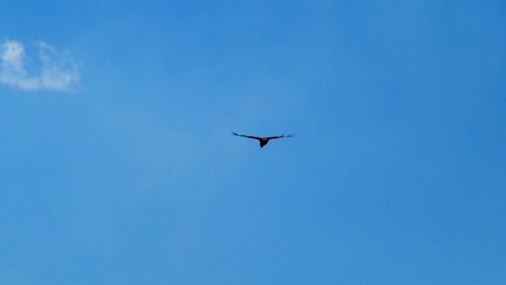
On the way back we were fortunate enough to see two young Ospreys carrying out a playful territorial fight. They kept attacking each other in the air over and over again. One of them would climb up high into the air and then nose dive down onto the second osprey who seemed to be waiting for him. Very difficult to capture this in pictures, especially because of their incredible speed, but here’s what we managed:
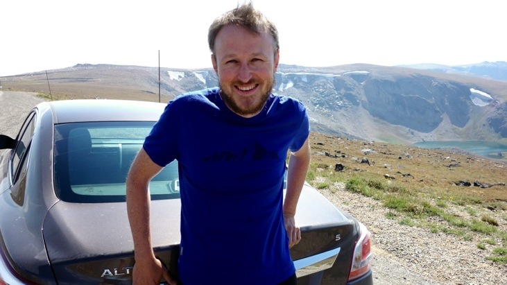
Have a look at the car model we were driving…
And two more pictures of the scenery on the way back.
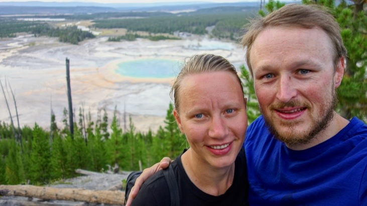
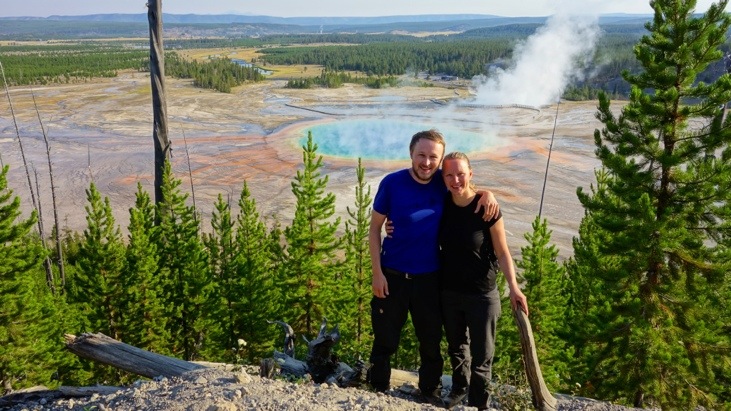
After returning in the early evening we decided to hike up that ridge to get a better look at the “Grand Prismatic Spring”. The view was well worth the short hike and no comparison to the view we had when standing next to the spring!
On the way back to our campsite we enjoyed a picture-perfect sundown.
Next morning we drove down south on our way to leave Yellowstone National Park. However we couldn’t resist of re-visiting the “Grand Prismatic Spring” in the morning. This time there was slightly more steam covering it.
We continued on and passed by “Firehole Spring” .
“Surprise Pool”:
The “Great Fountain Geyser”:
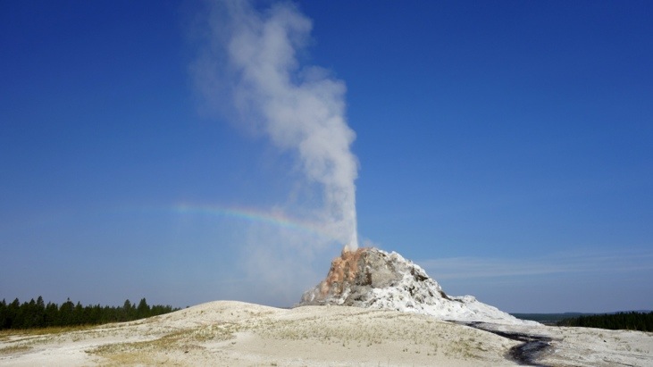
And finally “White Dome Geyser” featuring one of the largest cones of Yellowstone.
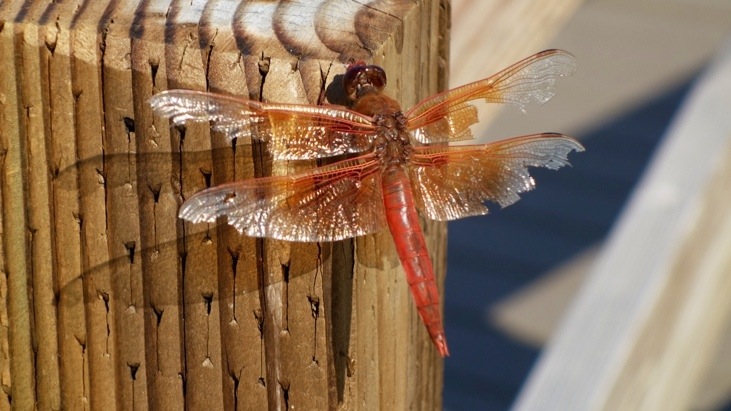
And eventually our last piece of wildlife, as we are guessing, a dragonfly.
From here we continued on to “Teton National Park” just south of Yellowstone, a park we had never even heard of before.
This entry was posted in North-America, WorldMap and tagged Bear, Camping, Food, Hiking, WildlifeComments
Leave a Reply
You must be logged in to post a comment.
AMAZING PICTURES! Andy, Tini: What camera do you use? I didn’t know my monitor does that kind of magic stuff before I browsed through this post ..
We are glad you enjoy the pictures, and let us know!
We have 2 cameras with us:
1) Sony RX100
2) Panasonic Lumix DMC-FT5
While the Sony is the preferred camera for most of the scenes, the Lumix is a very robust camera. It is entirely dust and even water proof, has a GPS sensor and most important a WiFi chip. Therefore we use it to copy the pictures to our iPhones from which we then upload the pictures to the blog. Also we consider it a rugged backup in case the Sony camera fails or we need a underwater camera while snorkeling… 🙂